Booby Island (Queensland)
| Booby Island (Queensland) | ||
|---|---|---|
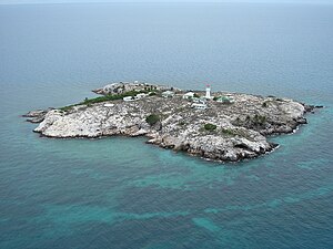
| Schrägluftbild | ||
| Gewässer | Torres-Straße | |
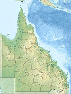
| Geographische Lage | 10° 36′ 14″ S, 141° 54′ 40″ O | |
| Länge | 360 m | |
| Breite | 340 m | |
| Fläche | 6 ha | |
| Höchste Erhebung | 37 m | |
| Einwohner | unbewohnt | |
| Landsat-Bild von Booby Island | ||
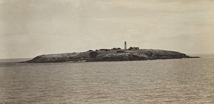
Booby Island ist eine kleine Insel in der Torres-Straße und gehört administrativ zu Queensland, Australien. Die Insel befindet sich 23 Kilometer westlich der Prince-of-Wales-Insel sowie 45 Kilometer nordwestlich der Kap-York-Halbinsel am westlichen Eingang der Torresstraße. Da die Passage dieses Gewässers äußerst schwierig ist, sanken hier im 19. Jahrhundert zahlreiche Schiffe. 1896 wurde schließlich ein 18 Meter hoher Leuchtturm errichtet.
Den Namen hat Booby Island von den Tölpelvögeln (englisch Booby).
Historische Ansicht
Weblinks
- Russ Rowlett: Lighthouses of Australia: Queensland’s East Coast (Englisch) In: The Lighthouse Directory. University of North Carolina at Chapel Hill. Abgerufen am 17. September 2011.
Auf dieser Seite verwendete Medien
Autor/Urheber: wal.cray, Lizenz: CC BY-SA 3.0
Aerial view of Booby Island. View from South
Autor/Urheber: Uwe Dedering, Lizenz: CC BY-SA 3.0
Location map of Queensland, Australia
Equirectangular projection, N/S stretching 106 %. Geographic limits of the map:
- N: 9.0° S
- S: 29.5° S
- W: 137.5° E
- E: 154.0° E
Booby Island
Landsat Image of Booby Island, Torres Strait Islands, Queensland, Australia


