Liste der Landschaftsschutzgebiete im Landkreis Kulmbach
Im Landkreis Kulmbach gibt es 14 Landschaftsschutzgebiete (LSG). (Stand: November 2018)[1]
Hinweise zu den Angaben in der Tabelle
- Gebietsname: Amtliche Bezeichnung des Schutzgebietes
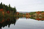
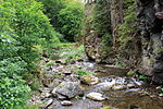
- Bild/Commons: Bild und Link zu weiteren Bildern aus dem Schutzgebiet
- LSG-ID: Amtliche Nummer des Schutzgebietes
- WDPA-ID: Link zum Eintrag des Schutzgebietes in der World Database on Protected Areas
- Wikidata: Link zum Wikidata-Eintrag des Schutzgebietes
- Ausweisung: Datum der Ausweisung als Schutzgebiet
- Gemeinde(n): Gemeinden, auf denen sich das Schutzgebiet befindet
- Lage: Geografischer Standort
- Fläche: Gesamtfläche des Schutzgebietes in Hektar
- Flächenanteil: Anteilige Flächen des Schutzgebietes in Landkreisen/Gemeinden, Angabe in % der Gesamtfläche
- Bemerkung: Besonderheiten und Anmerkungen
Bis auf die Spalte Lage sind alle Spalten sortierbar.
| Gebietsname | Bild/Commons | LSG-ID | WDPA-ID | Wikidata | Ausweisung | Gemeinde(n) | Lage | Fläche ha | Flächenanteil | Bemerkung |
|---|---|---|---|---|---|---|---|---|---|---|
| Kessel-Plosenberg | LSG-00483.01 | 395991 | Q59635628 | 1994 | Position | 110,12 | Landkreis Kulmbach (100 %) | |||
| LSG Fichtelgebirge |  | LSG-00449.01 | 395957 | Q59634836 | 1990 | Position | 62728,01 | Landkreis Bayreuth (31,0 %), Landkreis Hof (9,9 %), Landkreis Kulmbach (0,4 %), Landkreis Wunsiedel (58,7 %) | ||
| LSG Frankenwald im Gebiet der Landkreise Hof, Kronach und Kulmbach | LSG-00555.01 | 396106 | Q59635634 | 2001 | Position | 43183,38 | Landkreis Hof (17,2 %), Landkreis Kronach (74,6 %), Landkreis Kulmbach (8,0 %) | |||
| LSG Fränkische Schweiz - Veldensteiner Forst im Regierungsbezirk Oberfranken |  | LSG-00556.01 | 396107 | Q59635232 | 2001 | Position | 100393,8 | Landkreis Bamberg (23,2 %), Landkreis Bayreuth (34,0 %), Landkreis Forchheim (25,8 %), Landkreis Kulmbach (4,5 %), Landkreis Lichtenfels (12,6 %) | ||
| LSG Plassenburg im Gebiet der Stadt Kulmbach | LSG-00463.01 | 395971 | Q59635627 | 1992 | Position | 33,55 | Landkreis Kulmbach (100 %) | |||
| LSG Steinachtal mit Nebentälern im Gebiet der Landkreise Hof und Kulmbach |  | LSG-00363.01 | 395872 | Q59635622 | 1984 | Position | 1664,29 | Landkreis Hof (3,6 %), Landkreis Kulmbach (96,3 %) | ||
| LSG Unteres Rotmaintal im Gebiet der Landkreise Bayreuth und Kulmbach sowie der Stadt Bayreuth | LSG-00416.01 | 395924 | Q59635624 | 1988 | Position | 1133,76 | Bayreuth (7,6 %), Landkreis Bayreuth (20,0 %), Landkreis Kulmbach (72,3 %) | |||
| Schutz von Landschaftsräumen im Gebiet der Landkreise Bayreuth und Kulmbach (Trebgasttal) | LSG-00291.01 | 395768 | Q59635621 | 1978 | Position | 3199,06 | Landkreis Bayreuth (22,4 %), Landkreis Kulmbach (77,5 %) | |||
| Schutz von Landschaftsräumen im Gebiet der Stadt Bayreuth und der Landkreise Bayreuth und Kulmbach (Hohe Warte / Maintalhang) | LSG-00554.01 | 396105 | Q59635631 | 2001 | Position | 1548,56 | Bayreuth (18,1 %), Landkreis Bayreuth (59,3 %), Landkreis Kulmbach (22,6 %) | |||
| Schutz von Landschaftsteilen beiderseits der Ostmarkstraße Berneck-Weiden | LSG-00007.01 | 395451 | Q59635608 | 1951 | Position | 8,17 | Landkreis Bayreuth (3,4 %), Landkreis Kulmbach (96,6 %) | |||
| Schutz von Landschaftsteilen im Gebiet der Stadt Kulmbach und des Landkreises Kulmbach (Metzdorfer Gründlein und Dobrachtal) | LSG-00197.01 | 395678 | Q59635613 | 1970 | Position | 124,89 | Landkreis Kulmbach (100 %) | |||
| Schutz von Landschaftsteilen im Gebiet des Landkreises Kulmbach - Igelsweiher | LSG-00257.01 | 395735 | Q59635618 | 1973 | Position | 39,48 | Landkreis Kulmbach (100 %) | |||
| Schutz von Landschaftsteilen im Gebiet des Landkreises Kulmbach - Patersberg - Wacholdergrund | LSG-00245.01 | 395723 | Q59635616 | 1972 | Position | 483,12 | Landkreis Kulmbach (100 %) | |||
| Schutz von Landschaftsteilen in den Landkreisen Hof, Kronach, Kulmbach, Münchberg, Naila und Stadtsteinach (Landschaftsteil Schorgasttal) | LSG-00085.01 | 395506 | Q59635609 | 1956 | Position | 1073,09 | Landkreis Hof (10,5 %), Landkreis Kulmbach (89,4 %) |
Siehe auch
- Liste der Naturschutzgebiete im Landkreis Kulmbach
- Liste der FFH-Gebiete im Landkreis Kulmbach
- Liste der Geotope im Landkreis Kulmbach
- Liste der geschützten Landschaftsbestandteile im Landkreis Kulmbach
Einzelnachweise
- ↑ Grüne Liste Landschaftsschutzgebiete in Oberfranken, abgerufen am 22. April 2015.
Weblinks
Auf dieser Seite verwendete Medien
(c) OOjs UI Team and other contributors, MIT
An icon from the OOjs UI MediaWiki lib.
(c) Markus G. Klötzer / Wikimedia Commons / CC-BY-SA-3.0
![]() If you use this work outside of the Wikimedia projects, I would very much like to get a note from you.
If you use this work outside of the Wikimedia projects, I would very much like to get a note from you. ![]() Thanks in advance.
Thanks in advance.
- Markus G. Klötzer (author/photographer)
Kämmleinsfelsen südwestlich von Geroldsgrün, Geotop 475R002
Deutschland: Schild "Landschaftsschutzgebiet"
Autor/Urheber: J. Lunau, Lizenz: CC BY-SA 3.0
Blick über den herbstlichen Fichtelsee, im Hintergrund der Gipfel des Schneeberges


