Assab volcanic field
Autor/Urheber:
NASA Landsat image (courtesy of Hawaii Synergy Project, Univ. of Hawaii Institute of Geophysics & Planetology)
Shortlink:
Quelle:
Größe:
635 x 480 Pixel (72328 Bytes)
Beschreibung:
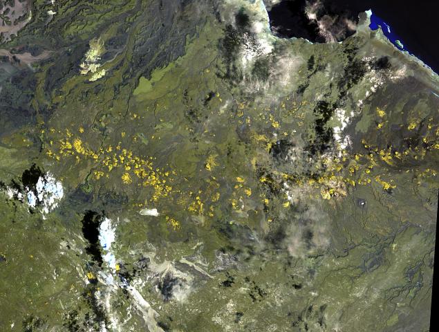
The long chain of pyroclastic cones and lava flows extending East-West across this Landsat image is the Assab volcanic field near the Red Sea coast in southern Eritrea.
- This spectacular range of basaltic cinder cones and associated lava flows covers a 55 x 90 km area, and flows reached the Red Sea along a broad front.
- The vents of the Assab volcanic field were constructed along a broad E-W-trending line that extends to the coastal city of Assab, out of view to right.
Lizenz:
Public domain
Bild teilen:


Relevante Bilder


.jpg)


.jpg)


Relevante Artikel
Assab-VulkanfeldDas Assab-Vulkanfeld liegt am südlichen Landzipfel von Eritrea, wenige Kilometer von der Küste des Roten Meeres entfernt. .. weiterlesen
Liste von VulkanenDies ist eine Liste von Vulkanen auf der Erde. .. weiterlesen