Liste von Vulkanen
Dies ist eine Liste von Vulkanen auf der Erde.
| Name | Vulkantyp | Höhe [m] | Koordinaten | Letzter Ausbruch |
|---|---|---|---|---|
| Dacht-i-Navar | Vulkanfeld | 3800 | unbekannt | |
| Vakak | Vulkanfeld | 3190 | 34° 15′ 0″ N, 67° 58′ 0″ O | unbekannt |
| Bild | Name | Gebirge | Vulkantyp | Höhe [m] | Koordinaten | Letzter Ausbruch |
|---|---|---|---|---|---|---|
 | Atakor | Ahaggar | Vulkanfeld | 2918 | 23° 20′ 00″ N, 005° 50′ 00″ O | unbekannt |
| In Ezzane | Ahaggar | Vulkanfeld | unbekannt | 23° 00′ 00″ N, 010° 50′ 00″ O | unbekannt | |
 | Manzaz | Ahaggar | Vulkanfeld | 1672 | 23° 55′ 00″ N, 005° 50′ 00″ O | unbekannt |
 | Tahalra | Ahaggar | Vulkanfeld | 1467 | 22° 40′ 00″ N, 005° 00′ 00″ O | unbekannt |
→ Liste von Vulkanen in der Antarktis
| Name | Insel | Vulkantyp | Höhe [m] | Koordinaten | Letzter Ausbruch |
|---|---|---|---|---|---|
| San Carlos | Bioko | Schildvulkan | 2260 | 03° 21′ 00″ N, 008° 31′ 00″ O | unbekannt |
| Pico Basile (Santa Isabel) | Bioko | Schildvulkan | 3007 | 03° 35′ 00″ N, 008° 45′ 00″ O | 1923 |
| San Joaquin (Pico Biao oder Pico do Moka) | Bioko | Schildvulkan | 2009 | 03° 21′ 00″ N, 008° 38′ 00″ O | unbekannt |
→ Liste von Vulkanen in Argentinien
| Bild | Name | Vulkantyp | Höhe [m] | Koordinaten | Letzter Ausbruch |
|---|---|---|---|---|---|
(c) I, Bouarf, CC BY-SA 3.0 | Aragaz | Schichtvulkan | 4095 | 40° 32′ 00″ N, 044° 12′ 00″ O | unbekannt |
| Dar-Alages | Schlackenkegel | 3329 | 39° 42′ 00″ N, 045° 32′ 30″ O | 2000 v. Chr. ± 1000 Jahre | |
 | Geghamgebirge | Vulkanfeld | 3597 | 40° 16′ 30″ N, 044° 45′ 00″ O | 1900 v. Chr. ± 1000 Jahre |
 | Porak | Schichtvulkan | 2800 | 40° 01′ 45″ N, 045° 44′ 27″ O | 778 v. Chr. ± 5 Jahre |
| Tskhouk-Karckar | Schlacken- und Aschenkegel | 3000 | 39° 44′ 00″ N, 046° 01′ 00″ O | 3000 v. Chr. ± 300 Jahre |
| Bild | Name | Vulkantyp | Höhe [m] | Koordinaten | Letzter Ausbruch |
|---|---|---|---|---|---|
 | Porak | Schichtvulkan | 2800 | 40° 1′ 45″ N, 45° 44′ 27″ O | 778 v. Chr. ± 5 Jahre |
| Tskhouk-Karckar | Schlacken- und Aschenkegel | 3000 | 39° 44′ 0″ N, 46° 1′ 0″ O | 3000 v. Chr. ± 300 Jahre |
→ Liste von Vulkanen in Äthiopien
→ Liste von Vulkanen in Australien
→ Liste von Vulkanen in Bolivien
| Bild | Name | Bundesstaat | Vulkantyp | Höhe [m] | Koordinaten | Letzter Ausbruch |
|---|---|---|---|---|---|---|
 | Trindade (Insel) | Espírito Santo | Schichtvulkan | 600 | 20° 30′ 52″ S, 29° 19′ 50″ W | unbekannt |
→ Liste von Vulkanen in Chile
→ Liste von Vulkanen in Costa Rica
→ Liste von Vulkanen in Deutschland
| Bild | Name | Vulkantyp | Höhe [m] | Koordinaten | Letzter Ausbruch |
|---|---|---|---|---|---|
 | Morne aux Diables | Schichtvulkan | 861 | 15° 36′ 45″ N, 061° 26′ 00″ W | unbekannt |
 | Morne Diablotins | Schichtvulkan | 1430 | 15° 30′ 12″ N, 061° 23′ 50″ W | unbekannt |
 | Morne Plat Pays | Schichtvulkan | 940 | 15° 15′ 18″ N, 061° 20′ 27″ W | 1270 ± 50 Jahre |
 | Morne Trois Pitons | Komplexer Vulkan | 1387 | 15° 22′ 00″ N, 061° 20′ 00″ W | 920 n. Chr. ± 50 Jahre |
 | Morne Watt | Schichtvulkan | 1224 | 15° 18′ 24″ N, 061° 18′ 18″ W | 1997 |
| Bild | Name | Vulkantyp | Höhe [m] | Koordinaten | Letzter Ausbruch |
|---|---|---|---|---|---|
 | Ardoukoba | Spaltenvulkan | 298 | 11° 35′ 00″ N, 042° 28′ 00″ O | 1978 |
 | Boina | Fumarole | 300 | 11° 15′ 00″ N, 041° 50′ 00″ O | Pleistozän |
| Garbes | Fumarole | 1000 | 11° 25′ 00″ N, 042° 12′ 00″ O | Pleistozän | |
 | Gufa | Vulkanfeld | 600 | 12° 33′ 00″ N, 042° 32′ 00″ O | unbekannt |
 | Manda-Inakir | Spaltenvulkane | 600 | 12° 23′ 00″ N, 042° 12′ 00″ O | 1928 |
 | Mousa Alli | Schichtvulkan | 2028 | 12° 28′ 04″ N, 042° 24′ 16″ O | unbekannt |
→ Liste von Vulkanen in Ecuador
→ Liste von Vulkanen in El Salvador
| Bild | Name | Vulkantyp | Höhe [m] | Koordinaten | Letzter Ausbruch |
|---|---|---|---|---|---|
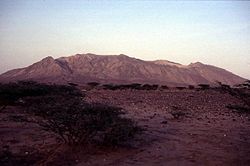 | Alid | Schichtvulkan | 904 | 14° 53′ 00″ N, 039° 55′ 00″ O | unbekannt |
 | Assab | Vulkanfeld | 987 | 12° 57′ 00″ N, 042° 26′ 00″ O | unbekannt |
| Dubbi | Schichtvulkan | 1625 | 13° 35′ 00″ N, 041° 48′ 30″ O | 1861 | |
 | Gufa | Vulkanfeld | 600 | 12° 33′ 00″ N, 042° 32′ 00″ O | unbekannt |
| Jalua | Schichtvulkan | 713 | 15° 02′ 30″ N, 039° 49′ 00″ O | unbekannt | |
 | Mousa Alli | Schichtvulkan | 2028 | 12° 28′ 04″ N, 042° 24′ 16″ O | unbekannt |
| Nabro | Schichtvulkan | 2218 | 13° 22′ 00″ N, 041° 42′ 00″ O | 2011 |
| Bild | Name | Insel | Vulkantyp | Höhe [m] | Koordinaten | Letzter Ausbruch |
|---|---|---|---|---|---|---|
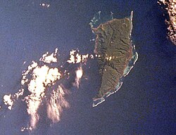 | Koro | Schlackenkegel | 522 | 17° 19′ 00″ S, 179° 24′ 00″ O | unbekannt | |
 | Nabukelevu | Kadavu | Lavadome | 805 | 19° 07′ 00″ S, 177° 59′ 00″ O | 1660 ± 30 Jahre |
 | Taveuni | Schildvulkan | 1241 | 16° 49′ 00″ S, 179° 58′ 00″ W | 1550 ± 100 Jahre |
→ Liste von Vulkanen in Frankreich
| Bild | Name | Vulkantyp | Höhe [m] | Koordinaten | Letzter Ausbruch |
|---|---|---|---|---|---|
| Kabargin-Oth-Gruppe | Schlackenkegel | 3650 | 42° 33′ 00″ N, 044° 00′ 00″ O | unbekannt | |
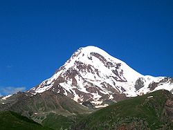 | Kasbek | Schichtvulkan | 5050 | 42° 42′ 00″ N, 044° 30′ 00″ O | 750 v. Chr. ± 50 Jahre |
| unbenannt | Schlackenkegel | 3750 | 42° 27′ 00″ N, 044° 15′ 00″ O | unbekannt | |
| unbenannt | Vulkankegel | 3400 | 41° 33′ 00″ N, 043° 36′ 00″ O | unbekannt |
| Bild | Name | Vulkantyp | Höhe [m] | Koordinaten | Letzter Ausbruch |
|---|---|---|---|---|---|
 | Kick-’em-Jenny | Submariner Vulkan | −185 | 12° 18′ 1″ N, 61° 38′ 24″ W | 2001 |
| Mount Saint Catherine | Schichtvulkan | 840 | 12° 9′ 0″ N, 61° 40′ 0″ W | unbekannt |
→ Liste von Vulkanen in Griechenland
→ Liste von Vulkanen in den Britischen Überseegebieten
→ Liste von Vulkanen in Guatemala
| Bild | Name | Insel | Vulkantyp | Höhe [m] | Koordinaten | Letzter Ausbruch |
|---|---|---|---|---|---|---|
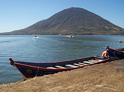 | Isla el Tigre | Schichtvulkan | 783 | 13° 16′ 20″ N, 087° 38′ 26″ W | unbekannt | |
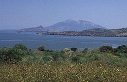 | Isla Zacate Grande | Schichtvulkan | 640 | 13° 20′ 00″ N, 087° 38′ 00″ W | unbekannt | |
 | Lago de Yojoa | Vulkanfeld | 1090 | 14° 59′ 00″ N, 087° 59′ 00″ W | unbekannt | |
 | Utila | Schlacken- und Aschenkegel | 74 | 16° 06′ 00″ N, 086° 54′ 00″ W | unbekannt |
| Bild | Name | Insel | Unionsterritorium | Vulkantyp | Höhe [m] | Koordinaten | Letzter Ausbruch |
|---|---|---|---|---|---|---|---|
 | Barren Island (Andamanen) | Andamanen und Nikobaren | Schichtvulkan | 354 | 12° 16′ 40″ N, 093° 51′ 30″ O | 2011 | |
 | Narkondam | Andamanen und Nikobaren | Schichtvulkan | 710 | 13° 26′ 00″ N, 094° 17′ 00″ O | unbekannt |
→ Liste von Vulkanen in Indonesien
→ Liste von Vulkanen in Italien
→ Liste von Vulkanen im Jemen
| Bild | Name | Vulkantyp | Höhe [m] | Koordinaten | Letzter Ausbruch |
|---|---|---|---|---|---|
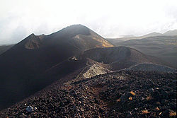 | Kamerunberg | Schichtvulkan | 4095 | 04° 12′ 12″ N, 009° 10′ 12″ O | 2000 |
| Bamenda-Berge | Komplexer Vulkan | 2621 | 05° 55′ 29″ N, 010° 14′ 41″ O | unbekannt | |
| Bambouto-Massiv | Komplexer Vulkan | 2740 | 05° 38′ 00″ N, 010° 05′ 00″ O | >500.000 Jahre | |
| Kupe | Schichtvulkan | 2064 | 04° 47′ 00″ N, 009° 43′ 00″ O | unbekannt | |
 | Manengouba | Schichtvulkan | 2411 | 05° 02′ 00″ N, 009° 50′ 00″ O | unbekannt |
| Ngaoundere-Plateau | Vulkanfeld | unbekannt | 07° 15′ 00″ N, 013° 40′ 00″ O | unbekannt | |
| Oku | Vulkanfeld | 3011 | 06° 15′ 00″ N, 010° 30′ 00″ O | unbekannt | |
 | Tombel | Vulkanfeld | 500 | 04° 45′ 00″ N, 009° 40′ 00″ O | unbekannt |
→ Liste von Vulkanen in Kanada
| Bild | Name | Insel | Vulkantyp | Höhe [m] | Koordinaten | Letzter Ausbruch |
|---|---|---|---|---|---|---|
 | Brava | Schichtvulkan | 900 | 14° 51′ 00″ N, 024° 43′ 00″ W | unbekannt | |
 | Pico do Fogo | Fogo | Schichtvulkan | 2829 | 14° 57′ 00″ N, 024° 21′ 00″ W | 2014 |
 | São Vicente | Schichtvulkan | 725 | 16° 51′ 00″ N, 024° 58′ 00″ W | unbekannt |
→ Liste von Vulkanen in Kolumbien
| Bild | Name | Insel | Vulkantyp | Höhe [m] | Koordinaten | Letzter Ausbruch |
|---|---|---|---|---|---|---|
| La Grille | Grande Comore bzw. Ngazidja | Schildvulkan | 1087 | 11° 28′ 0″ S, 43° 20′ 0″ O | unbekannt | |
 | Karthala | Grande Comore bzw. Ngazidja | Schildvulkan | 2361 | 11° 45′ 0″ S, 43° 23′ 0″ O | 2007 |
| Bild | Name | Gebirge | Vulkantyp | Höhe [m] | Koordinaten | Letzter Ausbruch |
|---|---|---|---|---|---|---|
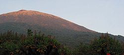 | Karisimbi | Virunga-Vulkane | Schichtvulkan | 4507 | 01° 30′ 00″ S, 029° 27′ 00″ O | ca. 8050 v. Chr. |
| May-ya-moto | Fumarole | 950 | 00° 56′ 00″ S, 029° 20′ 00″ O | unbekannt | ||
 | Nyamuragira | Virunga-Vulkane | Schildvulkan | 3058 | 01° 24′ 30″ S, 029° 12′ 00″ O | 2010 |
 | Nyiragongo | Virunga-Vulkane | Schichtvulkan | 3470 | 01° 31′ 00″ S, 029° 15′ 00″ O | 2010 |
 | Sabinyo | Virunga-Vulkane | Schichtvulkan | 3645 | 01° 24′ 00″ S, 029° 36′ 00″ O | Pleistozän |
| Tshibinda | Vulkanfeld | 1460 | 02° 19′ 00″ S, 028° 45′ 00″ O | unbekannt | ||
 | Visoke (Bisoke) | Virunga-Vulkane | Schichtvulkan | 3711 | 01° 28′ 00″ S, 029° 29′ 30″ O | 1957 |
| Bild | Name | Vulkantyp | Höhe [m] | Koordinaten | Letzter Ausbruch |
|---|---|---|---|---|---|
 | Charudsch | Vulkanfeld | 1200 | 27° 15′ 0″ N, 17° 30′ 0″ O | unbekannt |
 | Waw an-Namus | Caldera | 547 | 25° 3′ 0″ N, 17° 33′ 0″ O | unbekannt |
| Bild | Name | Insel | Vulkantyp | Höhe [m] | Koordinaten | Letzter Ausbruch |
|---|---|---|---|---|---|---|
| Ambre-Bobaomby | Madagaskar | Vulkanfeld | 1475 | 12° 36′ 00″ S, 049° 09′ 00″ O | unbekannt | |
| Ankaizina | Madagaskar | Vulkanfeld | 2878 | 14° 18′ 00″ S, 048° 40′ 00″ O | unbekannt | |
 | Ankaratra | Madagaskar | Vulkanfeld | 2644 | 19° 24′ 00″ S, 047° 12′ 00″ O | unbekannt |
 | Itasy | Madagaskar | Vulkanfeld | 1800 | 19° 00′ 00″ S, 046° 46′ 00″ O | ≈ 6050 v. Chr. |
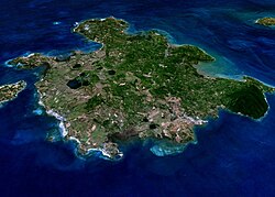 | Nosy Be | Schlackenkegel | 214 | 13° 19′ 00″ S, 048° 29′ 00″ O | unbekannt |
| Name | Bundesstaat | Vulkantyp | Höhe [m] | Koordinaten | Letzter Ausbruch |
|---|---|---|---|---|---|
| Bombalai | Sabah | Aschenkegel | 531 | 4° 24′ 0″ N, 117° 53′ 0″ O | unbekannt |
| Name | Region | Vulkantyp | Höhe [m] | Koordinaten | Letzter Ausbruch |
|---|---|---|---|---|---|
| Tin Zaouatene | Region Kidal | Vulkanfeld | unbekannt | 19° 50′ 0″ N, 2° 50′ 0″ O | unbekannt |
| Bild | Name | Vulkantyp | Höhe [m] | Koordinaten | Letzter Ausbruch |
|---|---|---|---|---|---|
 | Jbel Sirwa | Vulkanfeld | 3304 | 30° 42′ 15″ N, 7° 37′ 18″ W | unbekannt |
→ Liste von Vulkanen in Mexiko
| Bild | Name | Vulkantyp | Höhe [m] | Koordinaten | Letzter Ausbruch |
|---|---|---|---|---|---|
| Bus-Obo | Schlackenkegel | 1162 | 47° 07′ 00″ N, 109° 05′ 00″ O | unbekannt | |
 | Dariganga | Vulkanfeld | 1778 | 45° 20′ 00″ N, 114° 00′ 00″ O | unbekannt |
| Khanuy Gol (Chanuj Gol oder Bulgan) | Vulkanfeld | 1886 | 48° 40′ 00″ N, 102° 45′ 00″ O | unbekannt | |
| Mittlere Gobi | Vulkanfeld | 1120 | 45° 17′ 00″ N, 106° 42′ 00″ O | unbekannt | |
 | Taryatu-Chulutu (Hangayn oder Tariat) | Vulkanfeld | 2400 | 48° 10′ 00″ N, 099° 42′ 00″ O | 2980 v. Chr. ± 150 Jahre |
| Bild | Name | Vulkantyp | Höhe [m] | Koordinaten | Letzter Ausbruch |
|---|---|---|---|---|---|
| Lower Chindwin | Vulkanfeld | 385 | 22° 17′ 00″ N, 095° 06′ 00″ O | unbekannt | |
| Mount Popa | Schichtvulkan | 1518 | 20° 55′ 00″ N, 095° 15′ 00″ O | 442 v. Chr. | |
| Singu Plateau | Spaltenvulkane | 507 | 22° 42′ 00″ N, 095° 59′ 00″ O | unbekannt |
→ Liste von Vulkanen in Neuseeland
→ Liste von Vulkanen in Nicaragua
| Bild | Name | Insel | Vulkantyp | Höhe [m] | Koordinaten | Letzter Ausbruch |
|---|---|---|---|---|---|---|
 | Mount Scenery | Saba | Schichtvulkan | 887 | 17° 38′ 0″ N, 63° 14′ 0″ W | 1640 |
 | The Quill | Sint Eustatius | Schichtvulkan | 601 | 17° 28′ 40″ N, 62° 57′ 35″ W | 250 n. Chr. ± 150 Jahre |
| Name | Vulkantyp | Höhe [m] | Koordinaten | Letzter Ausbruch |
|---|---|---|---|---|
| In Ezzane | Vulkanfeld | unbekannt | 23° 0′ 0″ N, 10° 50′ 0″ O | unbekannt |
| Todra | Vulkanfeld | 1780 | 17° 41′ 0″ N, 8° 30′ 0″ O | unbekannt |
| Name | Vulkantyp | Höhe [m] | Koordinaten | Letzter Ausbruch |
|---|---|---|---|---|
| Biu-Plateau | Vulkanfeld | unbekannt | 10° 45′ 0″ N, 12° 0′ 0″ O | unbekannt |
| Bild | Name | Vulkantyp | Höhe [m] | Koordinaten | Letzter Ausbruch |
|---|---|---|---|---|---|
| Ch'uga-ryong (Seoul-Wonson) | Schildvulkan | 452 | 38° 20′ 00″ N, 127° 20′ 00″ O | unbekannt | |
(c) Bdpmax, CC BY-SA 3.0 | Paektusan (Changbaishan oder Baitoushan) | Schichtvulkan | 2744 | 41° 59′ 00″ N, 128° 05′ 00″ O | 1903 |
| Bild | Name | Insel | Vulkantyp | Höhe [m] | Koordinaten | Letzter Ausbruch |
|---|---|---|---|---|---|---|
 | Beerenberg | Jan Mayen | Schichtvulkan | 2277 | 71° 05′ 00″ N, 008° 10′ 00″ W | 1985 |
 | Bouvetinsel | Schildvulkan | 780 | 54° 25′ 00″ S, 003° 21′ 00″ O | ca. 50 v. Chr. | |
| Sør-Jan | Jan Mayen | Vulkanfeld | 700 | 70° 54′ 00″ N, 008° 54′ 00″ W | unbekannt |
| Bild | Name | Provinz | Vulkantyp | Höhe [m] | Koordinaten | Letzter Ausbruch |
|---|---|---|---|---|---|---|
 | Volcán Barú | Chiriquí | Schichtvulkan | 3474 | 08° 48′ 28″ N, 082° 32′ 34″ W | 1550 ± 10 Jahre |
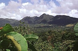 | El Valle | Coclé | Schichtvulkan | 1185 | 08° 35′ 00″ N, 080° 10′ 00″ W | 13 ka BP |
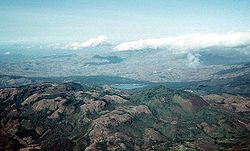 | La Yeguada | Veraguas | Schichtvulkan | 1297 | 08° 28′ 00″ N, 080° 49′ 00″ W | 45 ka BP |
→ Liste von Vulkanen in Papua-Neuguinea
→ Liste von Vulkanen in Peru
→ Liste von Vulkanen auf den Philippinen
→ Liste von Vulkanen in Portugal
| Bild | Name | Gebirge | Vulkantyp | Höhe [m] | Koordinaten | Letzter Ausbruch |
|---|---|---|---|---|---|---|
 | Karisimbi | Virunga-Vulkane | Schichtvulkan | 4507 | 01° 30′ 00″ S, 029° 27′ 00″ O | ca. 8050 v. Chr. |
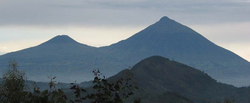 | Muhabura (Muhavura) | Virunga-Vulkane | Schichtvulkan | 4127 | 01° 23′ 00″ S, 029° 40′ 00″ O | unbekannt |
 | Sabinyo | Virunga-Vulkane | Schichtvulkan | 3645 | 01° 24′ 00″ S, 029° 36′ 00″ O | Pleistozän |
 | Visoke (Bisoke) | Virunga-Vulkane | Schichtvulkan | 3711 | 01° 28′ 00″ S, 029° 29′ 30″ O | 1957 |
→ Liste von Vulkanen in Russland
→ Liste von Vulkanen auf den Salomonen
| Bild | Insel | Vulkantyp | Höhe [m] | Koordinaten | Letzter Ausbruch |
|---|---|---|---|---|---|
 | Savaiʻi | Schildvulkan | 1858 | 13° 36′ 42″ S, 172° 31′ 30″ W | 1911 |
 | Upolu | Schildvulkan | 1100 | 13° 56′ 6″ S, 171° 43′ 0″ W | unbekannt |
| Name | Insel | Vulkantyp | Höhe [m] | Koordinaten | Letzter Ausbruch |
|---|---|---|---|---|---|
| São Tomé | Schildvulkan | 2024 | 0° 17′ 20″ N, 6° 32′ 46″ O | unbekannt |
→ Liste von Vulkanen in Saudi-Arabien
→ Liste von Vulkanen in Spanien
| Bild | Name | Vulkantyp | Höhe [m] | Koordinaten | Letzter Ausbruch |
|---|---|---|---|---|---|
 | Qualibou (Soufrière-Vulkanzentrum) | Caldera | 777 | 13° 50′ 0″ N, 61° 3′ 0″ W | 1766 |
| Bild | Name | Insel | Vulkantyp | Höhe [m] | Koordinaten | Letzter Ausbruch |
|---|---|---|---|---|---|---|
| Mount Liamuiga | St. Kitts | Schichtvulkan | 1156 | 17° 22′ 0″ N, 62° 48′ 0″ W | 160 n. Chr. ± 200 Jahre | |
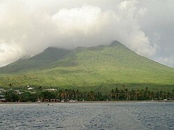 | Nevis Peak | Nevis | Schichtvulkan | 985 | 17° 9′ 0″ N, 62° 35′ 0″ W | unbekannt |
| Bild | Name | Vulkantyp | Höhe [m] | Koordinaten | Letzter Ausbruch |
|---|---|---|---|---|---|
 | Soufrière | Schichtvulkan | 1220 | 13° 20′ 0″ N, 61° 11′ 0″ W | 1979 |
| Bild | Name | Insel | Vulkantyp | Höhe [m] | Koordinaten | Letzter Ausbruch |
|---|---|---|---|---|---|---|
 | Marion-Insel | Schildvulkane | 1230 | 46° 54′ 0″ S, 37° 45′ 0″ O | 2004 | |
 | Prinz-Edward-Insel | Schildvulkan | 672 | 46° 38′ 0″ S, 37° 57′ 0″ O | unbekannt |
| Bild | Name | Vulkantyp | Höhe [m] | Koordinaten | Letzter Ausbruch |
|---|---|---|---|---|---|
 | Bayuda | Vulkanfeld | 670 | 18° 20′ 00″ N, 032° 45′ 00″ O | unbekannt |
 | Jebel Umm Arafieb | Schildvulkan | unbekannt | 18° 10′ 00″ N, 033° 50′ 00″ O | unbekannt |
 | Kutum (Tagabo- bzw. Berti-Berge) | Vulkanfeld | unbekannt | 14° 34′ 00″ N, 025° 51′ 00″ O | unbekannt |
(c) Hammy07, CC BY-SA 3.0 | Marra | Vulkanfeld | 3042 | 12° 57′ 00″ N, 024° 16′ 00″ O | ca. 2000 v. Chr. |
 | Meidob | Vulkanfeld | 2000 | 15° 19′ 00″ N, 026° 28′ 00″ O | 2950 v. Chr. ± 500 Jahre |
| Bild | Name | Insel | Vulkantyp | Höhe [m] | Koordinaten | Letzter Ausbruch |
|---|---|---|---|---|---|---|
| Ch'uga-ryong (Seoul-Wonson) | - | Schildvulkan | 452 | 38° 20′ 00″ N, 127° 20′ 00″ O | unbekannt | |
 | Hallasan | Jeju-do | Schildvulkan | 1950 | 33° 22′ 00″ N, 126° 32′ 00″ O | 1007 |
 | Ulleungdo | Schichtvulkan | 984 | 37° 30′ 00″ N, 130° 52′ 00″ O | 2990 v. Chr. ± 40 Jahre |
| Bild | Name | Vulkantyp | Höhe [m] | Koordinaten | Letzter Ausbruch |
|---|---|---|---|---|---|
| Dschebel ad-Duruz | Vulkanfeld | 1803 | 32° 39′ 30″ N, 036° 25′ 30″ O | unbekannt | |
 | Es-Safa | Vulkanfeld | 979 | 33° 15′ 00″ N, 037° 04′ 00″ O | 1850 ± 10 Jahre |
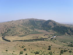 | Golanhöhen | Vulkanfeld | 1197 | 33° 06′ 00″ N, 035° 58′ 00″ O | unbekannt |
| Sharat Kovakab | Vulkanfeld | 534 | 36° 32′ 00″ N, 040° 51′ 00″ O | unbekannt | |
| unbenannt | Vulkanfeld | 1050 | 33° 00′ 00″ N, 036° 38′ 00″ O | 2670 v. Chr. ± 200 Jahre | |
| unbenannt | Vulkanfeld | unbekannt | 36° 40′ 00″ N, 037° 00′ 00″ O | 1222 |
→ Liste von Vulkanen in Tansania
| Bild | Name | Vulkantyp | Höhe [m] | Koordinaten | Letzter Ausbruch |
|---|---|---|---|---|---|
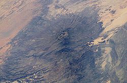 | Emi Koussi | Pyroklastischer Schildvulkan | 3445 | 19° 48′ 00″ N, 018° 32′ 00″ O | unbekannt |
 | Tarso Toh | Vulkanfeld | 2000 | 21° 20′ 00″ N, 016° 20′ 00″ O | unbekannt |
 | Tarso Toussidé, siehe Trou au Natron | Schichtvulkan | 3315 | 21° 02′ 00″ N, 016° 27′ 00″ O | unbekannt |
 | Tarso Voon | Schichtvulkan | 2859 | 20° 55′ 00″ N, 017° 17′ 00″ O | unbekannt |
→ Liste von Vulkanen in der Türkei
| Bild | Name | Vulkantyp | Höhe [m] | Koordinaten | Letzter Ausbruch |
|---|---|---|---|---|---|
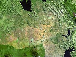 | Bufumbira | Vulkanfeld | 2440 | 01° 14′ 00″ S, 029° 43′ 00″ O | unbekannt |
 | Bunyaruguru (Kichwambe) | Vulkanfeld | 1554 | 00° 12′ 00″ S, 030° 05′ 00″ O | unbekannt |
| Fort-Portal-Vulkanfeld | Vulkanfeld | 1615 | 00° 42′ 00″ N, 030° 15′ 00″ O | 2120 v. Chr. ± 100 Jahre | |
| Katunga | Tuffkegel | 1707 | 00° 28′ 17″ S, 030° 11′ 27″ O | unbekannt | |
 | Katwe-Kikorongo | Vulkanfeld | 1067 | 00° 05′ 00″ S, 029° 55′ 00″ O | unbekannt |
 | Kyatwa (Ndale) | Vulkanfeld | 1430 | 00° 27′ 00″ N, 030° 15′ 00″ O | unbekannt |
 | Muhabura (Muhavura) | Schichtvulkan | 4127 | 01° 23′ 00″ S, 029° 40′ 00″ O | unbekannt |
 | Sabinyo | Schichtvulkan | 3645 | 01° 24′ 00″ S, 029° 36′ 00″ O | Pleistozän |
→ Liste von Vulkanen in den Vereinigten Staaten
→ Liste von Vulkanen in Vanuatu
| Name | Insel | Vulkantyp | Höhe [m] | Koordinaten | Letzter Ausbruch |
|---|---|---|---|---|---|
| Bas Dong Nai (Xuan-Loc-Plateau) | Vulkanfeld | 392 | 10° 48′ 00″ N, 107° 12′ 00″ O | unbekannt | |
| Cù-Lao Ré | Lý Sơn (Cù-Lao Ré), Cù Lao Bờ Bãi | Vulkanfeld | 181 | 15° 23′ 00″ N, 109° 07′ 00″ O | unbekannt |
| Haut Dong Nai (Djiring-Plateau) | Vulkanfeld | 1000 | 11° 36′ 00″ N, 108° 12′ 00″ O | unbekannt | |
| Ile des Cendres | Submarine Vulkane | −20 | 10° 09′ 27″ N, 109° 00′ 50″ O | 1923 | |
| Toroeng Prong | Schlackenkegel | 800 | 14° 56′ 00″ N, 108° 00′ 00″ O | unbekannt | |
| Veteran | Submariner Vulkan | unbekannt | 09° 50′ 00″ N, 109° 03′ 00″ O | unbekannt |
Einzelnachweise
- Hauptquelle: L. Siebert, T. Simkin (2002): Volcanoes of the World: an Illustrated Catalog of Holocene Volcanoes and their Eruptions. Smithsonian Institution, Global Volcanism Program Digital Information Series, GVP-3. (Weblink).
Auf dieser Seite verwendete Medien
(c) OOjs UI Team and other contributors, MIT
An icon from the OOjs UI MediaWiki lib.
Cinder cones of the Bufumbira volcanic field — in SW Uganda (center), lie north of the large stratovolcanoes of the NE part of the Virunga Mountains.
- The roughly 40 cinder cones occur in clusters and were erupted along lineaments; they are typically breached on one side by lava flows.
- The Bufumbira rocks are noted for their unusual ultrapotassic chemistry.
- Muhavura (center) and Sabinyo (left) stratovolcanoes are visible at the bottom of this Landsat image.
The dark-colored lava flows extending diagonally across the center of this Landsat image were erupted from pyroclastic cones of Manda-Inakir volcano. These NNW-trending fissure vents and cones are located along the Ethiopia-Djibouti border and represent an uplifted mid-ocean ridge spreading center now exposed above sea level. An eruption in 1928 or 1929 at the SE end of the Manda-Inakir rift near the town of Korili (in Djibouti) produced the Kammourta cinder cone and a lava flow.
Morne Diablotins - largest volcano on Dominica.
Freshwater Lake (L'Etang) lies in the moat between Micotrin lava dome and the eastern wall of the Wotten Waven caldera, partially visible in the background. The 7 x 4.5 x wide caldera is elongated in an SW-NE direction, and it extends on the SW to near the capital city of Roseau. The two coalesced lava domes of Micotrin straddle the NE rim of the caldera. Strong geothermal activity persists in the caldera, the most prominent of which lies near the village of Wotten Waven along the River Blanc and contains numerous bubbling pools and fumaroles.
One of Africa's most notable volcanoes, Nyiragongo is seen here from the south across Lake Kivu at Peyer Yard in Rwanda. Nyiragongo contained a lava lake in its deep summit crater that was active for half a century before draining suddenly in 1977. In contrast to the low profile of its neighboring shield volcano, Nyamuragira, 3470-m-high Nyiragongo displays the steep slopes of a stratovolcano. About 100 parasitic cones are located primarily along radial fissures east of the summit and along a NE-SW zone extending as far as Lake Kivu.
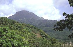
Steep-sided Morne Watt, seen here from the NW, is a lava-dome complex surrounded by block-and-ash flow deposits. The 1224-m-high volcano was constructed south of the Wotten Waven caldera and is flanked by Morne Anglais (4 km to the SW) and the Grand Soufrière Hills volcano, 3 km to the east. The renowned Valley of Depression geothermal area cuts the NE flank of Morne Watt and lies out of view to the left.
The massive Hallasan shield volcano, seen here from the south, forms much of the 40 x 80 km Cheju Island, which lies 90 km south of the Korean Peninsula.
Autor/Urheber: Maurice, cap sur le Hoggar, de l'Atakor à la Taessa, Lizenz: CC BY-SA 3.0
Le mont Tahat (3003 m) au sud ouest du Massif du Hoggar, sud de l'Algérie
The Itasy volcanic field in central Madagascar.
- It lies west of Lake Itasy (lower-center) and consists of a N-S-trending chain of scoria cones, lava domes, and maars. Several small dark-colored lake-filled maars can be seen in the NASA Landsat image (with north to the top), one of which lies just above the NW arm of Lake Itasy.
- Early eruptions producing trachytic lava domes and basanitic lava flows were followed by the effusion of trachytic lava flows and recent vulcanian eruptions. Mild seismicity and hot spring activity continue at Itasy.
The dark area at in the center above the bend in the Nile River in NE Sudan is the Jebel Umm Arafieb volcanic field, also known as Jebel Umm Marafieb. Located in the Bayuda Desert NE of the capital city of Khartoum, this volcanic field consists of a low-angle shield volcano formed of several overlapping aa lava flows erupted from a vent now capped by a spatter cone.
NASA Terra ASTER image of Prince Edward Island, Prince Edward Islands, in the Southern Indian Ocean
Tousside, Tibesti Mountains, Chad
- The Tibesti Mountains in northwestern Chad consist of rugged volcanic peaks, many impressive craters, and hot springs. Near the center of the photograph is Tousside Peak, which rises more than 10 710 feet (3265 meters) above sea level, the westernmost volcano of this high mountain range. The peak is almost centered within the black shape that has tentacle-shaped lava flows extending down the western flank. The volcano’s base measures approximately 55 miles (90 kilometers) in diameter. The light brownish area surrounding the peak shows a distinctive radial drainage pattern that is quite common for stratovolcanoes as the terrain falls away from the main peak. The depression southeast of the volcano measures approximately 5 miles (8 kilometers) in diameter and 3300 feet (1000 meters) in depth. The white base is caused by an accumulation of carbonate salts, creating this soda lake of Tibesti. With the exception of small vents that emit gasses and a few hot springs that continue to deposit minerals at the surface of the crater floor, little volcanic activity presently occurs in this region.
Image number STS052-73-14
Sonar image shows the submarine Kick-'em-Jenny cone from the NE in 1996. Depths are nominally meters but have an uncertainty of about 10%. This image shows the upper several hundred meters of the en:submarine volcano:submarine volcano that lies 8 km off the north shore of Grenada and rises 1300 m from the sea floor of the Caribbean Sea.
The Boina fumarole field immediately north of Lake Abbe (center). Location - border Ethiopia, Djibouti.
Tarso Voon volcano in Chad. Satellite view.
The dark-colored area in the center of this Space Shuttle view is the alkaline Meidob volcanic field in western Sudan. This broad volcanic field covers an area of 5000 sq km with nearly 700 Pliocene-to-Holocene vents. The margins of the field are dominated by basaltic scoria cones and associated lava flows, but trachytic-phonolitic lava domes, tuff rings, and maars, concentrated along the central E-W-trending axis of the volcanic field, are among the youngest features. The latest dated eruptions took place about 5000 years ago.
This NASA Landsat image shows small scoria cones and lava flows of the Manzaz volcanic field in the Hoggar (Ahaggar) volcanic district of Algeria. The volcanic field covers an area of 1500 sq km, overlying Precambrian metamorphic and plutonic rocks of the Tuareg shield. Many cones are breached, and the dominantly basaltic and basanitic volcanic products are rich in peridotite and pyroxenite xenoliths and megacrysts. The youngest volcanoes rest on Neolithic terraces and are of Holocene age.
The long chain of pyroclastic cones and lava flows extending East-West across this Landsat image is the Assab volcanic field near the Red Sea coast in southern Eritrea.
- This spectacular range of basaltic cinder cones and associated lava flows covers a 55 x 90 km area, and flows reached the Red Sea along a broad front.
- The vents of the Assab volcanic field were constructed along a broad E-W-trending line that extends to the coastal city of Assab, out of view to right.
Morne aux Diables volcano at the northern tip of Dominica is a stratovolcano composed of andesitic lava domes, lava flows, and block-and-ash flow deposits well exposed in coastal sea cliffs. Volcanism at the dominantly Pleistocene Morne aux Diables is considered to have likely continued into the Holocene; unconsolidated block-and-ash flow deposits extend to the NW and NE coasts. Fumarolic areas are present on the volcano, and the Penville Cold Soufrière, an area of bubbling pools, lies within the youngest crater of the volcano.
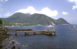
The Plat Pays volcanic complex rises to the south beyond the shoreline of the city of Roseau in the foreground. Three lava domes that formed after the roughly 39,000-year-old caldera collapse at Plat Pays lie on the horizon. On the left is the rounded Morne Canot dome, in the center is La Falaise dome, and the peak at the far right is Morne la Vue, which rises above the village of Pointe Michel. The summit of the Morne Plat Pays stratovolcano lies in the left-center background between Morne Canot and La Falaise domes.
Autor/Urheber: Francisco Santos (user: xuaxo), Lizenz: CC BY-SA 3.0
Calhau and the northern volcanoes, São Vicente Island, Cape Verde. Farm-oasis
Maars of the Bunyaruguru volcanic field, also known as the Kichwambe volcanic field, blanket the center of this NASA Landsat image (with north to the top) of the eastern side of the Western Rift Valley. The Bunyaruguru field, lying south of the river channel connecting Lake Edward (left-center) and Lake George (top right), contains more than 130 explosion craters, 27 of which contain lakes with water ranging from fresh to saline. Maars of the Katwe-Kikorongo volcanic field lie across the river channel at the upper left.
Lake Yojoa in Honduras
Zacate Grande Island, seen here from Punta el Chiquirín at the eastern tip of El Salvador.
Vista do Pico do Fogo e do Pico Pequeno à entrada na Chã das Caldeiras. Ilha do Fogo, Cabo Verde
Lake-filled and dry maars of the Katwe-Kikorongo volcanic field occupy the center of this NASA Landsat image (with north to the top). The volcanic field lies above the river channel connecting Lake Edward (lower left) with Lake George (upper right) in the Western Rift Valley of Uganda. Oblong, dark-colored Lake Katwe (lower left) is a shallow 3-km-long body of water that occupies two of three intersecting craters immediately NE of Lake Edward. Local folk tales suggest that volcanism in the Katwe-Kikorongo area has continued into historical times.
Picture of Kutum
Three lakes (maars) of Tombel Graben between Mount Cameroon (lower left) and lava flows from Manengouba volcano (top). The largest circular lake, just above center, is Lake Barombi Mbo. The two smaller circular lakes are Lake Dissoni in the north and Lake Barombi Koto in the south. The river running from the northeastern corner and south is the Mungo River.
Südostküste der Bouvetinsel bei Sonnenaufgang in 8 Seemeilen Entfernung. Handkolorierte Schwarzweiß-Fotografie. Fotografiert auf der Valdivia-Expedition.
(c) Hammy07, CC BY-SA 3.0
Inner and outer crater, Deriba Crater, Jebel Marra, Darfur, Sudan.
Autor/Urheber: User:Amakuru, Lizenz: CC BY-SA 3.0
Mount Gahinga and Mount Muhabura, on the Rwanda/Uganda border
Nabukelevu lava-dome complex occupies at the SW end of Kadavu Island.
Gufa volcanic field - yellow-colored pyroclastic cones and Mousa Alli volcano, a large stratovolcano that is visible at the bottom center.
NASA Space Shuttle image of Taveuni, a massive shield volcano which is the third largest island in Fiji. Top of image is NW.
Autor/Urheber: Marinha do Brasil, Lizenz: CC BY-SA 2.0
Ilha Martim Vaz
The elongated Alid volcano, which sits on the axis of the Danakil spreading center, is seen here from the west. Most of the flanks of the volcano in this view are composed of dipping rhyolitic lava flows; the light-colored area along the right skyline is rhyolitic pumice. The summit of the volcano is elongated in an E-W direction and contains a 1 x 1.5 km wide, 100-m-deep crater at the western end. Vast lava fields originating from fissure vents in the Alid graben extend to the NW and SE of the volcano. Vigorous fumarolic activity continues at Alid.
Pumpkin Hill, a pyroclastic cone at the northeast end of Utila Island.
The Pitons, the dramatic landmarks of the island of St. Lucia, are the eroded plugs of two Pleistocene lava domes. Gros Piton (left) and the even steeper Petit Piton (right) are pre-caldera lava domes west and SW of the late-Pleistocene Qualibou caldera. The lower ridge in the right foreground is the SW-most of the 3 Bois d'Indie Franciou andesitic lava domes. They were constructed along a NE-trending fault.
Waw An Namus (aka Uau En Namus) volcano in south-central Libya. Photographed from the Space Shuttle, mission STS052.
The Ankaratra volcanic field in central Madagascar consists of trachytic lava domes, fissure vents, basanitic cinder cones, and maars. The volcanic field is one of the largest on the island and covers a 100-km-long area in central Madagascar. Hot springs occur at Ranomafana. North is to the top in this NASA Landsat image.
A blocky lava flow extends across the foreground from a pyroclastic cone of the Porak volcanic field, located along the Vardeniss volcanic ridge about 20 km SE of Lake Sevan. The volcanic field straddles the Armenia/Azerbaijan border, and lava flows extend into both countries. .
Autor/Urheber: Yaan, Lizenz: CC BY-SA 3.0
Uran Togoo, an old volcano crater. View from Tulga Togoo, Bulgan aimag, Mongolia
Autor/Urheber: Die Autorenschaft wurde nicht in einer maschinell lesbaren Form angegeben. Es wird Amakuru als Autor angenommen (basierend auf den Rechteinhaber-Angaben)., Lizenz: CC BY-SA 3.0
Mount Karisimbi, Rwanda
NASA Terra ASTER image of Marion Island, Prince Edward Islands, in the Southern Indian Ocean
Autor/Urheber: Yaan, Lizenz: CC BY-SA 3.0
A view into the Horgo crater, near Terhiin Tsagaan nuur, Arhangai, Mongolia
Isla de El Tigre, en el Golfo de Fonseca, perteneciente a Honduras. Vista desde el muelle de Coyolito
Savaii, Samoainseln
Autor/Urheber: Holger Reineccius, Lizenz: CC BY-SA 3.0
Steilküste im Norden der Insel Brava, wie oft mit "Wolkenhut". Blick aus dem Hubschrauber.
Autor/Urheber: Walter Hellebrand, Lizenz: CC BY-SA 3.0
The Quill dormant volcano on St. Eustatius seen from the remains of Battery St. Louis
Autor/Urheber: Skilla1st, Lizenz: CC BY-SA 4.0
Blick auf Mousa Ali von der Südwestseite.
This composite NASA Landsat view (with north to the top) shows part of the Dariganga volcanic field. This large volcanic field is located in SE Mongolia near the border with China, which lies at the lower right. The small roughly circular features seen in this image are some of the more than 200 lava and cinder cones of Pleistocene and Holocene age that were erupted from NE-trending parallel fissures.
Autor/Urheber: Hagman, Lizenz: CC BY-SA 3.0
Der Beerenberg auf Jan Mayen bei ungewöhnlich klarer Sicht
Vista en 3D de Nosy Be, en dirección Sur - Norte, obtenido de Screenshot World Win 1.4 NASA
Depiction of the Nyiragongo and Nyamuragira volcanoes, based on data from the Shuttle Radar Topography Mission and Landsat. Vertical scale exaggerated (1.5x).
(c) Wagaung in der Wikipedia auf Englisch, CC BY-SA 3.0
Mount Popa near Bagan in central Myanmar
Picture taken June 20 2007 on ferry trip to Nevis taken myself.
Autor/Urheber: Nawfal Kharbach, Lizenz: CC BY-SA 4.0
The Jbel Sirwa, also spelled Djebel Siroua, is a peak in the Anti-Atlas mountain range. It is an old stratovolcano that rises 3,304 metres above sea level.
Lake Sevan and Ghegam Ridge
Shark-tooth-shaped Koro Island located between Fiji's two major island groups.
Mostly lake-filled maars and tuff cones dot the center of this NASA Landsat image (with north to the top) of the Kyatwa volcanic field. The Kyatwa vents, also known as the Ndale volcanic field, occupy the Western Rift Valley, east of the Ruwenzori Mountains halfway between Lake Edward and Lake Albert. The Kyatwa tuff cones are part of a group of Pleistocene-to-Recent volcanic fields in western Uganda.
NASA astronaut image of Barren Island (Andaman Islands, India) in the Indian Ocean
The Bayuda volcanic field is located near the center of the Bayuda desert of NE Sudan. The numerous small cinder cones that trend horizontally across the center of the volcanic field in this Space Shuttle image were erupted along a WNW-trending line. Lava flows, one of which was erupted about 1100 years ago, are visible in this image, but about 10% of the vents are explosion craters. Bayuda was constructed over Precambrian and Paleozoic granitic rocks, which form the darker areas at the lower right.
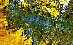
The dark-green and bluish-gray areas extending across this NASA Landsat image depict the elongated, E-W-trending Tahalra volcanic field, which covers an area of about 1800 sq km in the Hoggar Province of southern Algeria. About 100 small strombolian basaltic cones formed during the Pliocene and Pleistocene, and the most recent activity during the late-Pleistocene and Holocene produced about 20 maars and cones along the northern margin of the volcanic field.
Autor/Urheber: alKomor.com, Lizenz: CC BY-SA 2.0
Karthala volcano, Grande Comore
Autor/Urheber: User:Amcaja, Lizenz: CC BY-SA 3.0
Kraterji Kameruna, nastali po izbruhih leta 2000
Small cinder cones and lava flows of the Tarso Tôh volcanic field can be seen in the large darker-brownish area at the center of this NASA Landsat image. This Pleistocene-to-Holocene volcanic field in the Tibesti Range of Chad covers a 30 x 80 km area and contains 150 scoria cones and two maars. Basaltic lava flows at Tarso Tôh were erupted over a basement of Precambrian schists and Paleozoic sandstones. The black lava flows at the very bottom-center are distal lava flows from Tarso Toussidé volcano.
Autor/Urheber: Lidia Ilona, Lizenz: CC BY 2.0
Kazbegi. Mount. Mkinvarcveri (Kazbek) 5047 m., Stefancminda district (ყაზბეგის რაიონი)
Es Safa Volcanic Field — Es Safa is a striking basaltic volcanic field located to the south-east of Damascus, western Syria.
- Es Safa contains numerous vents that have been active during the Holocene Epoch (beginning approximately 12,000 years ago). The most recent recorded activity was a boiling lava lake observed in the area around 1850.
- The dark lava flow field (centre) likely represents the latest activity of the volcanic field, and is emplaced over older, lighter coloured flows. The older flow surfaces also have light tan sediment accumulating in shallow depressions, in contrast to the relatively pristine surfaces of the darker, younger flows.
- Cinder cones are scattered throughout the Es Safa field, but many are aligned along north-west south-east trends that likely indicate faults through which magma rose to the surface. Two such alignments are visible at image left.
- To the south-east (image right) a small reservoir feeds water distribution ditches extending northwards.
