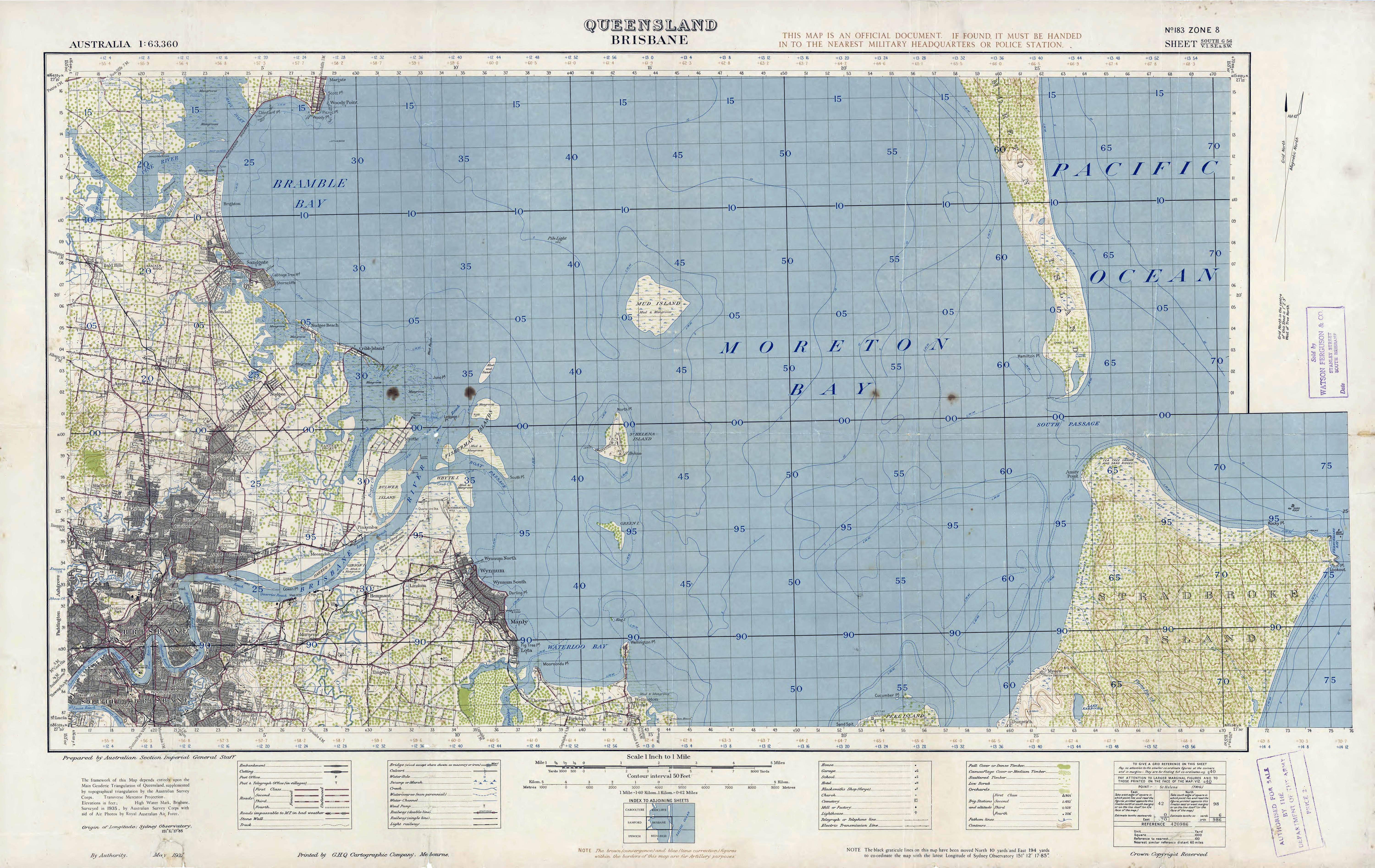
Brisbane, Queensland Topographic Map 1-63360 1937
Autor/Urheber:
Australian Section Imperial General Staff
Shortlink:
Quelle:
Größe:
6000 x 3789 Pixel (4143206 Bytes)
Beschreibung:
Topographic Map Brisbane, Queensland, Australia 1:63,360, 1937.
Note: Provided for historical reference only, without any implied warranty of fitness for any purpose or use whatsoever, not to be used for navigation.
Note: Provided for historical reference only, without any implied warranty of fitness for any purpose or use whatsoever, not to be used for navigation.
Lizenz:
Public domain
Credit:
State Library of Queensland Australia 1:63,360 : Military survey of Australia : Queensland
Bild teilen:


Relevante Bilder

.jpg)


Relevante Artikel
North Stradbroke IslandNorth Stradbroke Island ist eine große Sandinsel an der Ostküste Australiens. Sie liegt im Süden des Staates Queensland und gehört zu Redland City. Sie trennt die Moreton Bay vom Korallenmeer. Die Insel ist etwa 38 Kilometer lang und bis zu 11 Kilometer breit. Sie ist die größere der Stradbroke Islands und die flächenmäßig größte Insel in der Moreton Bay. .. weiterlesen