HudsonValley1777
Autor/Urheber:
Shortlink:
Quelle:
Größe:
360 x 1470 Pixel (254576 Bytes)
Beschreibung:
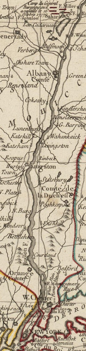
This is a detail from the source map, depicting the Hudson River Valley between Saratoga and New York City. Some features are inaccurate: Fort Montgomery is incorrectly depicted on the east side of the river.
Lizenz:
Public domain
Credit:
Norman B. Leventhal Map Center at the Boston Public Library Call Number: G3711.S3 1777 .B75
URL at time of upload: http://maps.bpl.org/details_10101/
Bild teilen:


Relevante Bilder

.svg)
.svg)


Relevante Artikel
Schlacht um Fort Clinton und Fort MontgomeryDie Schlacht um Fort Clinton und Fort Montgomery war eine Schlacht im Amerikanischen Unabhängigkeitskrieg. Die Schlacht fand am 6. Oktober 1777 an der Mündung des Popolopen Creeks in den Hudson River bei Bear Mountain im Orange County statt. Fort Clinton und Fort Montgomery lagen am Westufer des Hudson Rivers, circa 50 Meilen nördlich von New York City. Die Forts lagen erhöht auf schwer zugänglichem Gelände. .. weiterlesen