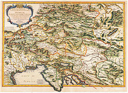
L'Afrique ou Lybie Ulterieure ou sont le Saara ou Desert, le Payes des Negres, La Guinee et les Pays circonv....
Autor/Urheber:
Shortlink:
Quelle:
Größe:
6878 x 4487 Pixel (12393571 Bytes)
Beschreibung:
Sanson's regional map of West Africa contains a lot of newer information about the coast, some speculation about the interior, and not a lot of ornamentation other than the cartouche. Instead of simply copying older Dutch maps, Sanson researched his subject and cited a couple of sources: Samuel Blommaert and Livio Sanuto. Samuel Blommaert (1583-1651) was a Flemish/Dutch merchant and director of the Dutch West India Company (West-Indische Compagnie or WIC) who had earlier made three trips to the East Indies with the Dutch East India Company (Vereinigde Oost-indische Compagnie or VOC), possibly visiting Benin. Livio Sanuto (1520-1576) was a Venetian geographer and cartographer who finished twelve maps of Africa shortly before his death. These had not been published until 1588 and copies were not widely distributed. Engraved by Jean (Jan van) Somer.
Lizenz:
Public domain
Relevante Bilder
Relevante Artikel
Nicolas SansonNicolas Sanson, der Ältere, auch: Nicolas Sanson d’Abbeville war ein französischer Kartograph. Er gilt als der Vater der Geographie in Frankreich. .. weiterlesen


