Nicolas Sanson

Nicolas Sanson, der Ältere, auch: Nicolas Sanson d’Abbeville (* 20. Dezember 1600 in Abbeville, Frankreich; † 7. Juli 1667 in Paris) war ein französischer Kartograph. Er gilt als der Vater der Geographie in Frankreich.[1]
Leben
Seine Vorfahren stammten aus Schottland. In den Jahren 1618 bis 1667 schuf Sanson etwa 300 einzelne Karten sowie Atlanten und illustrierte Texte. Er wurde zum Geographe Ordinaire du Roy (königlicher Kartenmacher) ernannt und unterrichtete die Könige Ludwig XIII. und Ludwig XIV. in Geographie.[2]
Sein Sohn Nicolas Sanson (1626–1648) starb während der Fronde. Nach des Vaters Tod, führten zwei weitere Söhne Adrien Sanson († 1708) und Guillaume Sanson († 1703) zusammen mit seinem Neffen Pierre Duval (1619–1683), dem Enkel Pierre Moulard Sanson († 1730) sowie Hubert Jaillot[2] und Gilles Robert de Vaugondy (1688–1766) die Arbeit fort.

1650, Karte Nordamerikas

1681, Karte der Grafschaft Mark

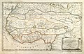
1655, Karte der Afrika
Einzelnachweise
- ↑ Guiana and Caribana. In: World Digital Library. 27. September 2013, abgerufen am 11. Januar 2014.
- ↑ a b Stadtarchiv Norderney
Weblinks
- Literatur von und über Nicolas Sanson im Katalog der Deutschen Nationalbibliothek
- Druckschriften von und über Nicolas Sanson im VD 17.
- Culturegraph Informationen über Nicolas Sanson
- Tables geographiques des divisions du globe terrestre. Paris: H. Jaillot, 1677 (Digitalisat)
- Geographia Sacra Ex Veteri Et Novo Testamento Desumta Et In Tabulas Quatuor Concinnata Amsterdam: Halma, 1704 Digitalisat
- Karten von Nicolas Sanson bei der Biblioteca Nacional de Portugal
- Table alphabétique des noms de villes, villages, etc. quit sont sur le carte de la Suisse. Auteur, Paris ca. 1650. (Digitalisat)
| Personendaten | |
|---|---|
| NAME | Sanson, Nicolas |
| ALTERNATIVNAMEN | Nicolas Sanson der Ältere; Nicolas Sanson d’Abbeville |
| KURZBESCHREIBUNG | französischer Kartograph |
| GEBURTSDATUM | 20. Dezember 1600 |
| GEBURTSORT | Abbeville, Frankreich |
| STERBEDATUM | 7. Juli 1667 |
| STERBEORT | Paris |
Auf dieser Seite verwendete Medien

Sanson's regional map of West Africa contains a lot of newer information about the coast, some speculation about the interior, and not a lot of ornamentation other than the cartouche. Instead of simply copying older Dutch maps, Sanson researched his subject and cited a couple of sources: Samuel Blommaert and Livio Sanuto. Samuel Blommaert (1583-1651) was a Flemish/Dutch merchant and director of the Dutch West India Company (West-Indische Compagnie or WIC) who had earlier made three trips to the East Indies with the Dutch East India Company (Vereinigde Oost-indische Compagnie or VOC), possibly visiting Benin. Livio Sanuto (1520-1576) was a Venetian geographer and cartographer who finished twelve maps of Africa shortly before his death. These had not been published until 1588 and copies were not widely distributed. Engraved by Jean (Jan van) Somer.

Map of Grafschaft Mark, Germany, 1681, by Nicolas Sanson

Hertzogthu(m)ber Steyer, Karnten, Krain etc. - Duchés de Stirie, Carinthie, Carniole etc. Paris 1657. Ca. 1:850.000. Landkarte von Innerösterreich: Steiermark, Kärnten, Krain, Görz, Istrien usw. Kolorierter Kupferstich mit Goldauflage bei den Ortsmarkierungen.

Sanson's landmark 1650 map of North America includes interesting details relating to chartered company operations in the northern and eastern part of the continent as well as the Caribbean. Employing a sinusoidal projection, its construction demonstrates considerable scientific acumen. Much of the Great Lakes system now appears, with Lakes Superior and Ontario named for the first time. Sanson's sources must have included the annual reports of the Jesuits which included eyewitness accounts of their missionary activities and explorations in association with the chartered fur companies. These augmented the earlier explorations of Champlain. There is also "Mon Royal", or Montreal, laid out as a trading site by Champlain in 1611. "N[ouvelle]. Anglet[erre]" refers to New England, while "Nouvelle Amsterdam" and "Nouvelle Hollandia" on the east coast allude to activities there of the New Netherland Company (beginning in 1614) and the Dutch WIC (beginning in 1625). There is even "N[ouvelle]. Suede" relating to the new settlements in the Delaware Valley of the New Sweden Company chartered by the Swedish government in 1638.