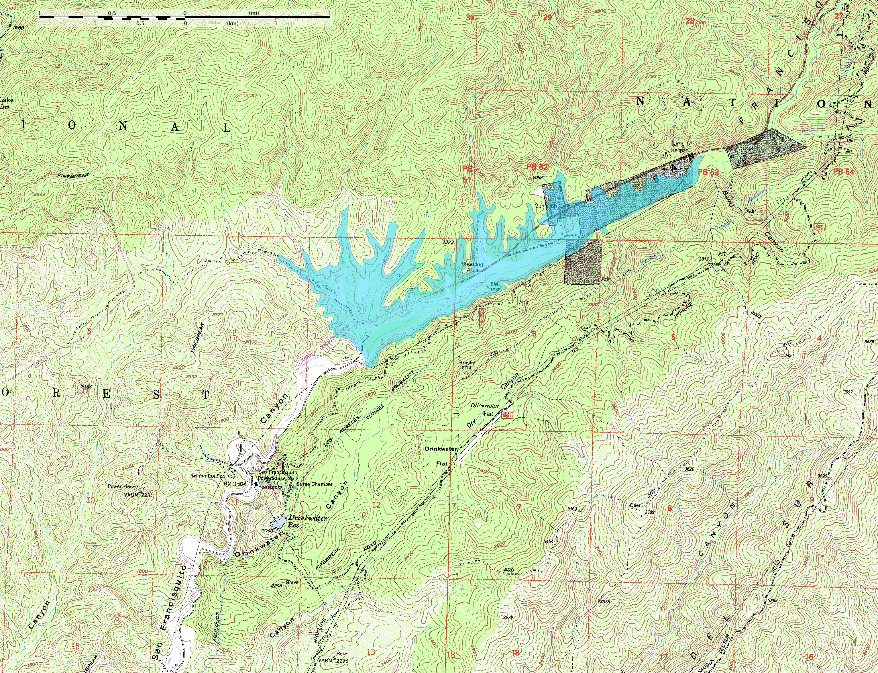
San Francisquito Reservoir on topo v2
The reservoir extent was determined by tracing at or just below the 1840-foot elevation contour; the pool elevation was about 1835 feet when full and when the dam collapsed. The topo map includes sections of the Warm Springs Mountain 7.5" quadrangle (o34118e5) and the Green Valley quadrangle (o34118e4) from the USGS obtained as DRG files.
Note: The location and orientation of the dam (at the southwest extent of the reservoir) is approximate. Additionally, the elevation data in this map is from after the breach of the dam, which caused significant erosion of the hillside at the southeast abuttment; the dam was probably a little smaller than this reconstruction depicts.


Relevante Bilder


Relevante Artikel
St.-Francis-TalsperreDie St.-Francis-Talsperre war eine gekrümmte Gewichtsstaumauer aus Beton mit einem großen Stausee nahe bei Los Angeles in Kalifornien. Die Staumauer wurde von 1924 bis 1926 unter der Leitung von William Mulholland, einem Ingenieur des Los Angeles Department of Water and Power, gebaut. Die Staumauer brach wenige Minuten vor Mitternacht am 12. März 1928. Die entstehende Flutwelle tötete zwischen 550 und 600 Menschen. 2019 wurden dort ein Saint Francis Dam Disaster National Monument und ein Saint Francis Dam Disaster National Memorial ausgewiesen. .. weiterlesen