Republic of Lucca, N. Sanson - Covens & Mortier, 18th century
The map was designed by Nicolas Sanson (1600-1667) and published after his death by Covens & Mortier.
Relevante Bilder
Relevante Artikel
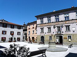
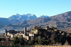
Castiglione di GarfagnanaCastiglione di Garfagnana ist eine italienische Gemeinde mit 1707 Einwohnern in der Provinz Lucca in der Toskana und ist Mitglied der Vereinigung I borghi più belli d’Italia. .. weiterlesen
Castelnuovo di GarfagnanaCastelnuovo di Garfagnana ist eine italienische Gemeinde mit 5650 Einwohnern in der Provinz Lucca in der Toskana. Sie ist der Hauptort der Garfagnana. .. weiterlesen
PietrasantaPietrasanta ist eine italienische Kleinstadt mit 23.066 Einwohnern in der Provinz Lucca in der nördlichen Toskana. .. weiterlesen
MontignosoMontignoso ist eine italienische Gemeinde mit 10.122 Einwohnern in der Provinz Massa-Carrara in der Region Toskana. .. weiterlesen


