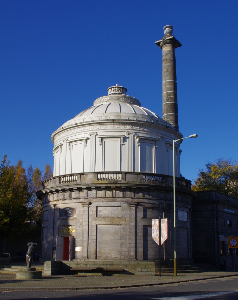
Perth Water Works
Autor/Urheber:
Attribution:
Das Bild ist mit 'Attribution Required' markiert, aber es wurden keine Informationen über die Attribution bereitgestellt. Vermutlich wurde bei Verwendung des MediaWiki-Templates für die CC-BY Lizenzen der Parameter für die Attribution weggelassen. Autoren und Urheber finden für die korrekte Verwendung der Templates hier ein Beispiel.
Shortlink:
Quelle:
Größe:
794 x 1004 Pixel (284041 Bytes)
Beschreibung:
Dieses Foto zeigt das geschützte Denkmal in Schottland mit der Nummer
Lizenz:
Relevante Bilder
![](https://upload.wikimedia.org/wikipedia/commons/thumb/0/08/Perth_Sheriff_Court_2.jpg/250px-Perth_Sheriff_Court_2.jpg)
![](https://upload.wikimedia.org/wikipedia/commons/thumb/5/5f/Perth_Bridge_and_the_River_Tay_-_geograph.org.uk_-_1077778.jpg/250px-Perth_Bridge_and_the_River_Tay_-_geograph.org.uk_-_1077778.jpg)
(c) Dr Richard Murray, CC BY-SA 2.0
![](https://upload.wikimedia.org/wikipedia/commons/thumb/8/8e/Perth_St_John%27s_Kirk.jpg/250px-Perth_St_John%27s_Kirk.jpg)
![](https://upload.wikimedia.org/wikipedia/commons/thumb/3/3c/Newton_Castle_from_SW.jpg/250px-Newton_Castle_from_SW.jpg)
![](https://upload.wikimedia.org/wikipedia/commons/thumb/a/a2/Lower_City_Mills%2C_Perth_-_geograph.org.uk_-_12129.jpg/250px-Lower_City_Mills%2C_Perth_-_geograph.org.uk_-_12129.jpg)
(c) Val Vannet, CC BY-SA 2.0
![](https://upload.wikimedia.org/wikipedia/commons/thumb/d/db/Wade%27s_Bridge_over_the_River_Tay%2C_Aberfeldy_-_geograph.org.uk_-_432981.jpg/250px-Wade%27s_Bridge_over_the_River_Tay%2C_Aberfeldy_-_geograph.org.uk_-_432981.jpg)
(c) Bill Henderson, CC BY-SA 2.0
![](https://upload.wikimedia.org/wikipedia/commons/thumb/a/aa/A_shop_in_the_main_street_with_an_interesting_design._-_geograph.org.uk_-_745712.jpg/250px-A_shop_in_the_main_street_with_an_interesting_design._-_geograph.org.uk_-_745712.jpg)
(c) Elliott Simpson, CC BY-SA 2.0
![](https://upload.wikimedia.org/wikipedia/commons/thumb/8/84/Pitheavlis_Castle_-_geograph.org.uk_-_959560.jpg/250px-Pitheavlis_Castle_-_geograph.org.uk_-_959560.jpg)
(c) James Nicol, CC BY-SA 2.0
![](https://upload.wikimedia.org/wikipedia/commons/thumb/c/c4/Megginch_Castle_gatehouse_-_geograph.org.uk_-_377931.jpg/250px-Megginch_Castle_gatehouse_-_geograph.org.uk_-_377931.jpg)
(c) James Allan, CC BY-SA 2.0
![](https://upload.wikimedia.org/wikipedia/commons/thumb/f/fa/Chinese_Bridge%2C_Taymouth_Castle_%28geograph_2025598%29.jpg/250px-Chinese_Bridge%2C_Taymouth_Castle_%28geograph_2025598%29.jpg)
(c) Dr Richard Murray, CC BY-SA 2.0
![](https://upload.wikimedia.org/wikipedia/commons/thumb/2/21/Dry_Arch%2C_Dalcrue%2C_Perthshire._-_geograph.org.uk_-_74247.jpg/250px-Dry_Arch%2C_Dalcrue%2C_Perthshire._-_geograph.org.uk_-_74247.jpg)
(c) Arthur Bruce, CC BY-SA 2.0
![](https://upload.wikimedia.org/wikipedia/commons/thumb/b/bc/Avanti_Restaurant%2C_High_Street_%28geograph_4132659%29.jpg/125px-Avanti_Restaurant%2C_High_Street_%28geograph_4132659%29.jpg)
(c) Basher Eyre, CC BY-SA 2.0
![](https://upload.wikimedia.org/wikipedia/commons/thumb/7/7e/Errol_Park_-_geograph.org.uk_-_1198696.jpg/250px-Errol_Park_-_geograph.org.uk_-_1198696.jpg)
(c) James Allan, CC BY-SA 2.0
![](https://upload.wikimedia.org/wikipedia/commons/thumb/9/9e/Ballindean_House_-_the_home_of_Teen_Ranch_%28geograph_4862857%29.jpg/250px-Ballindean_House_-_the_home_of_Teen_Ranch_%28geograph_4862857%29.jpg)
(c) Elliott Simpson, CC BY-SA 2.0
![](https://upload.wikimedia.org/wikipedia/commons/thumb/b/b5/Platform_at_Dunkeld_and_Birnam_Railway_Station_-_geograph.org.uk_-_1587478.jpg/250px-Platform_at_Dunkeld_and_Birnam_Railway_Station_-_geograph.org.uk_-_1587478.jpg)
(c) PAUL FARMER, CC BY-SA 2.0
![](https://upload.wikimedia.org/wikipedia/commons/thumb/5/5e/Perth_Prison_-_geograph.org.uk_-_962504.jpg/250px-Perth_Prison_-_geograph.org.uk_-_962504.jpg)
(c) James Nicol, CC BY-SA 2.0
![](https://upload.wikimedia.org/wikipedia/commons/thumb/9/98/Murthly_Castle_Chapel_-_geograph.org.uk_-_424698.jpg/250px-Murthly_Castle_Chapel_-_geograph.org.uk_-_424698.jpg)
(c) Raymond Chisholm, CC BY-SA 2.0
![](https://upload.wikimedia.org/wikipedia/commons/thumb/6/6a/Chapel_Scone_Palace_%2C_Perth_-_geograph.org.uk_-_452978.jpg/250px-Chapel_Scone_Palace_%2C_Perth_-_geograph.org.uk_-_452978.jpg)
(c) rob bishop, CC BY-SA 2.0
![](https://upload.wikimedia.org/wikipedia/commons/thumb/7/76/Murthly_Castle_-_geograph.org.uk_-_424676.jpg/250px-Murthly_Castle_-_geograph.org.uk_-_424676.jpg)
(c) Raymond Chisholm, CC BY-SA 2.0
![](https://upload.wikimedia.org/wikipedia/commons/thumb/4/41/Aviva_Perth_-_geograph.org.uk_-_1345184.jpg/250px-Aviva_Perth_-_geograph.org.uk_-_1345184.jpg)
(c) Lis Burke, CC BY-SA 2.0
![](https://upload.wikimedia.org/wikipedia/commons/thumb/c/ca/Aberuchill_Castle_-_geograph.org.uk_-_670086.jpg/250px-Aberuchill_Castle_-_geograph.org.uk_-_670086.jpg)
(c) Dr Richard Murray, CC BY-SA 2.0
![](https://upload.wikimedia.org/wikipedia/commons/thumb/5/5d/Church_with_spire%2C_Invergowrie_%28geograph_5017213%29.jpg/125px-Church_with_spire%2C_Invergowrie_%28geograph_5017213%29.jpg)
(c) Stanley Howe, CC BY-SA 2.0
![](https://upload.wikimedia.org/wikipedia/commons/thumb/4/4b/Errol_Parish_Church_-_geograph.org.uk_-_104301.jpg/125px-Errol_Parish_Church_-_geograph.org.uk_-_104301.jpg)
(c) James Allan, CC BY-SA 2.0
![](https://upload.wikimedia.org/wikipedia/commons/thumb/2/2d/Longforgan_mercat_cross%2C_Main_Street_%28geograph_3680878%29.jpg/125px-Longforgan_mercat_cross%2C_Main_Street_%28geograph_3680878%29.jpg)
(c) kim traynor, CC BY-SA 2.0
![](https://upload.wikimedia.org/wikipedia/commons/thumb/e/ef/Mercat_Cross%2C_Meikleour_-_geograph.org.uk_-_1768792.jpg/250px-Mercat_Cross%2C_Meikleour_-_geograph.org.uk_-_1768792.jpg)
(c) Dave Fergusson, CC BY-SA 2.0
![](https://upload.wikimedia.org/wikipedia/commons/thumb/8/8d/Monzie_Castle_-_geograph.org.uk_-_1632618.jpg/250px-Monzie_Castle_-_geograph.org.uk_-_1632618.jpg)
(c) Eleanor Miller, CC BY-SA 2.0
![](https://upload.wikimedia.org/wikipedia/commons/thumb/2/28/Dalguise_viaduct_%28geograph_3418380%29.jpg/250px-Dalguise_viaduct_%28geograph_3418380%29.jpg)
(c) Euan Nelson, CC BY-SA 2.0
![](https://upload.wikimedia.org/wikipedia/commons/thumb/2/22/King_James_VI_Hospital_%28geograph_3726022%29.jpg/250px-King_James_VI_Hospital_%28geograph_3726022%29.jpg)
(c) kim traynor, CC BY-SA 2.0
![](https://upload.wikimedia.org/wikipedia/commons/thumb/5/5b/Ochtertyre_House_-_geograph.org.uk_-_691363.jpg/250px-Ochtertyre_House_-_geograph.org.uk_-_691363.jpg)
(c) Dr Richard Murray, CC BY-SA 2.0
![](https://upload.wikimedia.org/wikipedia/commons/thumb/3/32/Nether_Gask_-_geograph.org.uk_-_449208.jpg/250px-Nether_Gask_-_geograph.org.uk_-_449208.jpg)
(c) Richard Webb, CC BY-SA 2.0
![](https://upload.wikimedia.org/wikipedia/commons/thumb/3/3f/Former_bank_building_on_St_John_Street_%28geograph_4257401%29.jpg/250px-Former_bank_building_on_St_John_Street_%28geograph_4257401%29.jpg)
(c) Graham Hogg, CC BY-SA 2.0
![](https://upload.wikimedia.org/wikipedia/commons/thumb/9/94/Tummel_Bridge_Power_Station_-_geograph.org.uk_-_776149.jpg/250px-Tummel_Bridge_Power_Station_-_geograph.org.uk_-_776149.jpg)
(c) Peter Bond, CC BY-SA 2.0
![](https://upload.wikimedia.org/wikipedia/commons/thumb/5/5b/Rannoch_Powerstation_-_geograph.org.uk_-_111831.jpg/250px-Rannoch_Powerstation_-_geograph.org.uk_-_111831.jpg)
(c) Alan Thomson, CC BY-SA 2.0
![](https://upload.wikimedia.org/wikipedia/commons/thumb/7/7d/Doocot%2C_Megginch_Castle._-_geograph.org.uk_-_214392.jpg/125px-Doocot%2C_Megginch_Castle._-_geograph.org.uk_-_214392.jpg)
(c) John Jenkins, CC BY-SA 2.0
![](https://upload.wikimedia.org/wikipedia/commons/thumb/3/32/Keathbank_Mill_beside_River_Ericht%2C_Blairgowrie_-_geograph.org.uk_-_962534.jpg/250px-Keathbank_Mill_beside_River_Ericht%2C_Blairgowrie_-_geograph.org.uk_-_962534.jpg)
(c) James Nicol, CC BY-SA 2.0
![](https://upload.wikimedia.org/wikipedia/commons/thumb/7/7f/St._Leonard%27s-in-the-Fields_-_geograph.org.uk_-_1469806.jpg/125px-St._Leonard%27s-in-the-Fields_-_geograph.org.uk_-_1469806.jpg)
(c) Martin Addison, CC BY-SA 2.0
![](https://upload.wikimedia.org/wikipedia/commons/thumb/c/c9/Pitlochry_Railway_Station_-_geograph.org.uk_-_776524.jpg/250px-Pitlochry_Railway_Station_-_geograph.org.uk_-_776524.jpg)
(c) Kenneth Allen, CC BY-SA 2.0
![](https://upload.wikimedia.org/wikipedia/commons/thumb/9/9d/Bridge_at_The_Hermitage_-_geograph.org.uk_-_1587501.jpg/250px-Bridge_at_The_Hermitage_-_geograph.org.uk_-_1587501.jpg)
(c) PAUL FARMER, CC BY-SA 2.0
![](https://upload.wikimedia.org/wikipedia/commons/thumb/6/60/Perth_and_Kinross_council_area.svg/125px-Perth_and_Kinross_council_area.svg.png)
![](https://upload.wikimedia.org/wikipedia/commons/thumb/3/3d/Cleish_Castle_-_geograph.org.uk_-_164184.jpg/250px-Cleish_Castle_-_geograph.org.uk_-_164184.jpg)
(c) James Allan, CC BY-SA 2.0
![](https://upload.wikimedia.org/wikipedia/commons/thumb/d/d3/Gates_to_Blair_Castle_-_geograph.org.uk_-_1588272.jpg/250px-Gates_to_Blair_Castle_-_geograph.org.uk_-_1588272.jpg)
(c) PAUL FARMER, CC BY-SA 2.0
Relevante Artikel
Liste der Kategorie-A-Bauwerke in Perth and KinrossDie Liste der Kategorie-A-Gebäude in Perth and Kinross umfasst sämtliche in der Kategorie A eingetragenen Baudenkmäler in der schottischen Council Area Perth and Kinross. Die Einstufung wird anhand der Kriterien von Historic Scotland vorgenommen, wobei in die höchste Kategorie A Bauwerke von nationaler oder internationaler Bedeutung einsortiert sind. In Perth and Kinross sind derzeit 158 Bauwerke in der Kategorie A gelistet. .. weiterlesen