Liste der Kategorie-A-Bauwerke in Perth and Kinross

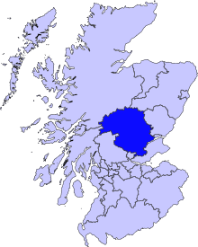
Lage von Perth and Kinross in Schottland

Die Liste der Kategorie-A-Gebäude in Perth and Kinross umfasst sämtliche in der Kategorie A eingetragenen Baudenkmäler in der schottischen Council Area Perth and Kinross. Die Einstufung wird anhand der Kriterien von Historic Scotland vorgenommen, wobei in die höchste Kategorie A Bauwerke von nationaler oder internationaler Bedeutung einsortiert sind. In Perth and Kinross sind derzeit 158 Bauwerke in der Kategorie A gelistet.

NameLageTypEintragBild
Bridge of Ruimnahe Alyth
56° 37′ 47,5″ N, 3° 11′ 32,1″ W
Brücke53
Old Fincastle Housenahe Blair Atholl
56° 44′ 14,7″ N, 3° 51′ 8,3″ W
Herrenhaus69
Sonnenuhr Nr. 2 von Stobhallnahe Stanley
56° 29′ 39,7″ N, 3° 24′ 38″ W
Sonnenuhr79
Drummonie Housenahe Bridge of Earn
56° 20′ 16,4″ N, 3° 25′ 46,5″ W
Villa163
Drummonie House
(c) Keith Proven, CC BY-SA 2.0
Balhary Housenahe Alyth
56° 36′ 19,8″ N, 3° 11′ 56,9″ W
Villa4379
Bridge of Islanahe Meikleour
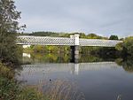
56° 31′ 40,9″ N, 3° 21′ 41,1″ W
Brücke4424
Bridge of Isla
(c) Trevor Littlewood, CC BY-SA 2.0
Gourdie Housenahe Spittalfield
56° 33′ 52,5″ N, 3° 25′ 46,1″ W
Villa4440
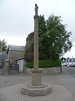
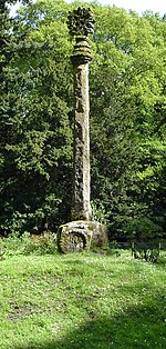
Meikleour CrossMeikleour
56° 32′ 24,6″ N, 3° 22′ 17,9″ W
Marktkreuz4446
Meikleour Cross
(c) Dave Fergusson, CC BY-SA 2.0
Bell MillStanley
56° 28′ 45,1″ N, 3° 26′ 27,3″ W
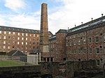
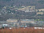
Mühle4486Bell Mill (rechts)
Mid MillStanley
56° 28′ 44,3″ N, 3° 26′ 25,1″ W
Mühle4489Mid Mill (links)
Kilgraston HouseBridge of Earn
56° 20′ 30″ N, 3° 24′ 58,6″ W
Herrenhaus4527Kilgraston House
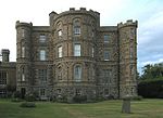
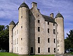
Aberuchill Castlenahe Comrie
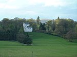
56° 21′ 57,7″ N, 4° 1′ 59,4″ W
Tower House5296
Aberuchill Castle
(c) Dr Richard Murray, CC BY-SA 2.0
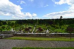
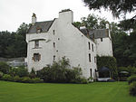
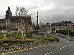
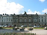
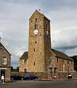
Comrie Old Parish ChurchComrie
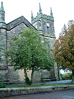
56° 22′ 25,9″ N, 3° 59′ 18,4″ W
Kirche5385
Comrie Old Parish Church
(c) wfmillar, CC BY-SA 2.0
1 Dunira StreetComrie
56° 22′ 27,4″ N, 3° 59′ 17,1″ W
Geschäftsgebäude5393
1 Dunira Street
(c) Elliott Simpson, CC BY-SA 2.0
Balmanno Castlenahe Bridge of Earn
56° 19′ 29,2″ N, 3° 23′ 10,9″ W
Tower House5422Balmanno Castle
Ecclesiamagirdle Housenahe Bridge of Earn
56° 19′ 53,4″ N, 3° 26′ 41,8″ W
Herrenhaus5427
Taubenhaus von Ecclesiamagirdle Housenahe Bridge of Earn
56° 19′ 53,4″ N, 3° 26′ 40,5″ W
Taubenhaus5430
Stobhallnahe Stanley
56° 29′ 35,7″ N, 3° 24′ 41″ W
Tower House5473
Stobhall
(c) Andrew Mitchell, CC BY-SA 2.0
Brauerei und Bäckerei von Stobhallnahe Stanley
56° 29′ 36,3″ N, 3° 24′ 41,6″ W
Wirtschaftsgebäude5474
Witwenhaus von Stobhallnahe Stanley
56° 29′ 36,3″ N, 3° 24′ 40,4″ W
Wohngebäude5475
Neue Bibliothek von Stobhallnahe Stanley
56° 29′ 35,2″ N, 3° 24′ 41,5″ W
Bibliothek5477
Sonnenuhr Nr. 1 von Stobhallnahe Stanley
56° 29′ 37,3″ N, 3° 24′ 40,3″ W
Sonnenuhr5479
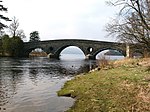
Dunkeld BridgeDunkeld
56° 33′ 50,2″ N, 3° 35′ 6,9″ W
Brücke5620
Dunkeld Bridge
(c) ronnie leask, CC BY-SA 2.0
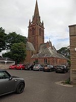
Dunkeld CathedralDunkeld
56° 33′ 54,2″ N, 3° 35′ 23,7″ W
Kirche5631
Dunkeld Cathedral
(c) Alison Stamp, CC BY-SA 2.0
Blackcraig Bridgenahe Bridge of Cally
56° 39′ 56,5″ N, 3° 27′ 23,1″ W
Brücke5674
Blackcraig Bridge
(c) Richard Webb, CC BY-SA 2.0
Ardblair Castlenahe Blairgowrie and Rattray
56° 35′ 6,7″ N, 3° 21′ 48″ W
Tower House5677
Cleish Castlenahe Kinross
56° 9′ 56,1″ N, 3° 28′ 45″ W
Tower House5711
Cleish Castle
(c) James Allan, CC BY-SA 2.0
Blair Adamnahe Kelty
56° 8′ 45,5″ N, 3° 24′ 10,5″ W
Villa5715
Camserney Longhousenahe Aberfeldy
56° 37′ 12,3″ N, 3° 55′ 47″ W
Bauernhaus5732
Tummel Bridgenahe Loch Tummel
56° 42′ 28,3″ N, 4° 1′ 23,5″ W
Brücke5742
Tummel Bridge
(c) David Greenhalgh, CC BY-SA 2.0
Monzie Castlenahe Crieff
56° 23′ 57,2″ N, 3° 49′ 34,2″ W
Herrenhaus5779
Monzie Castle
(c) Eleanor Miller, CC BY-SA 2.0
Innerpeffray Librarynahe Crieff
56° 20′ 40,7″ N, 3° 46′ 41,8″ W
Bibliothek5792
Innerpeffray Library
(c) John Hughes, CC BY-SA 2.0
Montrose MausoleumAberuthven
56° 19′ 1,6″ N, 3° 39′ 40,3″ W
Mausoleum5819Montrose Mausoleum
Keltie Castlenahe Dunning
56° 18′ 5,3″ N, 3° 36′ 19″ W
Herrenhaus5912
Taubenhaus von Duncrub Housenahe Dunning
56° 19′ 0,7″ N, 3° 35′ 39,2″ W
Taubenhaus5915
Auchleeks Housenahe Blair Atholl
56° 45′ 22,3″ N, 4° 3′ 37,4″ W
Herrenhaus6054
Front Lodge von Blair CastleBlair Atholl
56° 46′ 1″ N, 3° 50′ 45,1″ W
Wohngebäude6064
Front Lodge von Blair Castle
(c) PAUL FARMER, CC BY-SA 2.0
Grotte am TiltBlair Atholl
56° 46′ 29″ N, 3° 50′ 29,3″ W
Grotte6065
Blair Castlenahe Blair Atholl
56° 46′ 24,1″ N, 3° 51′ 26,8″ W
Burg6074Blair Castle
Sonnenuhr von Blair Castlenahe Blair Atholl
56° 46′ 23,8″ N, 3° 51′ 32,4″ W
Sonnenuhr6076
Keithick Housenahe Burrelton
56° 31′ 55,4″ N, 3° 17′ 49,7″ W
Herrenhaus6170
East MillStanley
56° 28′ 44,6″ N, 3° 26′ 22,6″ W
Mühle6690
East Mill (links)
(c) M J Richardson, CC BY-SA 2.0
Megginch Castlenahe Errol
56° 24′ 27,1″ N, 3° 13′ 48″ W
Burg10963
Stallungen von Megginch Castlenahe Errol
56° 24′ 29″ N, 3° 13′ 50,5″ W
Stallung10964
Stallungen von Megginch Castle
(c) John Jenkins, CC BY-SA 2.0
North Lodgenahe Errol
56° 24′ 37,5″ N, 3° 14′ 30,3″ W
Wohngebäude10969
North Lodge
(c) James Allan, CC BY-SA 2.0
Brücke von Balthayock Housenahe St Madoes
56° 23′ 35″ N, 3° 19′ 59,5″ W
Brücke10986
Forteviot SquareForteviot
56° 20′ 26,8″ N, 3° 32′ 7,8″ W
Wohngebäude11057
Forteviot Square
(c) Anne Burgess, CC BY-SA 2.0
Forteviot HallForteviot
56° 20′ 24,9″ N, 3° 32′ 7,1″ W
Halle11058Forteviot Hall
Invermay Housenahe Forgandenny
56° 19′ 40,4″ N, 3° 31′ 14,2″ W
Herrenhaus11071
Old House of Invermaynahe Forgandenny
56° 19′ 43,9″ N, 3° 31′ 13,1″ W
Tower House11074
Hermitage Bridgenahe Birnam
56° 33′ 26″ N, 3° 36′ 51,9″ W
Brücke11104
Hermitage Bridge
(c) PAUL FARMER, CC BY-SA 2.0
Dalguise Viaductnahe Dunkeld
56° 36′ 46″ N, 3° 38′ 19,8″ W
Brücke11117
Dalguise Viaduct
(c) Euan Nelson, CC BY-SA 2.0
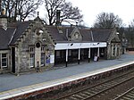
Bahnhof Dunkeld and BirnamBirnam
56° 33′ 25,1″ N, 3° 34′ 41,9″ W
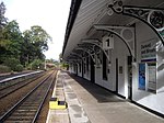
Bahnhof11139
Bahnhof Dunkeld and Birnam
(c) PAUL FARMER, CC BY-SA 2.0
Roman Bridgenahe Murthly
56° 32′ 18″ N, 3° 32′ 5,9″ W
Brücke11145
Murthly Castlenahe Murthly
56° 32′ 29,7″ N, 3° 30′ 40,7″ W
Herrenhaus11146
Murthly Castle
(c) Raymond Chisholm, CC BY-SA 2.0
Gärten von Murthly Castlenahe Murthly
56° 32′ 27,7″ N, 3° 30′ 36,9″ W
Gärten11147
Kinross HouseKinross
56° 12′ 10,8″ N, 3° 24′ 35″ W
Herrenhaus11200
Kinross House
(c) JThomas, CC BY-SA 2.0
Dalreoch Bridgenahe Dunning
56° 20′ 34,4″ N, 3° 36′ 47,4″ W
Brücke11211
Dalreoch Bridge
(c) Richard Webb, CC BY-SA 2.0
Kinnaird CastleKinnaird
56° 26′ 46,2″ N, 3° 13′ 56,8″ W
Tower House11218
Kinnaird Castle
(c) Anne Burgess, CC BY-SA 2.0
Kirk O’ The Muirnahe Murthly
56° 31′ 1,2″ N, 3° 26′ 39,9″ W
Kirchenruine11233
Hilton Housenahe Perth
56° 21′ 52,7″ N, 3° 25′ 54,8″ W
Wohngebäude11329
Tullibole Castlenahe Crook of Devon
56° 11′ 18,1″ N, 3° 31′ 40,8″ W
Tower House11459
Tullibole Castle
(c) Paul McIlroy, CC BY-SA 2.0
Aldie Castlenahe Crook of Devon
56° 9′ 47,6″ N, 3° 31′ 52,1″ W
Tower House11469
Aldie Castle
(c) James Allan, CC BY-SA 2.0
Errol Parish ChurchErrol
56° 23′ 34,7″ N, 3° 12′ 43,5″ W
Kirche11589
Errol Parish Church
(c) James Allan, CC BY-SA 2.0
Errol Park HouseErrol
56° 23′ 23″ N, 3° 13′ 12,6″ W
Villa11598
Errol Park House
(c) James Allan, CC BY-SA 2.0
Stallung von Errol Park HouseErrol
56° 23′ 24,7″ N, 3° 13′ 14,1″ W
Stallung11599
Seasyde Housenahe Errol
56° 24′ 22,7″ N, 3° 9′ 44,6″ W
Villa11605
Ballindean Housenahe Inchture
56° 27′ 21″ N, 3° 11′ 18,2″ W
Villa11760
Ballindean House
(c) Elliott Simpson, CC BY-SA 2.0
Rossie Churchnahe Inchture
56° 27′ 50,6″ N, 3° 9′ 4,4″ W
Kirche11786
Marktkreuz von Rossienahe Inchture
56° 27′ 48,2″ N, 3° 9′ 1,5″ W
Marktkreuz11787
Grandtully Castlenahe Grandtully
56° 38′ 26,4″ N, 3° 48′ 34,5″ W
Tower House11830
Grandtully Castle
(c) Elliott Simpson, CC BY-SA 2.0
St Mary’s Churchnahe Grandtully
56° 38′ 3,4″ N, 3° 48′ 58,3″ W
Kirche11831Grandtully Castle
Logierait ViaductLogierait
56° 38′ 48,4″ N, 3° 41′ 0,2″ W
Brücke11851Logierait Viaduct
Kinfauns Castlenahe Perth
56° 23′ 18,2″ N, 3° 22′ 39,4″ W
Burg11955
Kinfauns Castle
(c) Richard Webb, CC BY-SA 2.0
Glendoick Housenahe St Madoes
56° 23′ 52,8″ N, 3° 17′ 7,2″ W
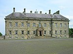
Herrenhaus11966
Glendoick House
(c) Dr Richard Murray, CC BY-SA 2.0
Molkerei von Taymouth Castlenahe Kenmore
56° 35′ 21,1″ N, 3° 59′ 18,7″ W
Landwirtschaftliches Gebäude12091
Taymouth Castlenahe Kenmore
56° 35′ 40,5″ N, 3° 58′ 52,8″ W
Schloss12093Taymouth Castle
Chinese Bridgenahe Kenmore
56° 35′ 47,6″ N, 3° 59′ 4,9″ W
Brücke12097
Chinese Bridge
(c) Dr Richard Murray, CC BY-SA 2.0
Fort Lodgenahe Kenmore
56° 35′ 28,1″ N, 3° 58′ 19,3″ W
Wohngebäude12096
Rustic Lodgenahe Kenmore
56° 35′ 25,3″ N, 3° 58′ 26,1″ W
Wohngebäude12100
Kenmore BridgeKenmore
56° 35′ 8,5″ N, 4° 0′ 6,5″ W
Brücke12138
Kenmore Bridge
(c) Gordon Hatton, CC BY-SA 2.0
Connachan Lodgenahe Crieff
56° 25′ 39,1″ N, 3° 47′ 30,7″ W
Wohngebäude12213
Sonnenuhr von Abercairnynahe Crieff
56° 22′ 52,5″ N, 3° 45′ 53,9″ W
Sonnenuhr12257
All Souls Episcopal ChurchInvergowrie
56° 27′ 39,1″ N, 3° 3′ 46,2″ W
Kirche12849
All Souls Episcopal Church
(c) Stanley Howe, CC BY-SA 2.0
Castle HuntlyLongforgan
56° 26′ 55,9″ N, 3° 8′ 1,9″ W
Burg12868Castle Huntly
Eishaus von Castle HuntlyLongforgan
56° 26′ 59,5″ N, 3° 8′ 2″ W
Eishaus12870
North GateLongforgan
56° 27′ 11,7″ N, 3° 7′ 48,8″ W
Tor12871
North Gate
(c) Maigheach-gheal, CC BY-SA 2.0
Marktkreuz von LongforganLongforgan
56° 27′ 25,9″ N, 3° 7′ 11,8″ W
Marktkreuz13283
Marktkreuz von Longforgan
(c) kim traynor, CC BY-SA 2.0
Chapel of St Anthony the Eremitenahe Murthly
56° 32′ 35,9″ N, 3° 30′ 42,6″ W
Kirche13460
Chapel of St Anthony the Eremite
(c) Raymond Chisholm, CC BY-SA 2.0
Marlee HouseKinloch
56° 35′ 5,1″ N, 3° 23′ 13,6″ W
Herrenhaus13742
Inchmartine Housenahe Inchture
56° 26′ 20,3″ N, 3° 11′ 52,4″ W
Herrenhaus13773
Inchmartine House
(c) Paul Taylor, CC BY-SA 2.0
Maxwell’s Templenahe Kenmore
56° 35′ 22,9″ N, 3° 59′ 43,3″ W
Folly13804
Meggernie Castlenahe Loch Tay
56° 35′ 1,4″ N, 4° 21′ 22,7″ W
Tower House13812Meggernie Castle
Inchyra Housenahe St Madoes
56° 22′ 37,5″ N, 3° 18′ 45,5″ W
Herrenhaus17624
Pitfour CastleSt Madoes
56° 22′ 24,3″ N, 3° 17′ 51,6″ W
Herrenhaus17628
Pitfour Castle
(c) Rob Burke, CC BY-SA 2.0
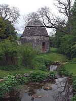
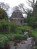
Taubenturm von Elcho Castlenahe Rhynd
56° 22′ 23,2″ N, 3° 21′ 22,6″ W
Taubenturm17714
Taubenturm von Elcho Castle
(c) ronnie leask, CC BY-SA 2.0
Telefonzelle von RhyndRhynd
56° 21′ 55″ N, 3° 21′ 51,9″ W
Telefonzelle17718
Telefonzelle von Rhynd
(c) Snaik, CC BY-SA 2.0
Colquhalzie Housenahe Muthill
56° 20′ 13,3″ N, 3° 45′ 31,4″ W
Herrenhaus17771
Weem Old Parish KirkWeem
56° 37′ 32,2″ N, 3° 53′ 14,9″ W
Kirche17815
Weem Old Parish Kirk
(c) Richard Hoare, CC BY-SA 2.0
Williamston Housenahe Methven
56° 22′ 46,5″ N, 3° 39′ 57,2″ W
Herrenhaus17836
Glenalmond Collegenahe Methven
56° 26′ 30,9″ N, 3° 39′ 36,5″ W
Schule17869
Glenalmond College
(c) Russel Wills, CC BY-SA 2.0
Methven Castlenahe Methven
56° 25′ 0,5″ N, 3° 33′ 17,5″ W
Burg17895
Methven Castle
(c) Arthur Bruce, CC BY-SA 2.0
Dalcrue Housenahe Methven
56° 26′ 1,5″ N, 3° 33′ 12,3″ W
Villa17897
Dry Bridgenahe Methven
56° 26′ 15,8″ N, 3° 32′ 13,1″ W
Brücke17921
Dry Bridge
(c) Arthur Bruce, CC BY-SA 2.0
Methven AisleMethven
56° 24′ 58,9″ N, 3° 34′ 51,7″ W
Kirchenrest17928Methven Aisle (links)
Lochlane Housenahe Crieff
56° 22′ 12,2″ N, 3° 53′ 20,5″ W
Herrenhaus18149
Lawers Housenahe Comrie
56° 23′ 3,3″ N, 3° 56′ 46,4″ W
Herrenhaus18152Lawers House
Ochtertyre Housenahe Crieff
56° 23′ 26,1″ N, 3° 52′ 57,4″ W
Herrenhaus18170
Ochtertyre House
(c) Dr Richard Murray, CC BY-SA 2.0
Belmont CastleMeigle
56° 34′ 54,1″ N, 3° 9′ 50″ W
Herrenhaus18332
Scone Palacenahe Scone
56° 25′ 22,2″ N, 3° 26′ 18,1″ W
Schloss18370Scone Palace
Mausoleum von Scone Palacenahe Scone
56° 25′ 24,9″ N, 3° 26′ 15,6″ W
Mausoleum18371
Mausoleum von Scone Palace
(c) rob bishop, CC BY-SA 2.0
Cottown SchoolCottown
56° 22′ 29,2″ N, 3° 17′ 15,1″ W
Schule19809
Haugh of Drimmie Bridgenahe Bridge of Cally
56° 38′ 11″ N, 3° 21′ 16,7″ W
Brücke19830
Old Cross of Sconenahe Scone
56° 25′ 25,6″ N, 3° 26′ 6,3″ W
Marktkreuz19876Old Cross of Scone
Gärten von Drummond Castlenahe Muthill
56° 20′ 22,3″ N, 3° 52′ 15″ W
Gärten19883Gärten von Drummond Castle
Aberfeldy Water MillAberfeldy
56° 37′ 9,9″ N, 3° 52′ 1,9″ W
Mühle20859
Aberfeldy Water Mill
(c) David Greenhalgh, CC BY-SA 2.0
General Wade’s BridgeAberfeldy
56° 37′ 16,9″ N, 3° 52′ 24,9″ W
Brücke20861
General Wade’s Bridge
(c) Bill Henderson, CC BY-SA 2.0
Newton CastleBlairgowrie and Rattray
56° 35′ 31,3″ N, 3° 21′ 1,5″ W
Tower House22314Newton Castle
Kriegsdenkmal von BlairgowrieBlairgowrie and Rattray
56° 35′ 30,2″ N, 3° 20′ 13,3″ W
Denkmal22321
Kriegsdenkmal von Blairgowrie
(c) Paul Store, CC BY-SA 2.0
Keathbank MillBlairgowrie and Rattray
56° 36′ 0,1″ N, 3° 20′ 26,9″ W
Mühle22332
Keathbank Mill
(c) James Nicol, CC BY-SA 2.0
InchglasCrieff
56° 22′ 12,5″ N, 3° 50′ 19,1″ W
Villa23488
British Linen BankCrieff
56° 22′ 22″ N, 3° 50′ 22,3″ W
Wohn- und Geschäftsgebäude23489
British Linen Bank
(c) Basher Eyre, CC BY-SA 2.0
South United Free ChurchCrieff
56° 22′ 28″ N, 3° 50′ 35,9″ W
Kirche23509
South United Free Church
(c) David Dixon, CC BY-SA 2.0
St John’s ChurchPerth
56° 23′ 44,8″ N, 3° 25′ 41,1″ W
Kirche39300St John’s Church
St Leonard’s-in-the-FieldsPerth
56° 23′ 32,2″ N, 3° 25′ 57,8″ W
Kirche39310
St Leonard’s-in-the-Fields
(c) Martin Addison, CC BY-SA 2.0
St Ninian’s CathedralPerth
56° 23′ 56,8″ N, 3° 26′ 7,5″ W
Kirche39314St Ninian’s Cathedral
King James VI HospitalPerth
56° 23′ 41,1″ N, 3° 26′ 6,2″ W
Krankenhaus39319
King James VI Hospital
(c) kim traynor, CC BY-SA 2.0
Murray Royal HospitalPerth
56° 24′ 1,3″ N, 3° 24′ 43,7″ W
Krankenhaus39321
Old Perth AcademyPerth
56° 24′ 0,5″ N, 3° 25′ 56,7″ W
Schule39322Old Perth Academy
AK Bell LibraryPerth
56° 23′ 42,1″ N, 3° 26′ 15,1″ W
Bibliothek39323AK Bell Library
Perth Sheriff CourtPerth
56° 23′ 40,6″ N, 3° 25′ 33,8″ W
Gerichtsgebäude39325Perth Sheriff Court
Wärterhaus des HM Prisons PerthPerth
56° 23′ 8,9″ N, 3° 25′ 54,2″ W
Gefängnis39326
Wärterhaus des HM Prisons Perth (längliche Gebäude links im Vordergrund)
(c) James Nicol, CC BY-SA 2.0
Aultbea HousePerth
56° 23′ 9,3″ N, 3° 25′ 54,2″ W
Gefängnis39328
Aultbea House (kleines Gebäude links in zweiter Reihe)
(c) James Nicol, CC BY-SA 2.0
Haupttrakt des HM Prisons PerthPerth
56° 23′ 8″ N, 3° 25′ 48,5″ W
Gefängnis39331
Haupttrakt des HM Prisons Perth (hohes Gebäude in der Bildmitte)
(c) James Nicol, CC BY-SA 2.0
Greyfriars-FriedhofPerth
56° 23′ 36,2″ N, 3° 25′ 37,9″ W
Friedhof39338Greyfriars-Friedhof
Perth BridgePerth
56° 23′ 56,4″ N, 3° 25′ 30,7″ W
Brücke39339
Perth Bridge
(c) Dr Richard Murray, CC BY-SA 2.0
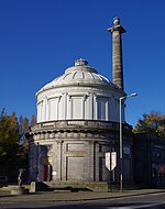
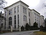
Perth Water Works BuildingPerth
56° 23′ 31,7″ N, 3° 25′ 34,9″ W
Industriegebäude39341Perth Water Works Building
Pitheavlis CastlePerth
56° 23′ 20,3″ N, 3° 27′ 3″ W
Tower House39346
Pitheavlis Castle
(c) James Nicol, CC BY-SA 2.0
2–8 Atholl CrescentPerth
56° 23′ 57″ N, 3° 25′ 52,8″ W
Wohngebäude39354
2–8 Atholl Crescent
(c) Paul McIlroy, CC BY-SA 2.0
2–4 Charlotte PlacePerth
56° 23′ 55″ N, 3° 25′ 43,3″ W
Wohn- und Geschäftsgebäude39392
Barnhill TollhousePerth
56° 22′ 56,8″ N, 3° 24′ 49″ W
Zollhaus39422
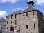
Upper City MillsPerth
56° 23′ 50,6″ N, 3° 26′ 10,4″ W
Mühle39577
Upper City Mills
(c) rob bishop, CC BY-SA 2.0
Lower City MillsPerth
56° 23′ 50,6″ N, 3° 26′ 7,9″ W
Mühle39578
Lower City Mills
(c) Val Vannet, CC BY-SA 2.0
Bank of ScotlandPerth
56° 23′ 44,5″ N, 3° 25′ 38,1″ W
Geschäftsgebäude39618
Bank of Scotland
(c) Graham Hogg, CC BY-SA 2.0
Pitlochry Parish ChurchPitlochry
56° 42′ 14,9″ N, 3° 43′ 57,8″ W
Kirche39850
Pitlochry Parish Church
(c) Bill Henderson, CC BY-SA 2.0
Sunnybrae CottagePitlochry
56° 42′ 15,4″ N, 3° 44′ 19,2″ W
Wohngebäude39866
Sunnybrae Cottage
(c) Jonathan Billinger, CC BY-SA 2.0
Bahnhof PitlochryPitlochry
56° 42′ 8,5″ N, 3° 44′ 8,6″ W
Bahnhof39867
Bahnhof Pitlochry
(c) Kenneth Allen, CC BY-SA 2.0
Castle Menziesnahe Aberfeldy
56° 37′ 26,1″ N, 3° 53′ 49,6″ W
Tower House43568
Castle Menzies
(c) Mike Searle, CC BY-SA 2.0
Folly von Stobhallnahe Stanley
56° 29′ 40,8″ N, 3° 24′ 38,5″ W
Folly43856
Wasserkraftwerk PitlochryPitlochry
56° 41′ 57″ N, 3° 44′ 25,4″ W
Kraftwerk47534Wasserkraftwerk Pitlochry
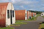
Baracken 19–20 und 44–46 des Cultybraggan Campsnahe Comrie
56° 21′ 22,1″ N, 3° 59′ 38,9″ W
Militäranlage50471
Baracken 19–20 und 44–46 des Cultybraggan Camps
(c) Mick Garratt, CC BY-SA 2.0
Hallyburton Housenahe Kettins
56° 32′ 1″ N, 3° 13′ 28,6″ W
Herrenhaus51605
Sonnenuhr von Hallyburton Housenahe Kettins
56° 32′ 0,4″ N, 3° 13′ 27,3″ W
Sonnenuhr51607
Wasserkraftwerk TummelLoch Tummel
56° 42′ 22,9″ N, 4° 1′ 16,2″ W
Kraftwerk51715
Wasserkraftwerk Tummel
(c) Peter Bond, CC BY-SA 2.0
Wasserkraftwerk RannochLoch Rannoch
56° 41′ 34,7″ N, 4° 24′ 7″ W
Kraftwerk51716
Wasserkraftwerk Rannoch
(c) Alan Thomson, CC BY-SA 2.0
Aviva UK Insurance BuildingPerth
56° 23′ 0,9″ N, 3° 27′ 43,1″ W
Geschäftsgebäude52450
Aviva UK Insurance Building
(c) Lis Burke, CC BY-SA 2.0
St Serf’s ChurchDunning
56° 18′ 45,6″ N, 3° 35′ 14,3″ W
Kirche52454
St Serf’s Church
(c) Lis Burke, CC BY-SA 2.0

Weblinks

Commons: Kategorie-A-Bauwerke in Perth and Kinross – Sammlung von Bildern, Videos und Audiodateien

Auf dieser Seite verwendete Medien

Lawers House.jpg
Autor/Urheber: Hazel Cameron, Lizenz: CC BY-SA 4.0
Lawers House, Herrenhaus nahe der schottischen Ortschaft Comrie in der Council Area Perth and Kinross
Forteviot Village Hall.JPG
Autor/Urheber: Stephencdickson, Lizenz: CC BY-SA 4.0
Forteviot Village Hall
Grandtully Castle (geograph 3890325).jpg
(c) Elliott Simpson, CC BY-SA 2.0
Grandtully Castle
Ochtertyre House - geograph.org.uk - 691363.jpg
(c) Dr Richard Murray, CC BY-SA 2.0
Ochtertyre House
Avanti Restaurant, High Street (geograph 4132659).jpg
(c) Basher Eyre, CC BY-SA 2.0
Avanti Restaurant, High Street
Monzie Castle - geograph.org.uk - 1632618.jpg
(c) Eleanor Miller, CC BY-SA 2.0
Monzie Castle Monzie Castle from Monzie Moor Crieff
Dry Arch, Dalcrue, Perthshire. - geograph.org.uk - 74247.jpg
(c) Arthur Bruce, CC BY-SA 2.0
Dry Arch, Dalcrue, Perthshire. The "Dry Arch" is part of a road system that connected Lynedoch House with Scone Palace allowing the gentry to travel between their big houses without coming into contact with the common people.
Wade's Bridge over the River Tay, Aberfeldy - geograph.org.uk - 432981.jpg
(c) Bill Henderson, CC BY-SA 2.0
Wade's Bridge over the River Tay, Aberfeldy
Crieff War Memorial (geograph 2673584).jpg
(c) David Dixon, CC BY-SA 2.0
Crieff War Memorial
Kinfauns Castle (geograph 2079961).jpg
(c) Richard Webb, CC BY-SA 2.0
Kinfauns Castle
Hydro-electric Dam (3288329922).jpg
Autor/Urheber: xlibber, Lizenz: CC BY 2.0
The hydro-electric dam at Pitlochry with the salmon leap on the left.
Rannoch Powerstation - geograph.org.uk - 111831.jpg
(c) Alan Thomson, CC BY-SA 2.0
Rannoch Powerstation. Powered by the water of the River Ericht that flows to Loch Rannoch
St Mary's Church (Grandtully) 20090615.jpg
Autor/Urheber: Otter, Lizenz: CC BY-SA 3.0
St Mary's Church, Grandtully, Perth and Kinross, Scotland
Platform at Dunkeld and Birnam Railway Station - geograph.org.uk - 1587478.jpg
(c) PAUL FARMER, CC BY-SA 2.0
Platform at Dunkeld & Birnam Railway Station
Tummel Bridge - geograph.org.uk - 152638.jpg
(c) David Greenhalgh, CC BY-SA 2.0
Tummel Bridge General Wade had the bridge built as part of his military road system. A modern bridge alongside now carries motor traffic and the old bridge is for pedestrians.
Entrance, HMP Castle Huntly (geograph 1853027).jpg
(c) Maigheach-gheal, CC BY-SA 2.0
Entrance, HMP Castle Huntly
Perth Water Works.jpg
Autor/Urheber: Simon Armstrong, Lizenz: CC BY-SA 3.0
Dieses Foto zeigt das geschützte Denkmal in Schottland mit der Nummer
Newton Castle from SW.jpg
Autor/Urheber: Odysseus1479, Lizenz: CC BY-SA 3.0
Dieses Foto zeigt das geschützte Denkmal in Schottland mit der Nummer
Atholl Place - geograph.org.uk - 548918.jpg
(c) Paul McIlroy, CC BY-SA 2.0
Atholl Place This row of houses is now occupied by a variety of businesses. The building nearest the camera is the home of a masonic lodge.
Scottish-Castle-Symbol.svg
Autor/Urheber: Majo statt Senf, Lizenz: CC BY-SA 4.0
Schlosssymbol Schottland
Bridge of Isla (geograph 2230560).jpg
(c) Trevor Littlewood, CC BY-SA 2.0
Bridge of Isla
Greyfriars Burial Ground, Perth, Scotland (8925641462).jpg
Autor/Urheber: Aaron Bradley from Vancouver, Canada, Lizenz: CC BY-SA 2.0
Greyfriars Burial Ground, Perth, Scotland
Stobhall Castle and chapel - geograph.org.uk - 82721.jpg
(c) Andrew Mitchell, CC BY-SA 2.0
Stobhall Castle and chapel. In the middle of the 14th century Sir John Drummond married the last of the Montfichets who owned the lands of Cargill and Stobhall. They moved from about three miles away to Stobhall where the Chapel may already have been standing. Recently the plain plaster ceiling of the passage was taken down and underneath were found the painted beams c. 1578. See http://www.stobhall.com/pages/history.html .
Taymouth Castle.jpg
Taymouth Castle, Kenmore, Scotland. Photo taken by Dudesleeper on June 6, 2003.
Perth Sheriff Court 2.jpg
Autor/Urheber: Simon Armstrong, Lizenz: CC BY-SA 3.0
Dieses Foto zeigt das geschützte Denkmal in Schottland mit der Nummer
Lower City Mills, Perth - geograph.org.uk - 12129.jpg
(c) Val Vannet, CC BY-SA 2.0
Lower City Mills, Perth. The Lower City Mills which today house Perth's Tourist Information Centre were once grain mills using water power from a lade dug from the River Almond, a tributary of the Tay.
Drummonie House - geograph.org.uk - 55034.jpg
(c) Keith Proven, CC BY-SA 2.0
Drummonie House. Picture taken from "Silver Walk" a footpath that runs beside a burn between Drummonie and Ballendrick House
Methven Church and churchyard.jpg
Autor/Urheber: Stephencdickson, Lizenz: CC BY-SA 4.0
Methven Church and churchyard
AK Bell Library, Perth - Front view.jpg
Autor/Urheber: Delphine_Dallison, Lizenz: CC BY-SA 3.0
Front view of the AK Bell Library in Perth, Scotland
Kenmore bridge - geograph.org.uk - 1239966.jpg
(c) Gordon Hatton, CC BY-SA 2.0
Kenmore bridge Stone bridge marking the point where Loch Tay ends and the River Tay begins.
Methven Castle.jpg
(c) Arthur Bruce, CC BY-SA 2.0
Methven Castle
Errol Park - geograph.org.uk - 1198696.jpg
(c) James Allan, CC BY-SA 2.0
Errol Park The mansion house and adjacent octagonal tower in Errol Park. The house dates from 1875 and was built on the site of an earlier building destroyed by fire. It is now available for weddings, as a film venue etc.
Innerpeffray Library - geograph.org.uk - 581585.jpg
(c) John Hughes, CC BY-SA 2.0
Innerpeffray Library A library was established in the adjoining 16th century Collegiate Chapel of St Mary and the contents moved to this handsome building in 1762. The library welcomes visitors and under the aegis of Historic Scotland the Chapel also welcomes visitors.
Murthly Castle Chapel - geograph.org.uk - 424698.jpg
(c) Raymond Chisholm, CC BY-SA 2.0
Murthly Castle Chapel The castle's Chapel of St Anthony the Eremite was built in the 17th & 19th centuries. The approach is bounded by a double row of yew trees that are over 500 years old
Mid and East Mills at Stanley (geograph 3166622).jpg
(c) M J Richardson, CC BY-SA 2.0
Mid and East Mills at Stanley
Nether Gask - geograph.org.uk - 449208.jpg
(c) Richard Webb, CC BY-SA 2.0
Nether Gask View up the hill from Dalreoch Bridge. The bridge once carried the A9 over the River Earn, but the road has been rebuilt as a dual carriageway on a more direct line.
Dunkeld Cathedral.jpg
(c) Alison Stamp, CC BY-SA 2.0
Dunkeld Cathedral
Church with spire, Invergowrie (geograph 5017213).jpg
(c) Stanley Howe, CC BY-SA 2.0
Church with spire, Invergowrie
Glendoick House (geograph 1871658).jpg
(c) Dr Richard Murray, CC BY-SA 2.0
Glendoick House
Keathbank Mill beside River Ericht, Blairgowrie - geograph.org.uk - 962534.jpg
(c) James Nicol, CC BY-SA 2.0
Keathbank Mill beside River Ericht, Blairgowrie
St Serf's Church, Dunning.jpg
(c) Lis Burke, CC BY-SA 2.0
St Serf's Church, Dunning
Old watermill building, Aberfeldy.jpg
(c) David Greenhalgh, CC BY-SA 2.0
Old watermill building, Aberfeldy. The former watermill is now a shop, cafe and gallery. Some of the old machinery is visible inside, and the wheel itself is still in place.
St. Leonard's-in-the-Fields - geograph.org.uk - 1469806.jpg
(c) Martin Addison, CC BY-SA 2.0
St. Leonard's-in-the-Fields A Church of Scotland building with the classical crown on top of the tower, located on Marshall Place.
Stanley Mills 20090617 Mid Mill and Bell Mill.jpg
Autor/Urheber: Otter, Lizenz: CC BY-SA 3.0
Stanley Mills, Stanley, Perth and Kinross, Scotland - Mid Mill and Bell Mill
Scone Palace 20090617.jpg
Autor/Urheber: Otter, Lizenz: CC BY-SA 3.0
Scone Palace, Scone, Perth and Kinross, Scotland
Dunkeld Bridge - geograph.org.uk - 1202125.jpg
(c) ronnie leask, CC BY-SA 2.0
Dunkeld Bridge This elegant seven spanned bridge across the Tay was designed by Thomas Telford and opened in 1809. It is 685 feet in length, 26 1/2 feet wide and 90 feet high at the centre. Since the Duke of Atholl met part of the cost and was losing ferry dues, tolls were levied on his behalf. This was highly unpopular and over the years many riots took place. Toll gates were thrown into the river. Indeed in 1868 troops were sent to maintain order. An added annoyance was with the coming of the railway it was necessary to cross the bridge to get to the station. Eventually tolls were removed in May 1879. An added point of interest is that the landward arch was utilised as the local jail.
Longforgan mercat cross, Main Street (geograph 3680878).jpg
(c) kim traynor, CC BY-SA 2.0
Longforgan mercat cross, Main Street
Ballindean House - the home of Teen Ranch (geograph 4862857).jpg
(c) Elliott Simpson, CC BY-SA 2.0
Ballindean House - the home of Teen Ranch
Glenalmond College - geograph.org.uk - 1305507.jpg
(c) Russel Wills, CC BY-SA 2.0
Glenalmond College As the website says: 'We are extremely privileged in our location, enjoying 300 acres of Perthshire's finest countryside within easy reach of Scotland's main cities and airports.'
Kinnaird Castle.jpg
(c) Anne Burgess, CC BY-SA 2.0
Kinnaird Castle, by Kinnaird, Gowrie
The mausoleum of James Graham, Duke of Montrose, Aberuthven.JPG
Autor/Urheber: Stephencdickson, Lizenz: CC BY-SA 4.0
The mausoleum of James Graham, Duke of Montrose, Aberuthven
The Old Kirk of Weem (geograph 5115067).jpg
(c) Richard Hoare, CC BY-SA 2.0
The Old Kirk of Weem
Sunnybrae Cottage - geograph.org.uk - 658435.jpg
(c) Jonathan Billinger, CC BY-SA 2.0
Sunnybrae Cottage. On the corner of Atholl Road and Larchwood Road, see 658431.
Chinese Bridge, Taymouth Castle (geograph 2025598).jpg
(c) Dr Richard Murray, CC BY-SA 2.0
Chinese Bridge, Taymouth Castle
Pitlochrychurchofscotlandbhenderson.jpg
(c) Bill Henderson, CC BY-SA 2.0
Pitlochry, Church of Scotland and Tryst.
Balmanno Castle (3636176895).jpg
Autor/Urheber: B4bees from Kinross, Scotland, Lizenz: CC BY 2.0
This castle is seen from Wicks Of Baiglie Road, Bridge of Earn. It is unusually painted. Originally built as square tower in 1570 for a Geo.Auchinleck. It was completely refurbished in 1915 to the highest quality, extra wings added to form a quadrangle with an inner courtyard. William Millar a Glasgow shipping and transport magnate had puchased the building and surrounding land five years earlier.
Murthly Castle - geograph.org.uk - 424676.jpg
(c) Raymond Chisholm, CC BY-SA 2.0
Murthly Castle Murthly Castle dates from the 14th century, it started off as a Royal Hunting Lodge and has been added to over the centuries. It is a private home which has been in the same family since 1615
Errol Parish Church - geograph.org.uk - 104301.jpg
(c) James Allan, CC BY-SA 2.0
Errol Parish Church. Viewed from the south
Pitlochry Railway Station - geograph.org.uk - 776524.jpg
(c) Kenneth Allen, CC BY-SA 2.0
Pitlochry Railway Station These station buildings are well preserved.
Pitfour Castle.jpg
(c) Rob Burke, CC BY-SA 2.0
Pitfour Castle, St Madoes, Perthshire, Scotland, designed by Robert Adam, 1764.
Aviva Perth - geograph.org.uk - 1345184.jpg
(c) Lis Burke, CC BY-SA 2.0
Aviva Perth The Pitheavlis office building with the company name updated and new flags raised outside.
Mercat Cross, Meikleour - geograph.org.uk - 1768792.jpg
(c) Dave Fergusson, CC BY-SA 2.0
Mercat Cross, Meikleour Meikleour is a quiet Perthshire village, famed for the nearby Beech hedge.
Bridge at The Hermitage - geograph.org.uk - 1587501.jpg
(c) PAUL FARMER, CC BY-SA 2.0
Bridge at The Hermitage The bridge spans the River Braan
King James VI Hospital (geograph 3726022).jpg
(c) kim traynor, CC BY-SA 2.0
King James VI Hospital
Cleish Castle - geograph.org.uk - 164184.jpg
(c) James Allan, CC BY-SA 2.0
Cleish Castle. A 16th Century castle
Former bank building on St John Street (geograph 4257401).jpg
(c) Graham Hogg, CC BY-SA 2.0
Former bank building on St John Street
Blackcraig Castle - geograph.org.uk - 349221.jpg
(c) Richard Webb, CC BY-SA 2.0
Blackcraig Castle With a baronial "castle" for a bridge.
Logierait Bridge (8125829606).jpg
Autor/Urheber: Glen Wallace from Inverness, Scotland, Lizenz: CC BY-SA 2.0
The former railway bridge, now maintained as a road access by the local community, over the River Tay at Logierait.
Main Square, Forteviot.jpg
(c) Anne Burgess, CC BY-SA 2.0
Dieses Foto zeigt das geschützte Denkmal in Schottland mit der Nummer
St Ninian's Cathedral, Perth (Scotland).jpg

St Ninian's Cathedral, Perth, Perth and Kinross, Scotland
Rose Terrace.jpg
The Old Academy in Rose Terrace, Perth, Scotland. Photo taken by Dudesleeper on June 7, 2003.
Inchmartine House - geograph.org.uk - 726895.jpg
(c) Paul Taylor, CC BY-SA 2.0
Inchmartine House Looking east from the farm track to Boyne farm.
Aldie Castle - geograph.org.uk - 164153.jpg
(c) James Allan, CC BY-SA 2.0
Aldie Castle. A 15th century tower, converted to a mansion in the 17th century.
War Memorial Blairgowrie - geograph.org.uk - 26302.jpg
(c) Paul Store, CC BY-SA 2.0
War Memorial Blairgowrie. The War memorial in Blairgowrie. Very close to Eastern edge of the square.
Perth St John's Kirk.jpg
Autor/Urheber: Simon Armstrong, Lizenz: CC BY-SA 3.0
Dieses Foto zeigt das geschützte Denkmal in Schottland mit der Nummer
K3 Telephone Kiosk, Scotland.jpg
(c) Snaik, CC BY-SA 2.0
Only K3 Telephone Kiosk in Scotland
Doocot at Elcho - geograph.org.uk - 1280869.jpg
(c) ronnie leask, CC BY-SA 2.0
Doocot at Elcho This doocot has an attractive setting near to Elcho castle. It dates from the 16th century but has been restored several times and remains in excellent condition. Now no longer in use birds entered through a hole in the domed roof which has now been covered by a perspex panel. It remains open for the public to view the interior with its rows of numerous roosting boxes and interestingly has a double rat course to deter vermin.
White Kirk, Comrie - geograph.org.uk - 542916.jpg
(c) wfmillar, CC BY-SA 2.0
White Kirk, Comrie River Earn in foreground. This church is now Comrie Community Centre.
A shop in the main street with an interesting design. - geograph.org.uk - 745712.jpg
(c) Elliott Simpson, CC BY-SA 2.0
A shop in the main street with an interesting design. This shop, with first floor corner turret, on the corner of Melville Square, was designed by Charles Rennie Mackintosh in a version of the Scottish vernacular style.
Nissen Huts, Cultybraggan Camp.jpg
(c) Mick Garratt, CC BY-SA 2.0
Nissen Huts, Cultybraggan Camp
Perth Bridge and the River Tay - geograph.org.uk - 1077778.jpg
(c) Dr Richard Murray, CC BY-SA 2.0
Perth Bridge and the River Tay Taken from the observation deck on Tay Street. The bridge was built in 1766 and widened in 1869.
Scone cross.JPG
Scone en:mercat cross; uploader's own photograph.
Aberuchill Castle - geograph.org.uk - 670086.jpg
(c) Dr Richard Murray, CC BY-SA 2.0
Aberuchill Castle Upper Strathearn behind