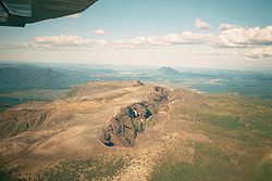
MtRuapehu 23oct2002
Autor/Urheber:
Landsat data provided courtesy of the University of Maryland Global Land Cover Facility Landsat processing by Laura Rocchio, Landsat Project Science Office SRTM 3-arcsecond elevation data courtesy of SRTM Team NASA/JPL/NIMA
Visualization created by Earth Observatory staff.
Shortlink:
Quelle:
Größe:
4500 x 3375 Pixel (3351538 Bytes)
Beschreibung:
Composite image of Mount Ruapehu, with Hauhungatahi visible beyond. North Island, New Zealand. Image is composed of satellite imagery from Landsat and topography data from the Shuttle Radar Topography Mission aboard the Space Shuttle Endeavour.
Lizenz:
Public domain
Relevante Bilder
Relevante Artikel
Taupo Volcanic ZoneDie Taupo Volcanic Zone ist ein aktives Vulkangebiet auf der Nordinsel Neuseelands. Sie ist nach dem Lake Taupo, der gefluteten Caldera des größten Vulkans dieser Zone benannt. .. weiterlesen


