Marker at the beginning of the Wolds Way - geograph.org.uk - 120094
(c) Oliver Dixon, CC BY-SA 2.0
Autor/Urheber:
Shortlink:
Quelle:
Größe:
480 x 640 Pixel (128055 Bytes)
Beschreibung:
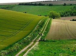
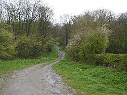
Marker at the beginning of the Yorkshire Wolds Way, Hessle, East Riding of Yorkshire, England.
The Yorkshire Wolds Way, probably the least-known National Trail runs for 79 miles from Hessle Foreshore to Filey Brigg, where it leads straight on into another National Trail, the Cleveland Way.
The Yorkshire Wolds Way, probably the least-known National Trail runs for 79 miles from Hessle Foreshore to Filey Brigg, where it leads straight on into another National Trail, the Cleveland Way.
Kommentar zur Lizenz:
Creative Commons Attribution Share-alike license 2.0
Lizenz:
Credit:
From geograph.org.uk
Relevante Bilder

(c) Roger Gilbertson, CC BY-SA 2.0

(c) Paul Harrop, CC BY-SA 2.0

(c) Peter Church, CC BY-SA 2.0

(c) Jeremy Howat, CC BY-SA 2.0

Relevante Artikel
Yorkshire Wolds WayDer Yorkshire Wolds Way ist ein Wanderweg in England. Er wurde am 2. Oktober 1982 als National Trail im Land eingeweiht und führt von Hessle bei Hull in East Riding of Yorkshire nach Norden und Nordosten über die Yorkshire Wolds bis nach Filey, einer Kleinstadt an der Nordseeküste in North Yorkshire. Der Weg ist 127 km lang. .. weiterlesen
