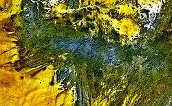
Kyatwa
Autor/Urheber:
NASA Landsat7 image (worldwind.arc.nasa.gov)
Shortlink:
Quelle:
Größe:
640 x 456 Pixel (53581 Bytes)
Beschreibung:
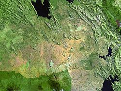
Mostly lake-filled maars and tuff cones dot the center of this NASA Landsat image (with north to the top) of the Kyatwa volcanic field. The Kyatwa vents, also known as the Ndale volcanic field, occupy the Western Rift Valley, east of the Ruwenzori Mountains halfway between Lake Edward and Lake Albert. The Kyatwa tuff cones are part of a group of Pleistocene-to-Recent volcanic fields in western Uganda.
Lizenz:
Public domain
Relevante Bilder
Relevante Artikel
Liste von VulkanenDies ist eine Liste von Vulkanen auf der Erde. .. weiterlesen


