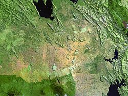
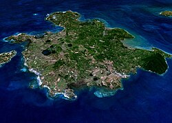
Katwe-Kikorongo
Autor/Urheber:
NASA Landsat7 image (worldwind.arc.nasa.gov)
Shortlink:
Quelle:
Größe:
640 x 456 Pixel (69042 Bytes)
Beschreibung:
Lake-filled and dry maars of the Katwe-Kikorongo volcanic field occupy the center of this NASA Landsat image (with north to the top). The volcanic field lies above the river channel connecting Lake Edward (lower left) with Lake George (upper right) in the Western Rift Valley of Uganda. Oblong, dark-colored Lake Katwe (lower left) is a shallow 3-km-long body of water that occupies two of three intersecting craters immediately NE of Lake Edward. Local folk tales suggest that volcanism in the Katwe-Kikorongo area has continued into historical times.
Lizenz:
Public domain
Relevante Bilder
Relevante Artikel
Liste von VulkanenDies ist eine Liste von Vulkanen auf der Erde. .. weiterlesen


