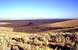
Ingakslugwat Hills
Autor/Urheber:
NASA Landsat7
Shortlink:
Quelle:
Größe:
640 x 444 Pixel (108266 Bytes)
Beschreibung:
This relatively featureless area in this NASA Landsant image (with north to the top) of the Yukon-Kuskokwin delta contains part of the Ingakslugwat Hills volcanic field. This monogentic volcanic field consists of at least 32 small cinder cones and 8 larger craters covering an area of more than 500 sq km. Numerous small spatter cones and cinder cones dot the NW side of the volcanic field. The latest activity was considered to have occurred during the Holocene. One low cone containing a 400-m-wide lake may be a maar.
Lizenz:
Public domain
Relevante Bilder
Relevante Artikel
Liste von Vulkanen in den Vereinigten StaatenDies ist eine Liste von Vulkanen in den USA, die während des Quartärs mindestens einmal aktiv waren. .. weiterlesen


