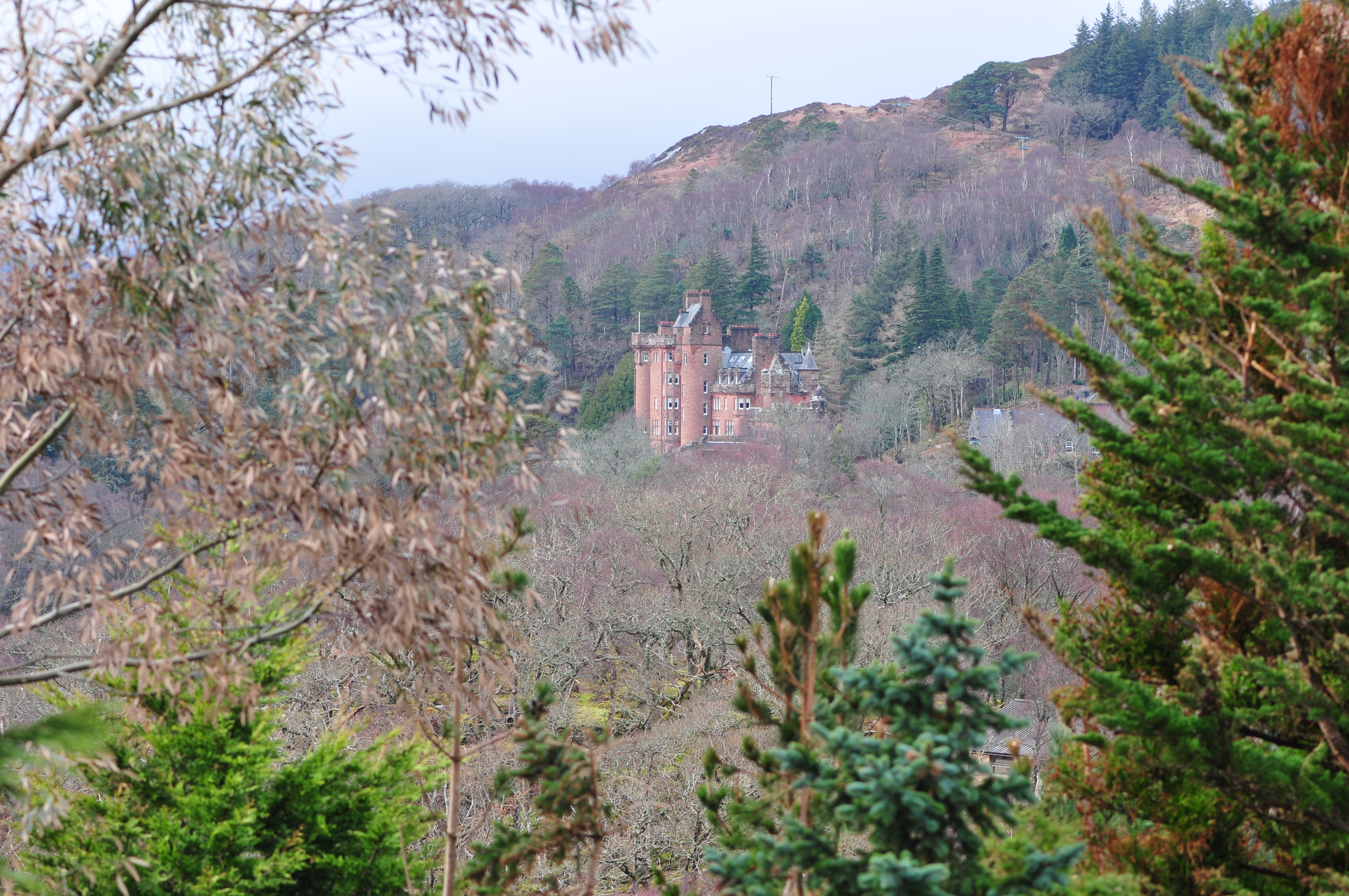
Glenborrodale
Autor/Urheber:
Attribution:
Das Bild ist mit 'Attribution Required' markiert, aber es wurden keine Informationen über die Attribution bereitgestellt. Vermutlich wurde bei Verwendung des MediaWiki-Templates für die CC-BY Lizenzen der Parameter für die Attribution weggelassen. Autoren und Urheber finden für die korrekte Verwendung der Templates hier ein Beispiel.
Shortlink:
Quelle:
Größe:
4288 x 2848 Pixel (7837044 Bytes)
Beschreibung:
glenborrodale castle
Kommentar zur Lizenz:
Ich, der Urheber dieses Werkes, veröffentliche es unter der folgenden Lizenz:
Lizenz:
Relevante Bilder
![](https://upload.wikimedia.org/wikipedia/commons/thumb/b/b8/Chanonry_Lighthouse_Fortrose_and_Rosemarkie_-_Black_Isle%2C_Ross_and_Cromarty%2C_Scotland_%284622320141%29.jpg/250px-Chanonry_Lighthouse_Fortrose_and_Rosemarkie_-_Black_Isle%2C_Ross_and_Cromarty%2C_Scotland_%284622320141%29.jpg)
![](https://upload.wikimedia.org/wikipedia/commons/thumb/2/2f/Glen_Loy_Aqueduct%2C_Caledonain_Canal_%28geograph_3285838%29.jpg/250px-Glen_Loy_Aqueduct%2C_Caledonain_Canal_%28geograph_3285838%29.jpg)
(c) Colin Park, CC BY-SA 2.0
![](https://upload.wikimedia.org/wikipedia/commons/thumb/0/0a/St._Marys%2C_the_first_Roman_Catholic_Church_built_in_Inverness_after_the_Reformation_completed_in_1837_%287124964339%29.jpg/250px-St._Marys%2C_the_first_Roman_Catholic_Church_built_in_Inverness_after_the_Reformation_completed_in_1837_%287124964339%29.jpg)
![](https://upload.wikimedia.org/wikipedia/commons/thumb/6/67/Southern_elevation_of_Inverness_Castle_-_geograph.org.uk_-_1638216.jpg/250px-Southern_elevation_of_Inverness_Castle_-_geograph.org.uk_-_1638216.jpg)
(c) Dr Julian Paren, CC BY-SA 2.0
![](https://upload.wikimedia.org/wikipedia/commons/thumb/0/04/Sheangain_Aqueduct%2C_Torcastle%2C_Caledonian_Canal_%28geograph_3285844%29.jpg/250px-Sheangain_Aqueduct%2C_Torcastle%2C_Caledonian_Canal_%28geograph_3285844%29.jpg)
(c) Colin Park, CC BY-SA 2.0
![](https://upload.wikimedia.org/wikipedia/commons/thumb/3/33/Northern_Constabulary_Pipe_Band_at_Eden_Court_Theatre_Inverness_Scotland_%2826974190062%29.jpg/250px-Northern_Constabulary_Pipe_Band_at_Eden_Court_Theatre_Inverness_Scotland_%2826974190062%29.jpg)
![](https://upload.wikimedia.org/wikipedia/commons/thumb/9/96/Aldourie_Castle_-_on_the_shore_of_Loch_Ness_Inverness_Scotland_2.jpg/250px-Aldourie_Castle_-_on_the_shore_of_Loch_Ness_Inverness_Scotland_2.jpg)
![](https://upload.wikimedia.org/wikipedia/commons/thumb/8/8e/Plockton_church_%28Architect%2C_Thomas_Telford%29_-_geograph.org.uk_-_1266656.jpg/250px-Plockton_church_%28Architect%2C_Thomas_Telford%29_-_geograph.org.uk_-_1266656.jpg)
(c) Roger Davies, CC BY-SA 2.0
![](https://upload.wikimedia.org/wikipedia/commons/thumb/1/16/Golspie_-_St_Andrew%27s_Church_of_Scotland_-_geograph.org.uk_-_225503.jpg/250px-Golspie_-_St_Andrew%27s_Church_of_Scotland_-_geograph.org.uk_-_225503.jpg)
(c) Bill Henderson, CC BY-SA 2.0
![](https://upload.wikimedia.org/wikipedia/commons/thumb/2/2a/The_Gardener%27s_House%2C_Cromarty_01.jpg/125px-The_Gardener%27s_House%2C_Cromarty_01.jpg)
![](https://upload.wikimedia.org/wikipedia/commons/thumb/1/11/Affric_Lodge%2C_Glen_Affric_%28geograph_3199291%29.jpg/250px-Affric_Lodge%2C_Glen_Affric_%28geograph_3199291%29.jpg)
(c) Mike Pennington, CC BY-SA 2.0
![](https://upload.wikimedia.org/wikipedia/commons/thumb/d/df/The_Kirkhill_Mausoleum%2C_Kirkhill%2C_Nr%2C_Inverness%2C_Scotland_-_geograph.org.uk_-_101143.jpg/250px-The_Kirkhill_Mausoleum%2C_Kirkhill%2C_Nr%2C_Inverness%2C_Scotland_-_geograph.org.uk_-_101143.jpg)
(c) Dave Napier, CC BY-SA 2.0
![](https://upload.wikimedia.org/wikipedia/commons/thumb/3/3c/Inverness_Public_Library_-_geograph.org.uk_-_832498.jpg/250px-Inverness_Public_Library_-_geograph.org.uk_-_832498.jpg)
(c) Dave Fergusson, CC BY-SA 2.0
![](https://upload.wikimedia.org/wikipedia/commons/thumb/4/4c/Inchindown_entry_portal_%28geograph_3092111%29.jpg/250px-Inchindown_entry_portal_%28geograph_3092111%29.jpg)
(c) Peter Moore, CC BY-SA 2.0
![](https://upload.wikimedia.org/wikipedia/commons/thumb/d/d0/The_Lovat_Bridge%2C_Beauly_-_geograph.org.uk_-_523049.jpg/400px-The_Lovat_Bridge%2C_Beauly_-_geograph.org.uk_-_523049.jpg)
(c) John S Ross, CC BY-SA 2.0
![](https://upload.wikimedia.org/wikipedia/commons/thumb/e/ef/Tongue%2C_Sutherland%2C_the_Parish_Church_of_St_Andrew_-_geograph.org.uk_-_222970.jpg/250px-Tongue%2C_Sutherland%2C_the_Parish_Church_of_St_Andrew_-_geograph.org.uk_-_222970.jpg)
(c) Bill Henderson, CC BY-SA 2.0
![](https://upload.wikimedia.org/wikipedia/commons/thumb/a/aa/Skibo_Castle_near_Dornoch_-_geograph.org.uk_-_45480.jpg/250px-Skibo_Castle_near_Dornoch_-_geograph.org.uk_-_45480.jpg)
(c) Christine Matthews, CC BY-SA 2.0
![](https://upload.wikimedia.org/wikipedia/commons/thumb/4/47/Ullapool_Museum%2C_Telford_Church_-_geograph.org.uk_-_532139.jpg/250px-Ullapool_Museum%2C_Telford_Church_-_geograph.org.uk_-_532139.jpg)
(c) Anne Burgess, CC BY-SA 2.0
![](https://upload.wikimedia.org/wikipedia/commons/thumb/6/62/Hugh_Miller%27s_Birthplace%2C_Cromarty_-_geograph.org.uk_-_1469973.jpg/250px-Hugh_Miller%27s_Birthplace%2C_Cromarty_-_geograph.org.uk_-_1469973.jpg)
(c) Marion Haworth, CC BY-SA 2.0
![](https://upload.wikimedia.org/wikipedia/commons/thumb/7/73/Old_Contin_Bridge%2C_over_the_Black_Water_%28geograph_4000616%29.jpg/250px-Old_Contin_Bridge%2C_over_the_Black_Water_%28geograph_4000616%29.jpg)
(c) Craig Wallace, CC BY-SA 2.0
![](https://upload.wikimedia.org/wikipedia/commons/thumb/8/8f/Old_houses_at_Lower_Ardelve_%28geograph_3049656%29.jpg/250px-Old_houses_at_Lower_Ardelve_%28geograph_3049656%29.jpg)
(c) Dr Julian Paren, CC BY-SA 2.0
![](https://upload.wikimedia.org/wikipedia/commons/thumb/c/ce/Glendale_Water_Mill_%28geograph_2339695%29.jpg/250px-Glendale_Water_Mill_%28geograph_2339695%29.jpg)
(c) Glen Breaden, CC BY-SA 2.0
![](https://upload.wikimedia.org/wikipedia/commons/thumb/0/05/Culloden_House_stables_-_geograph.org.uk_-_1747464.jpg/250px-Culloden_House_stables_-_geograph.org.uk_-_1747464.jpg)
(c) Richard Dorrell, CC BY-SA 2.0
![](https://upload.wikimedia.org/wikipedia/commons/thumb/f/f9/Presbyterian_Cathedral_of_St._Andrew.jpg/250px-Presbyterian_Cathedral_of_St._Andrew.jpg)
(c) Chris Downer, CC BY-SA 2.0
![](https://upload.wikimedia.org/wikipedia/commons/thumb/c/c4/Eilean_Donan_Castle_%283%29_-_geograph.org.uk_-_967614.jpg/250px-Eilean_Donan_Castle_%283%29_-_geograph.org.uk_-_967614.jpg)
(c) Mike Searle, CC BY-SA 2.0
![](https://upload.wikimedia.org/wikipedia/commons/thumb/e/ef/%27Castle%27_near_Drynie_Farm_-_geograph.org.uk_-_124245.jpg/250px-%27Castle%27_near_Drynie_Farm_-_geograph.org.uk_-_124245.jpg)
(c) Iain Macaulay, CC BY-SA 2.0
![](https://upload.wikimedia.org/wikipedia/commons/thumb/9/9c/Culloden_House_Hotel_-_geograph.org.uk_-_259875.jpg/250px-Culloden_House_Hotel_-_geograph.org.uk_-_259875.jpg)
(c) Stanley Howe, CC BY-SA 2.0
![](https://upload.wikimedia.org/wikipedia/commons/thumb/b/b2/Glenfinnan_viaduct_-_geograph.org.uk_-_984061.jpg/250px-Glenfinnan_viaduct_-_geograph.org.uk_-_984061.jpg)
(c) sylvia duckworth, CC BY-SA 2.0
![](https://upload.wikimedia.org/wikipedia/commons/thumb/0/03/Inverness%2C_26_-_28_Academy_Street%2C_National_Bank_Of_Scotland_-_20140424171251.jpg/250px-Inverness%2C_26_-_28_Academy_Street%2C_National_Bank_Of_Scotland_-_20140424171251.jpg)
![](https://upload.wikimedia.org/wikipedia/commons/thumb/a/ae/Townlands_Barn%2C_Cromarty_01.jpg/250px-Townlands_Barn%2C_Cromarty_01.jpg)
![](https://upload.wikimedia.org/wikipedia/commons/thumb/7/70/Invershin_Viaduct_png_reduced.jpg/400px-Invershin_Viaduct_png_reduced.jpg)
![](https://upload.wikimedia.org/wikipedia/commons/thumb/9/96/Fearn_Abbey_20090615_from_south_east.jpg/250px-Fearn_Abbey_20090615_from_south_east.jpg)
![](https://upload.wikimedia.org/wikipedia/commons/thumb/6/63/Armadale_Castle_stables_-_view_from_NE.jpg/250px-Armadale_Castle_stables_-_view_from_NE.jpg)
![](https://upload.wikimedia.org/wikipedia/commons/thumb/e/e9/Fasnakyle_Power_Station_-_geograph.org.uk_-_1536012.jpg/250px-Fasnakyle_Power_Station_-_geograph.org.uk_-_1536012.jpg)
(c) Stanley Howe, CC BY-SA 2.0
![](https://upload.wikimedia.org/wikipedia/commons/thumb/f/f6/Kinlochleven_Valve_House_-_geograph.org.uk_-_1105454.jpg/250px-Kinlochleven_Valve_House_-_geograph.org.uk_-_1105454.jpg)
(c) David Bowie, CC BY-SA 2.0
![](https://upload.wikimedia.org/wikipedia/commons/thumb/3/36/Former_Drill_Hall_in_Golspie_-_geograph.org.uk_-_4029453.jpg/250px-Former_Drill_Hall_in_Golspie_-_geograph.org.uk_-_4029453.jpg)
(c) Andrew Tryon, CC BY-SA 2.0
![](https://upload.wikimedia.org/wikipedia/commons/thumb/7/74/Logie_Bridge_over_the_River_Findhorn._-_geograph.org.uk_-_273205.jpg/250px-Logie_Bridge_over_the_River_Findhorn._-_geograph.org.uk_-_273205.jpg)
(c) Des Colhoun, CC BY-SA 2.0
![](https://upload.wikimedia.org/wikipedia/commons/thumb/f/ff/Castle_Grant_-_geograph.org.uk_-_576144.jpg/250px-Castle_Grant_-_geograph.org.uk_-_576144.jpg)
(c) Ann Harrison, CC BY-SA 2.0
![](https://upload.wikimedia.org/wikipedia/commons/thumb/6/6d/Telford%27s_bridge_at_The_Mound_-_geograph.org.uk_-_583036.jpg/250px-Telford%27s_bridge_at_The_Mound_-_geograph.org.uk_-_583036.jpg)
(c) John Allan, CC BY-SA 2.0
![](https://upload.wikimedia.org/wikipedia/commons/thumb/4/47/Nairn_railway_viaduct_near_Culloden_-_geograph.org.uk_-_1801643.jpg/250px-Nairn_railway_viaduct_near_Culloden_-_geograph.org.uk_-_1801643.jpg)
(c) John Jessiman, CC BY-SA 2.0
Relevante Artikel
Liste der Kategorie-A-Bauwerke in HighlandDie Liste der Kategorie-A-Gebäude in Highland umfasst sämtliche in der Kategorie A eingetragenen Baudenkmäler in der schottischen Council Area Highland. Die Einstufung wird anhand der Kriterien von Historic Scotland vorgenommen, wobei in die höchste Kategorie A Bauwerke von nationaler oder internationaler Bedeutung einsortiert sind. In Highland sind derzeit 183 Bauwerke in der Kategorie A gelistet. .. weiterlesen