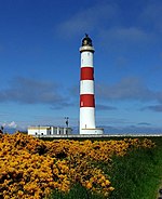
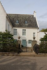
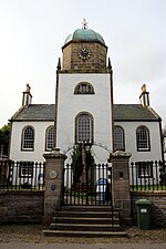
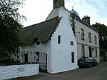
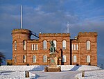
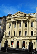
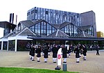
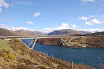
Liste der Kategorie-A-Bauwerke in Highland

Lage von Highland in Schottland

Die Liste der Kategorie-A-Gebäude in Highland umfasst sämtliche in der Kategorie A eingetragenen Baudenkmäler in der schottischen Council Area Highland. Die Einstufung wird anhand der Kriterien von Historic Scotland vorgenommen, wobei in die höchste Kategorie A Bauwerke von nationaler oder internationaler Bedeutung einsortiert sind. In Highland sind derzeit 183 Bauwerke in der Kategorie A gelistet.

NameLageTypEintragBild
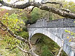
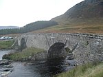
Sluggan Bridgenahe Carrbridge
57° 16′ 28,8″ N, 3° 52′ 33,3″ W
Brücke240
Sluggan Bridge
(c) Jim Bain, CC BY-SA 2.0
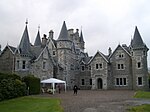
Muckrach Castlenahe Dulnain Bridge
57° 18′ 17,1″ N, 3° 41′ 5,3″ W
Tower House249
Muckrach Castle
(c) Mike Searle, CC BY-SA 2.0
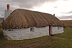
Croft Housenahe Aviemore
57° 9′ 42,6″ N, 3° 48′ 55,5″ W
Villa251
Croft House
(c) Peter Bond, CC BY-SA 2.0
Bahnhof AviemoreAviemore
57° 11′ 17,5″ N, 3° 49′ 44,4″ W
Bahnhof257Bahnhof Aviemore
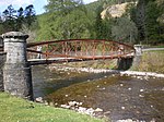
Broomhill Bridgenahe Dulnain Bridge
57° 16′ 50,6″ N, 3° 39′ 55,4″ W
Brücke260
Broomhill Bridge
(c) jeff collins, CC BY-SA 2.0
Shin Viaductnahe Culrain
57° 55′ 26,4″ N, 4° 24′ 3,6″ W
Brücke279Shin Viaduct
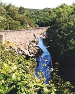
Borrodale Viaductnahe Arisaig
56° 54′ 12,2″ N, 5° 46′ 59,6″ W
Brücke302
Borrodale Viaduct
(c) Jim Bain, CC BY-SA 2.0
Friedhof der St Finan’s ChapelSt Finan’s Isle
56° 45′ 5,9″ N, 5° 40′ 43,6″ W
Friedhof306
Glenfinnan MonumentGlenfinnan
56° 52′ 9,2″ N, 5° 26′ 13,4″ W
Denkmal308
Glenfinnan Monument
(c) WyrdLight.com, CC BY-SA 3.0
Glenfinnan-ViaduktGlenfinnan
56° 52′ 34,6″ N, 5° 25′ 53,4″ W
Brücke310
Glenfinnan-Viadukt
(c) sylvia duckworth, CC BY-SA 2.0
Kinlochmoidart Housenahe Ardmolich
56° 47′ 12,7″ N, 5° 44′ 25,5″ W
Villa317
Kinlochmoidart House
(c) Callum Black, CC BY-SA 2.0
Old Spey Bridgenahe Grantown-on-Spey
57° 19′ 2,8″ N, 3° 35′ 45,4″ W
Brücke335
Old Spey Bridge
(c) Mike Searle, CC BY-SA 2.0
Castle Grantnahe Grantown-on-Spey
57° 21′ 7,2″ N, 3° 35′ 41″ W
Burg348
Castle Grant
(c) Ann Harrison, CC BY-SA 2.0
East Lodge von Castle Grantnahe Grantown-on-Spey
57° 21′ 7,3″ N, 3° 36′ 31,9″ W
Wohngebäude349
East Lodge von Castle Grant
(c) Ann Harrison, CC BY-SA 2.0
The Dairynahe Avoch
57° 34′ 18,7″ N, 4° 12′ 19,9″ W
Landwirtschaftliches Gebäude374
The Dairy
(c) Julian Paren, CC BY-SA 2.0
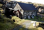
Glendale Millnahe Glendale
57° 26′ 59,5″ N, 6° 43′ 20,9″ W
Mühle467
Glendale Mill
(c) Glen Breaden, CC BY-SA 2.0
Cape Wrath LighthouseCape Wrath
58° 37′ 31,5″ N, 4° 59′ 56,8″ W
Leuchtturm488
Cape Wrath Lighthouse
(c) Helen Baker, CC BY-SA 2.0
Dunvegan Parish ChurchDunvegan
57° 26′ 18,1″ N, 6° 34′ 58,9″ W
Kirche498
Dunvegan Parish Church
(c) Tom Pennington, CC BY-SA 2.0
Dunvegan Castlenahe Dunvegan
57° 26′ 54,4″ N, 6° 35′ 23,9″ W
Burg501Dunvegan Castle
The Laundrynahe Dunvegan
57° 26′ 51,6″ N, 6° 35′ 27,6″ W
Wohngebäude503
The Laundry
(c) John Allan, CC BY-SA 2.0
Balnakeil Housenahe Durness
58° 34′ 33,3″ N, 4° 46′ 1,7″ W
Herrenhaus517
Balnakeil House
(c) Bob Jones, CC BY-SA 2.0
Ardnamurchan LighthouseArdnamurchan
56° 43′ 37,5″ N, 6° 13′ 33,5″ W
Leuchtturm521
Ardnamurchan Lighthouse
(c) Catherine Morgan, CC BY-SA 2.0
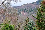
Glenborrodale CastleGlenborrodale
56° 40′ 41,8″ N, 5° 54′ 33,9″ W
Villa524Glenborrodale Castle
Mingary Castlenahe Kilchoan
56° 41′ 33,9″ N, 6° 4′ 48″ W
Burg527
Aldourie Castlenahe Dores
57° 24′ 13,7″ N, 4° 19′ 46,4″ W
Herrenhaus535Aldourie Castle
Aultmore Housenahe Nethy Bridge
57° 16′ 29,9″ N, 3° 38′ 10,3″ W
Villa549
Ardclach Bell Towernahe Ferness
57° 29′ 10″ N, 3° 44′ 48,2″ W
Glockenturm551Ardclach Bell Tower
Dulsie Bridgenahe Ferness
57° 27′ 2,5″ N, 3° 46′ 53,3″ W
Brücke557
Dulsie Bridge
(c) Anne Burgess, CC BY-SA 2.0
Glenferness Housenahe Ferness
57° 27′ 48,3″ N, 3° 46′ 24,3″ W
Herrenhaus560
Logie Bridgenahe Ferness
57° 29′ 39,4″ N, 3° 44′ 14,3″ W
Brücke564
Logie Bridge
(c) Des Colhoun, CC BY-SA 2.0
Skibo Castlenahe Dornoch
57° 52′ 22,8″ N, 4° 7′ 56″ W
Schloss597
Skibo Castle
(c) Christine Matthews, CC BY-SA 2.0
Embo Housenahe Embo
57° 54′ 12,8″ N, 4° 0′ 41,6″ W
Villa608
Embo House
(c) Peter Moore, CC BY-SA 2.0
Boath HouseAuldearn
57° 34′ 46,3″ N, 3° 48′ 30,3″ W
Herrenhaus1649
Boath House
(c) Alpin Stewart, CC BY-SA 2.0
Brightmony Housenahe Auldearn
57° 33′ 40,2″ N, 3° 47′ 27,2″ W
Villa1657
Nairn Viaductnahe Culloden
57° 28′ 41,5″ N, 4° 3′ 46,6″ W
Brücke1709
Nairn Viaduct
(c) John Jessiman, CC BY-SA 2.0
Dalcross Castlenahe Culloden
57° 30′ 29,9″ N, 4° 2′ 24,7″ W
Tower House1713
Dalcross Castle
(c) James Allan, CC BY-SA 2.0
Fort Georgenahe Ardersier
57° 35′ 0″ N, 4° 4′ 14″ W
Festung1721
Fort George
(c) Stephen Branley, CC BY-SA 2.0
Budgate HouseCawdor
57° 31′ 14″ N, 3° 56′ 41,5″ W
Wohngebäude1727Budgate House
Cawdor CastleCawdor
55° 31′ 27,5″ N, 3° 55′ 35″ W
Schloss1728
Cawdor Castle
(c) Dr Richard Murray, CC BY-SA 2.0
Cawdor Parish ChurchCawdor
57° 31′ 29,3″ N, 3° 55′ 57,4″ W
Kirche1760
Cawdor Parish Church
(c) Ann Harrison, CC BY-SA 2.0
Coul HouseContin
57° 34′ 16,9″ N, 4° 34′ 20,5″ W
Villa1769
Coul House
(c) Alpin Stewart, CC BY-SA 2.0
Contin BridgeContin
57° 34′ 24,9″ N, 4° 35′ 12,4″ W
Brücke1789
Contin Bridge
(c) Craig Wallace, CC BY-SA 2.0
Canisbay Parish ChurchCanisbay
58° 38′ 18,8″ N, 3° 7′ 57,4″ W
Kirche1795
Canisbay Parish Church
(c) Glen Breaden, CC BY-SA 2.0
Castle of Meynahe John o’ Groats
58° 38′ 49,5″ N, 3° 13′ 29,2″ W
Schloss1797
Castle of Mey
(c) Colin Smith, CC BY-SA 2.0
Freswick Housenahe John o’ Groats
58° 35′ 15,9″ N, 3° 4′ 17,4″ W
Tower House1799
Freswick House
(c) Stanley Howe, CC BY-SA 2.0
Holme Rosenahe Croy
57° 30′ 43,7″ N, 3° 59′ 38,3″ W
Herrenhaus1812
Cromarty HouseCromarty
57° 40′ 36,2″ N, 4° 1′ 32,2″ W
Herrenhaus1818
Stallungen von Cromarty HouseCromarty
57° 40′ 31,2″ N, 4° 1′ 26,9″ W
Stallungen1820
Stallungen von Cromarty House
(c) Julian Paren, CC BY-SA 2.0
Kilravock Castlenahe Croy
57° 31′ 11″ N, 3° 59′ 0,4″ W
Tower House1841
Kilravock Castle
(c) John Allan, CC BY-SA 2.0
White Bridgenahe Cawdor
57° 31′ 36,4″ N, 3° 57′ 54,4″ W
Brücke1843
White Bridge
(c) Anne Burgess, CC BY-SA 2.0
Fort Augustus AbbeyFort Augustus
57° 8′ 41″ N, 4° 40′ 35,5″ W
Kloster1861
Fort Augustus Abbey
(c) Colin Wilson, CC BY-SA 2.0
Kirche der Fort Augustus AbbeyFort Augustus
57° 8′ 40,6″ N, 4° 40′ 32,2″ W
Kirche1862
Kirche der Fort Augustus Abbey
(c) Colin Wilson, CC BY-SA 2.0
Oich Old Bridgenahe Fort Augustus
57° 5′ 36″ N, 4° 44′ 43″ W
Brücke1872
Oich Old Bridge
(c) Colin Smith, CC BY-SA 2.0
Old Bridgenahe Fort Augustus
57° 12′ 14,8″ N, 4° 30′ 9,5″ W
Brücke1874
Old Bridge
(c) Ann Harrison, CC BY-SA 2.0
Foyers Aluminium WorksFoyers
57° 15′ 19,3″ N, 4° 29′ 35,4″ W
Industriebauwerk1880
Foyers Aluminium Works
(c) Paul Hookway, CC BY-SA 2.0
Dunnet Parish ChurchDunnet
58° 37′ 17,5″ N, 3° 20′ 41,6″ W
Kirche1888
Dunnet Parish Church
(c) Bill Henderson, CC BY-SA 2.0
Edderton Old Parish ChurchEdderton
57° 49′ 44,9″ N, 4° 9′ 30″ W
Kirche4572
Edderton Old Parish Church
(c) Donald Bain, CC BY-SA 2.0
Stauwerk von Loch LagganLoch Laggan
56° 53′ 22,2″ N, 4° 40′ 23,1″ W
Stauwerk6835Stauwerk von Loch Laggan
Keppoch BarnRoybridge
56° 53′ 14,6″ N, 4° 50′ 31,2″ W
Stallungen6837
Commando Memorialnahe Spean Bridge
56° 53′ 52,4″ N, 4° 56′ 38,6″ W
Denkmal6842Commando Memorial
Mucomir BridgeGairlochy
56° 54′ 35,9″ N, 4° 59′ 5,9″ W
Brücke6868
Garvamore Barracksnahe Laggan
57° 0′ 58,7″ N, 4° 25′ 33,7″ W
Wohngebäude6899
Garvamore Barracks
(c) Nigel Brown, CC BY-SA 2.0
Garvamore Bridgenahe Laggan
57° 1′ 12,3″ N, 4° 26′ 11,7″ W
Brücke6900
Garvamore Bridge
(c) Stanley Howe, CC BY-SA 2.0
Ardverikie HouseLoch Laggan
56° 57′ 18,5″ N, 4° 27′ 18″ W
Herrenhaus6910Ardverikie House
Torhaus von Ardverikie HouseLoch Laggan
56° 58′ 30,9″ N, 4° 24′ 16,8″ W
Wohngebäude6911
Torhaus von Ardverikie House
(c) John Ferguson, CC BY-SA 2.0
Cluny Castlenahe Laggan
57° 1′ 11,2″ N, 4° 13′ 56,3″ W
Herrenhaus6914
Cluny Castle
(c) Russel Wills, CC BY-SA 2.0
Plockton ChurchPlockton
57° 20′ 13,6″ N, 5° 39′ 9″ W
Kirche6927
Plockton Church
(c) Roger Davies, CC BY-SA 2.0
12 Lower ArdelveArdelve
57° 16′ 51,7″ N, 5° 31′ 43″ W
Wohngebäude6999
12 Lower Ardelve
(c) Dr Julian Paren, CC BY-SA 2.0
Mound Bridgenahe Golspie
57° 57′ 22,9″ N, 4° 4′ 15,3″ W
Brücke7022
Mound Bridge
(c) John Allan, CC BY-SA 2.0
St Andrew’s Parish ChurchGolspie
57° 58′ 33,7″ N, 3° 58′ 0,3″ W
Kirche7036
St Andrew’s Parish Church
(c) Bill Henderson, CC BY-SA 2.0
Dunrobin Castlenahe Golspie
57° 58′ 54,4″ N, 3° 56′ 43,7″ W
Schloss7044
Dunrobin Castle
(c) AwOiSoAk KaOsIoWa, CC BY-SA 3.0
Gärten von Dunrobin Castlenahe Golspie
57° 58′ 53,2″ N, 3° 56′ 36,2″ W
Gärten7045
Glen Loy Aqueductnahe Gairlochy
56° 53′ 25″ N, 5° 2′ 23,2″ W
Brücke7085
Glen Loy Aqueduct
(c) Colin Park, CC BY-SA 2.0
Loy Sluicesnahe Gairlochy
56° 53′ 7,7″ N, 5° 2′ 24,4″ W
Wasserbauwerk7089
Loy Sluices
(c) Des Colhoun, CC BY-SA 2.0
Torcastle Aqueductnahe Fort William
56° 51′ 57,9″ N, 5° 3′ 59,2″ W
Brücke7090
Torcastle Aqueduct
(c) Colin Park, CC BY-SA 2.0
Callert Housenahe North Ballachulish
56° 41′ 46,1″ N, 5° 7′ 7″ W
Herrenhaus7091
Callert House
(c) C A Millar, CC BY-SA 2.0
Fasnakyle Power Stationnahe Cannich
57° 19′ 33,6″ N, 4° 47′ 38,4″ W
Kraftwerk7118
Fasnakyle Power Station
(c) Stanley Howe, CC BY-SA 2.0
Glen Affric LodgeLoch Affric
57° 15′ 38,8″ N, 5° 0′ 44,3″ W
Villa7121
Glen Affric Lodge
(c) Mike Pennington, CC BY-SA 2.0
Loth Parish Churchnahe Helmsdale
58° 4′ 46″ N, 3° 44′ 48,2″ W
Kirche7149
Loth Parish Church
(c) John Ferguson, CC BY-SA 2.0
Gärten von Bighousenahe Melvich
58° 33′ 26,2″ N, 3° 54′ 23,7″ W
Gärten7160
Croick Churchnahe Bonar Bridge
57° 53′ 9,2″ N, 4° 36′ 16,2″ W
Kirche7181
Croick Church
(c) J M Briscoe, CC BY-SA 2.0
Helmsdale BridgeHelmsdale
58° 7′ 0″ N, 3° 39′ 18,4″ W
Brücke7193
Helmsdale Bridge
(c) Jim Bain, CC BY-SA 2.0
Eilean Donan CastleDornie
57° 16′ 26,5″ N, 5° 30′ 58″ W
Burg7209
Eilean Donan Castle
(c) Mike Searle, CC BY-SA 2.0
Glenelg War MemorialGlenelg
57° 12′ 39,3″ N, 5° 37′ 43,1″ W
Denkmal7236
Glenelg War Memorial
(c) Steven Brown, CC BY-SA 2.0
Beaton’s CottageBornesketaig
57° 38′ 59,8″ N, 6° 23′ 46,3″ W
Wohngebäude7240
Beaton’s Cottage
(c) John Allan, CC BY-SA 2.0
New Kelso Housenahe Strathcarron
57° 25′ 44,9″ N, 5° 26′ 0,2″ W
Wohngebäude7262
Auchindrean BridgeAuchindrean
57° 46′ 42,6″ N, 5° 2′ 11,4″ W
Brücke7754
Auchindrean Bridge
(c) Gregoire, CC BY-SA 2.0
Ullapool MuseumUllapool
57° 53′ 45,5″ N, 5° 9′ 43,1″ W
Museum7764
Ullapool Museum
(c) Anne Burgess, CC BY-SA 2.0
Fearn AbbeyFearn
57° 46′ 12,4″ N, 3° 57′ 22,2″ W
Kirche7780Fearn Abbey
Lovat MausoleumKirkhill
57° 28′ 42,1″ N, 4° 25′ 13,4″ W
Mausoleum7815
Lovat Mausoleum
(c) Dave Napier, CC BY-SA 2.0
Castle Leodnahe Strathpeffer
57° 35′ 55″ N, 4° 32′ 6″ W
Burg7826Castle Leod
Tarbat Housenahe Milton
57° 44′ 7″ N, 4° 4′ 2″ W
Herrenhaus7848
Tarbat House
(c) sylvia duckworth, CC BY-SA 2.0
Kilmuir Easter Parish Churchnahe Milton
57° 43′ 52,3″ N, 4° 5′ 17,2″ W
Kirche7876
Kilmuir Easter Parish Church
(c) Bill Henderson, CC BY-SA 2.0
Udrigle HouseAchgarve
57° 52′ 56,1″ N, 5° 33′ 3,8″ W
Wohngebäude7902
Udrigle House
(c) Roger McLachlan, CC BY-SA 2.0
Wyvis Lodgenahe Evanton
57° 43′ 37,3″ N, 4° 32′ 44,9″ W
Villa7906
Wyvis Lodge
(c) Nick Fergusson, CC BY-SA 2.0
Flowerdale Housenahe Gairloch
57° 42′ 53,1″ N, 5° 40′ 17,2″ W
Herrenhaus7910
Flowerdale House
(c) Roger McLachlan, CC BY-SA 2.0
Foulis Castlenahe Alness
57° 38′ 42″ N, 4° 21′ 55″ W
Herrenhaus7911
Foulis Point Granarynahe Evanton
57° 38′ 25,7″ N, 4° 20′ 51,4″ W
Speicher7914
Foulis Point Granary
(c) Ian Taylor, CC BY-SA 2.0
The Corrnahe Latheron
58° 18′ 9,6″ N, 3° 21′ 45″ W
Bauernhof7935
The Corr
(c) Richard Webb, CC BY-SA 2.0
Dunbeath Castlenahe Dunbeath
58° 14′ 6″ N, 3° 26′ 8″ W
Schloss7936
Dunbeath Castle
(c) Bill Henderson, CC BY-SA 2.0
Taubenhaus von Forse Housenahe Latheron
58° 14′ 6″ N, 3° 26′ 8″ W
Taubenhaus7949
Laidhay Croft Museumnahe Dunbeath
58° 15′ 21,2″ N, 3° 24′ 33,7″ W
Museum7951
Laidhay Croft Museum
(c) Stanley Howe, CC BY-SA 2.0
Kilcoy Castlenahe Muir of Ord
57° 31′ 43,7″ N, 4° 22′ 44,1″ W
Tower House8007
Old Allangrange Housenahe Munlochy
57° 31′ 54,2″ N, 4° 17′ 56,6″ W
Herrenhaus8013
Dochfour Housenahe Inverness
57° 25′ 18″ N, 4° 19′ 30,3″ W
Herrenhaus8028
Dochfour House
(c) Des Colhoun, CC BY-SA 2.0
Culloden HouseCulloden
57° 29′ 25,5″ N, 4° 8′ 6,3″ W
Herrenhaus8039
Culloden House
(c) Stanley Howe, CC BY-SA 2.0
Taubenturm von Inshes HouseInverness
57° 27′ 52,8″ N, 4° 10′ 37,8″ W
Taubenturm8050
Leys CastleInverness
57° 26′ 23,6″ N, 4° 12′ 2,5″ W
Herrenhaus8053
Beaufort Castlenahe Kiltarlity
57° 27′ 10,1″ N, 4° 29′ 24,4″ W
Herrenhaus8068
Beaufort Castle
(c) Craig Wallace, CC BY-SA 2.0
Lovat Bridgenahe Beauly
57° 28′ 14,3″ N, 4° 28′ 32,7″ W
Brücke8083
Lovat Bridge
(c) John S Ross, CC BY-SA 2.0
Stallungen von Culloden HouseCulloden
57° 29′ 18,4″ N, 4° 8′ 8,6″ W
Stallungen10954
Stallungen von Culloden House
(c) Richard Dorrell, CC BY-SA 2.0
Exerzierhalle von GolspieGolspie
57° 58′ 41,3″ N, 3° 57′ 48,4″ W
Militärbauwerk12951
Exerzierhalle von Golspie
(c) Andrew Tryon, CC BY-SA 2.0
Raasay HouseRaasay
57° 21′ 12,6″ N, 6° 4′ 44,5″ W
Herrenhaus13932
Raasay House
(c) John Allan, CC BY-SA 2.0
Ardtornish Housenahe Lochaline
56° 33′ 48,3″ N, 5° 44′ 22,4″ W
Herrenhaus13951
Ardtornish House
(c) David Medcalf, CC BY-SA 2.0
Stallungen von Armadale Castlenahe Armadale
57° 4′ 10,7″ N, 5° 53′ 49″ W
Stallungen14004Stallungen von Armadale Castle
Fairburn Towernahe Muir of Ord
57° 32′ 7,1″ N, 4° 33′ 29,5″ W
Tower House14030
Fairburn Tower
(c) valenta, CC BY-SA 2.0
Nigg Old Parish ChurchNigg
57° 43′ 9,1″ N, 4° 0′ 31,4″ W
Kirche14044
Nigg Old Parish Church
(c) sylvia duckworth, CC BY-SA 2.0
Ackergill Towernahe Wick
58° 28′ 29,3″ N, 3° 6′ 45,8″ W
Tower House14072Ackergill Tower
Keiss HarbourKeiss
58° 31′ 52,9″ N, 3° 6′ 58,8″ W
Hafen14085
Keiss Harbour
(c) Bob Jones, CC BY-SA 2.0
Noss Head Lighthousenahe Wick
58° 28′ 44,4″ N, 3° 3′ 3,2″ W
Leuchtturm14087
Noss Head Lighthouse
(c) Doug Lee, CC BY-SA 2.0
Sibster Farm Steadingnahe Wick
58° 27′ 35,7″ N, 3° 9′ 42,6″ W
Scheune14088
Southern WarehousePortmahomack
57° 50′ 17,5″ N, 3° 49′ 41,6″ W
Speicher14091
Southern Warehouse
(c) David Maclennan, CC BY-SA 2.0
Tarbat West ChurchPortmahomack
57° 49′ 57,2″ N, 3° 49′ 45″ W
Kirche14098Tarbat West Church
Tarbat Ness Lighthousenahe Portmahomack
57° 51′ 54,2″ N, 3° 46′ 35,8″ W
Leuchtturm14100
Tarbat Ness Lighthouse
(c) Kirsty Jarman, CC BY-SA 2.0
Ballone Castlenahe Portmahomack
57° 49′ 49″ N, 3° 48′ 19″ W
Tower House14104
Ballone Castle
(c) Dg-505, CC BY 3.0
Kinloch CastleRùm
57° 0′ 48,8″ N, 6° 16′ 55,9″ W
Herrenhaus14125
Kinloch Castle
(c) John Allan, CC BY-SA 2.0
Aultnaslanach Viaductnahe Moy
57° 23′ 16,5″ N, 4° 3′ 51,7″ W
Brücke14887
Aultnaslanach Viaduct
(c) Dave Fergusson, CC BY-SA 2.0
Kinkell Castlenahe Conon Bridge
57° 33′ 21,4″ N, 4° 25′ 6,6″ W
Tower House14906
Kinkell Castle
(c) Richard Dorrell, CC BY-SA 2.0
Newhall Housenahe Jemimaville
57° 39′ 39,8″ N, 4° 10′ 59,9″ W
Herrenhaus14942
Newhall House
(c) sylvia duckworth, CC BY-SA 2.0
Poyntzfield Housenahe Jemimaville
57° 38′ 58,7″ N, 4° 9′ 43″ W
Herrenhaus14949Poyntzfield House
Achingale Millnahe Watten
58° 27′ 46,2″ N, 3° 18′ 11,9″ W
Mühle14976
Achingale Mill
(c) Steven Brown, CC BY-SA 2.0
Scheune von Sandside Housenahe Reay
58° 33′ 44,9″ N, 3° 48′ 10,2″ W
Scheune14986
Sandside Harbournahe Reay
58° 34′ 11,6″ N, 3° 47′ 35,9″ W
Hafen14988
Sandside Harbour
(c) Bill Henderson, CC BY-SA 2.0
Reay Parish ChurchReay
58° 33′ 32,9″ N, 3° 46′ 36,5″ W
Kirche14992
Reay Parish Church
(c) John Ferguson, CC BY-SA 2.0
Torgoyle Bridgenahe Fort Augustus
57° 10′ 33,2″ N, 4° 47′ 55,4″ W
Brücke14996
Torgoyle Bridge
(c) John Allan, CC BY-SA 2.0
Corrimony Grange BarnCorrimony
57° 20′ 7,7″ N, 4° 41′ 52,6″ W
Scheune14997
Invermoriston Home Farmnahe Invermoriston
57° 12′ 43,6″ N, 4° 35′ 57,3″ W
Bauernhof15021
Ardross Castlenahe Ardross
57° 44′ 6,8″ N, 4° 20′ 1,7″ W
Herrenhaus15031Ardross Castle
Old Rosskeen Parish Churchnahe Invergordon
57° 41′ 37,9″ N, 4° 12′ 7,5″ W
Kirche15040
Old Rosskeen Parish Church
(c) Peter Moore, CC BY-SA 2.0
Castle Stuartnahe Culloden
57° 31′ 14,5″ N, 4° 6′ 10,4″ W
Tower House17591
Castle Stuart
(c) Anne Burgess, CC BY-SA 2.0
Tongue Parish ChurchTongue
58° 28′ 43,8″ N, 4° 25′ 6,1″ W
Kirche18456
Tongue Parish Church
(c) Bill Henderson, CC BY-SA 2.0
Tongue Housenahe Tongue
58° 29′ 38,2″ N, 4° 25′ 3,7″ W
Herrenhaus18458
Tongue House
(c) Stanley Howe, CC BY-SA 2.0
The Gardener’s HouseCromarty
57° 40′ 42,6″ N, 4° 1′ 32,5″ W
Villa23570The Gardener’s House
Cromarty Courthouse MuseumCromarty
57° 40′ 48″ N, 4° 1′ 52,2″ W
Museum23585Cromarty Courthouse Museum
Miller HouseCromarty
57° 40′ 48″ N, 4° 1′ 51,1″ W
Villa23587
Miller House (rechts)
(c) Marion Haworth, CC BY-SA 2.0
Hugh Miller’s CottageCromarty
57° 40′ 47,8″ N, 4° 1′ 50,8″ W
Wohngebäude23588Hugh Miller’s Cottage
East Parish ChurchCromarty
57° 40′ 44,2″ N, 4° 1′ 44,8″ W
Kirche23595
East Parish Church
(c) Dan, CC BY-SA 2.0
Cromarty LighthouseCromarty
57° 40′ 58,9″ N, 4° 2′ 11,4″ W
Leuchtturm23680
Cromarty Lighthouse
(c) derek dye, CC BY-SA 2.0
Townlands BarnCromarty
57° 40′ 49,9″ N, 4° 2′ 6,9″ W
Scheune23695Townlands Barn
Cromarty HarbourCromarty
57° 40′ 59,2″ N, 4° 2′ 18,3″ W
Hafen23700
Cromarty Harbour
(c) Bob Jones, CC BY-SA 2.0
St Clement’s ChurchDingwall
57° 35′ 50,3″ N, 4° 25′ 43,8″ W
Kirche24516
St Clement’s Church
(c) Graeme Smith, CC BY-SA 2.0
Caisteal GorachDingwall
57° 36′ 59,3″ N, 4° 26′ 17,4″ W
Turm24520
Caisteal Gorach
(c) Iain Macaulay, CC BY-SA 2.0
Dornoch CathedralDornoch
57° 52′ 49,4″ N, 4° 1′ 47,7″ W
Kirche24632
Dornoch Cathedral
(c) Bill Henderson, CC BY-SA 2.0
St Mary and the Immaculate ConceptionFort William
56° 49′ 11,5″ N, 5° 6′ 12,6″ W
Kirche31780
St Mary and the Immaculate Conception
(c) RC Church, Fort William by Kenneth Allen, CC BY-SA 2.0
St Andrew’s Episcopal ChurchFort William
56° 49′ 7,4″ N, 5° 6′ 31,7″ W
Kirche31788
St Andrew’s Episcopal Church
(c) David Dixon, CC BY-SA 2.0
Chanonry Lighthousenahe Fortrose
57° 34′ 26,3″ N, 4° 5′ 33,9″ W
Leuchtturm31799Chanonry Lighthouse
Speyside Housenahe Grantown-on-Spey
57° 19′ 53,1″ N, 3° 36′ 24,5″ W
Hilfseinrichtung34073
Speyside House
(c) Kenneth Allen, CC BY-SA 2.0
28–34 Academy StreetInverness
57° 28′ 45,8″ N, 4° 13′ 27,7″ W
Geschäftsgebäude3512728–34 Academy Street
Inverness Town SteepleInverness
57° 28′ 38,9″ N, 4° 13′ 31,8″ W
Turm35153Inverness Town Steeple
Inverness Sheriff Court and Police StationInverness
57° 28′ 34″ N, 4° 13′ 32″ W
Öffentliches Gebäude35166
Inverness Sheriff Court and Police Station
(c) Dr Julian Paren, CC BY-SA 2.0
Old High ChurchInverness
57° 28′ 48,1″ N, 4° 13′ 43,9″ W
Kirche35179Old High Church
Dunbar’s HospitalInverness
57° 28′ 48,1″ N, 4° 13′ 40,4″ W
Hilfseinrichtung35184
Dunbar’s Hospital
(c) Andrew Abbott, CC BY-SA 2.0
9–11 High StreetInverness
57° 28′ 39,7″ N, 4° 13′ 29,9″ W
Geschäftsgebäude35251
9–11 High Street
(c) John MacKenzie, CC BY-SA 2.0
54–60 High StreetInverness
57° 28′ 40,6″ N, 4° 13′ 22,7″ W
Geschäftsgebäude3525954–60 High Street
Inverness Town HouseInverness
57° 28′ 38,3″ N, 4° 13′ 29,9″ W
Rathaus35260Inverness Town House
St Mary’s ChurchInverness
57° 28′ 40,4″ N, 4° 13′ 48,1″ W
Kirche35272St Mary’s Church
Balnain HouseInverness
57° 28′ 43,2″ N, 4° 13′ 53,1″ W
Villa35276
Balnain House
(c) wfmillar, CC BY-SA 2.0
Inverness Public LibraryInverness
57° 28′ 51,8″ N, 4° 13′ 28,5″ W
Bibliothek35311
Inverness Public Library
(c) Dave Fergusson, CC BY-SA 2.0
Inverness CathedralInverness
57° 28′ 27,9″ N, 4° 13′ 44,8″ W
Kirche35330
Inverness Cathedral
(c) Chris Downer, CC BY-SA 2.0
Nairn Old Parish ChurchNairn
57° 35′ 1,7″ N, 3° 52′ 33,2″ W
Kirche38400
Nairn Old Parish Church
(c) Ian R Maxwell, CC BY-SA 2.0
Nairn BandstandNairn
57° 35′ 16,5″ N, 3° 52′ 16,3″ W
Pavillon35450Nairn Bandstand
St Duthus Collegiate ChurchTain
57° 48′ 45,2″ N, 4° 3′ 16,5″ W
Kirche41843
St Duthus Collegiate Church
(c) Anne Burgess, CC BY-SA 2.0
Tain TolboothTain
57° 48′ 43,3″ N, 4° 3′ 17,9″ W
Rathaus41867
Tain Tolbooth
(c) Anne Burgess, CC BY-SA 2.0
Wick Heritage CentreWick
58° 26′ 22,8″ N, 3° 5′ 18,6″ W
Museum42286Wick Heritage Centre
Dunbar MemorialWick
58° 26′ 37,6″ N, 3° 5′ 40,8″ W
Denkmal44956
Straßenbrücke von KinlochlevenKinlochleven
56° 42′ 47,8″ N, 4° 58′ 13,3″ W
Brücke46256
Kraftwerk der Kinlochleven Aluminium WorksKinlochleven
56° 42′ 46″ N, 4° 57′ 28,8″ W
Industriebauwerk49944
Kraftwerk der Kinlochleven Aluminium Works
(c) Jim Barton, CC BY-SA 2.0
Eden Court TheatreInverness
57° 28′ 22″ N, 4° 13′ 50,4″ W
Theater49959Eden Court Theatre
Staumauer des Blackwater Reservoirsnahe Kinlochleven
56° 42′ 6,7″ N, 4° 51′ 49,1″ W
Stauwerk51833
Staumauer des Blackwater Reservoirs
(c) John Naisbitt, CC BY-SA 2.0
Wassersteuerung der Kinlochleven Aluminium Worksnahe Kinlochleven
56° 42′ 4,2″ N, 4° 56′ 19,6″ W
Industriebauwerk51834
Wassersteuerung der Kinlochleven Aluminium Works
(c) David Bowie, CC BY-SA 2.0
Tanklager Inchindownnahe Invergordon
57° 44′ 26,1″ N, 4° 12′ 17,4″ W
Militärbauwerk52317
Tanklager Inchindown
(c) Peter Moore, CC BY-SA 2.0
Kirkhill Cruck CottageKirkhill
57° 28′ 42,7″ N, 4° 24′ 41,9″ W
Wohngebäude52377
Kylesku Bridgenahe Kylesku
58° 15′ 25,8″ N, 5° 1′ 25,6″ W
Brücke52497
Kylesku Bridge
(c) Roger Davies, CC BY-SA 2.0

Weblinks

Commons: Kategorie-A-Bauwerke in Highland – Sammlung von Bildern, Videos und Audiodateien

Auf dieser Seite verwendete Medien

Ballone Castle - panoramio.jpg
(c) Dg-505, CC BY 3.0
Ballone Castle, Portmahomack, Highland, Scotland
Heritage Centre, Wick 01.jpg
Autor/Urheber: Braveheart, Lizenz: CC BY-SA 4.0
Dieses Foto zeigt das geschützte Denkmal in Schottland mit der Nummer
Affric Lodge, Glen Affric (geograph 3199291).jpg
(c) Mike Pennington, CC BY-SA 2.0
Affric Lodge, Glen Affric
Kinlochleven Valve House - geograph.org.uk - 1105454.jpg
(c) David Bowie, CC BY-SA 2.0
Kinlochleven Valve House The point where the aqueduct from the Blackwater Dam enters the pipelines to fall to the hydro-electric power station at Kinlochleven. Surplus water spills over the overflow section to the right. However, water release from the dam is regulated to keep this spillwater to a minimum.
Broomhill Bridge - geograph.org.uk - 1020584.jpg
(c) jeff collins, CC BY-SA 2.0
Broomhill Bridge Originally built in 1894,partially reconstructed in 1987.This listed structure was mostly built using local timber.It spans the river Spey near Broomhill station,and gives a handy short cut from Nethy Bridge to the A95 Trunk road.
Former Drill Hall in Golspie - geograph.org.uk - 4029453.jpg
(c) Andrew Tryon, CC BY-SA 2.0
Former Drill Hall in Golspie, Scotland
Townhall, Grantown-on-Spey - geograph.org.uk - 1287502.jpg
(c) Kenneth Allen, CC BY-SA 2.0
Townhall, Grantown-on-Spey Looking south
The Kirkhill Mausoleum, Kirkhill, Nr, Inverness, Scotland - geograph.org.uk - 101143.jpg
(c) Dave Napier, CC BY-SA 2.0
The Kirkhill Mausoleum, Kirkhill, Nr, Inverness, Scotland. The Mausoleum of the Frasers of Lovat. Motto "Je Suis Pret"
Logie Bridge over the River Findhorn. - geograph.org.uk - 273205.jpg
(c) Des Colhoun, CC BY-SA 2.0
Logie Bridge over the River Findhorn.
Ardross 04.jpg
Autor/Urheber: David Kratz, Lizenz: CC-BY-SA-3.0
Scenery Photo
Nigg Old Church - geograph.org.uk - 1119110.jpg
(c) sylvia duckworth, CC BY-SA 2.0
Nigg Old Church The rear, taken from The Bishop's Walk
Inverness Public Library - geograph.org.uk - 832498.jpg
(c) Dave Fergusson, CC BY-SA 2.0
Inverness Public Library The Library sits opposite the Bus Station and is overlooked by the nearby multi storey car park.
Ardclach Bell Tower 20110521.jpg
Autor/Urheber: Otter, Lizenz: CC BY-SA 3.0
Ardclach Bell Tower, Ardclach, Highland, Scotland
Beaufort Castle view.jpg
(c) Craig Wallace, CC BY-SA 2.0
A view of Beaufort Castle, Inverness-shire
Inchindown entry portal (geograph 3092111).jpg
(c) Peter Moore, CC BY-SA 2.0
Inchindown entry portal
Old High Church Inverness Scotland (10178392024).jpg
Autor/Urheber: Dave Conner from Inverness, Scotland, Lizenz: CC BY 2.0

1,000 views on 4th December 2013

The Old High Church is the original Parish Church of Inverness.

There has been a church on this site for 900 years and the site may also have been the location for the first church in Inverness following St columba's preaching from (probably) this spot in 566.

In the aftermath of the Battle of Culloden (April 1746) the church was used to house Jacobite prisoners, and those sentended to death were executed in the graveyard.


The "bottom end" of Church Street in Inverness is a quieter part of the Town (City) Centre these days, and yet it contains some really old and beautiful buildings which really should attract more visitors. Grouped closely together between Church Street and Bank Street (River Ness) are the Dunbar Hospital, Old High Church and the Free North Church. At the top end of Church Lane is the Dunbar Hospital, alongside the lane (its graveyard running the length of the lane) is the Old High Church of Scotland, and at the foot of the lane facing the Greig Street footbridge over the River Ness is the Free North Church of the Free Church of Scotland.

The last couple of days, while the sun shone (briefly each day!) I have had a wee opportunty to wander about with my camera and take some shots from different angles.
Dunrobin Castle - panoramio (10).jpg
(c) AwOiSoAk KaOsIoWa, CC BY-SA 3.0
Dunrobin Castle
Telford's bridge at The Mound - geograph.org.uk - 583036.jpg
(c) John Allan, CC BY-SA 2.0
Telford's bridge at The Mound The bridge once carried the main road across the narrows of Loch Fleet, but is now used only for local access. The gates are used to control the tidal surges.
Kylesku Bridge.jpg
(c) Roger Davies, CC BY-SA 2.0
Kylesku Bridge
Nairn railway viaduct near Culloden - geograph.org.uk - 1801643.jpg
(c) John Jessiman, CC BY-SA 2.0
An aerial photo of the Culloden Viaduct (also known as Nairn viaduct) in the Highland council area, Scotland. This double-track viaduct is the longest (1800ft (549m)) masonry railway viaduct in Scotland. It was opened in 1898.
Old Garva Bridge (north side) - geograph.org.uk - 247577.jpg
(c) Stanley Howe, CC BY-SA 2.0
Old Garva Bridge (north side) The carpark on the east side is popular with walkers heading for the hills.
Ardnamurchan lighthouse - geograph.org.uk - 218922.jpg
(c) Catherine Morgan, CC BY-SA 2.0
Ardnamurchan lighthouse.
Tongue House and Kyle of Tongue - geograph.org.uk - 261522.jpg
(c) Stanley Howe, CC BY-SA 2.0
Tongue House and Kyle of Tongue The house is in left centre, with the causeway bridge over the Kyle curving away to the west.
Tongue, Sutherland, the Parish Church of St Andrew - geograph.org.uk - 222970.jpg
(c) Bill Henderson, CC BY-SA 2.0
Tongue, Sutherland, the Parish Church of St Andrew.
Blackwater Dam - geograph.org.uk - 68434.jpg
(c) John Naisbitt, CC BY-SA 2.0
Blackwater Dam. About 2/3 of the way between Corrour Station and Kinlochleven. It took twenty minutes to cross the dam.
Skibo Castle near Dornoch - geograph.org.uk - 45480.jpg
(c) Christine Matthews, CC BY-SA 2.0
Skibo Castle near Dornoch. Skibo Castle is situated just to the west of Clashmore and the A9 trunk road, some 4 miles West of Dornoch. Skibo Castle was built between 1899 and 1903 for the American steel magnate and philanthropist Andrew Carnegie and his wife Margaret as their Scottish retirement home. A substantial baronial mansion overlooking the Dornoch Firth, Skibo incorporated another house built some 20 years earlier. Now a hotel, Skibo Castle was used by Madonna when she married Guy Ritchie.
Ullapool Museum, Telford Church - geograph.org.uk - 532139.jpg
(c) Anne Burgess, CC BY-SA 2.0
Ullapool Museum, Telford Church This is one of the 'parliamentary' churches designed by Thomas Telford. It now houses the Ullapool Museum, which tells 'the Lochbroom Story'.
Old Bridge, Helmsdale - geograph.org.uk - 197458.jpg
(c) Jim Bain, CC BY-SA 2.0
Old Bridge, Helmsdale. The old A9 bridge replaced by the modern one down by the harbour in the 1970s.
Kinlochmoidart-geograph-72807.jpg
(c) Callum Black, CC BY-SA 2.0
Kinlochmoidart House from the path to Loch nam Paitean.
Rosskeen Parish Church (geograph 2089620).jpg
(c) Peter Moore, CC BY-SA 2.0
Rosskeen Parish Church
Scottish-Castle-Symbol.svg
Autor/Urheber: Majo statt Senf, Lizenz: CC BY-SA 4.0
Schlosssymbol Schottland
Ardverikie House.jpg
Ardverikie House, designed by John Rhind in 1870 and built in the Scottish baronial style, the setting for the BBC TV series Monarch of the Glen.
The Old Spey Bridge (geograph 1870340).jpg
(c) Mike Searle, CC BY-SA 2.0
The Old Spey Bridge
Glenfinnanmonument-wyrd-5214.jpg
(c) WyrdLight.com, CC BY-SA 3.0
The monument at Glenfinnan
Kinloch Castle - geograph.org.uk - 400304.jpg
(c) John Allan, CC BY-SA 2.0
Kinloch Castle Kinloch Castle was built for George Bullough around 1900. It is constructed from red sandstone from Corsehill Quarry NY2070, near Annan. From the beginning, the house has been lit by electricity from its own hydro-electric scheme, which is still in use today. Much of the castle reflects the eccentricity of its owner. Barking, in my opinion. But it’s a wonderful building.
Hugh Miller's Birthplace, Cromarty - geograph.org.uk - 1469973.jpg
(c) Marion Haworth, CC BY-SA 2.0
Hugh Miller's Birthplace, Cromarty
Dunvegan Castle - entrance.jpg
Autor/Urheber: Otter, Lizenz: CC-BY-SA-3.0
Dunvegan Castle, Skye (Scotland)
The Dairy, Rosehaugh (geograph 6404104).jpg
(c) Julian Paren, CC BY-SA 2.0
The Dairy, Rosehaugh
Chanonry Lighthouse Fortrose and Rosemarkie - Black Isle, Ross and Cromarty, Scotland (4622320141).jpg
Autor/Urheber: Dave Conner from Inverness, Scotland, Lizenz: CC BY 2.0

Chanonry Lighthouse, originally a 'one-man station', is situated on the Black Isle, south of Rosemarkie, as the moray Firth narrows between Chanonry Point and Fort George. The establishment of a light on Chanonry Point was first proposed in 1834 and again in 1837 by the Commissioners' Engineer, Alan Stevenson, but it was not until 1843 that the motion to erect such a lighthouse was approved by the Commissioners. In May 1843 the Commissioners made representations to Trinity House who duly approved the proposed seamark in July 1843.

The cost of building the lighthouse and lightkeepers' dwellings was £3,570 and the light was first exhibited on the night of 15 May 1846.

When the station was manned, the lightkeeper, in addition to his normal lightkeeping duties, was the "Observer" of Munlochy Shoal, Middle Bank East, Craigmee, Riff Bank East and Navitty Bank Lighted buoys.

The station was automated in 1984 and is now remotely monitored from the Northern Lighthouse Board’s offices in Edinburgh.

www.nlb.org.uk/ourlights/history/chanonry.htm
Dingwall Parish Church - geograph.org.uk - 946476.jpg
(c) Graeme Smith, CC BY-SA 2.0
Dingwall Parish Church Strange looking church which the local website describes as being caused by..."The parish church was rebuilt by Davidson of Tulloch in 1801 after being accidentally burned down by Kenneth Bayne. The new church was built back-to-front following a dispute between Tulloch and the Kirk Session."
Borrodale viaduct - geograph.org.uk - 66363.jpg
(c) Jim Bain, CC BY-SA 2.0
Borrodale viaduct. When built this was the longest unreinforced concrete span in the world and the finest example of Concrete Bob’s work. Not only is it a massive span but it curves around at fair angle over a very deep gorge. As nobody seems to build in unreinforced concrete these days I assume it still is the longest single span in this material. It carried its first fare paying passengers on the 1st of April 1901. Not bad for an ex brickie. Sir Robert MacAlpine 1847 – 1934.
The Stables, Cromarty (geograph 4684384).jpg
(c) Julian Paren, CC BY-SA 2.0
The Stables, Cromarty
Church at Lothmore (geograph 2013855).jpg
(c) John Ferguson, CC BY-SA 2.0
Church at Lothmore
Boath House, Auldearn (geograph 3963616).jpg
(c) Alpin Stewart, CC BY-SA 2.0
Boath House, Auldearn
Ardtornish House (geograph 5090046).jpg
(c) David Medcalf, CC BY-SA 2.0
Ardtornish House
Glen Loy Aqueduct, Caledonain Canal (geograph 3285838).jpg
(c) Colin Park, CC BY-SA 2.0
Glen Loy Aqueduct, Caledonain Canal
St Andrews Episcopal Church, Fort William (geograph 3909205).jpg
(c) David Dixon, CC BY-SA 2.0
St Andrew's Episcopal Church, Fort William
Beaton's Croft House - geograph.org.uk - 740315.jpg
(c) John Allan, CC BY-SA 2.0
Beaton's Croft House. A property of the National Trust for Scotland, used as a holiday cottage.
The Gardener's House, Cromarty 01.jpg
Autor/Urheber: Braveheart, Lizenz: CC BY-SA 4.0
Dieses Foto zeigt das geschützte Denkmal in Schottland mit der Nummer
Edderton Old Church - geograph.org.uk - 47617.jpg
(c) Donald Bain, CC BY-SA 2.0
Edderton Old Church. It was lovely.
Old Contin Bridge, over the Black Water (geograph 4000616).jpg
(c) Craig Wallace, CC BY-SA 2.0
Old Contin Bridge, over the Black Water
Tain Tolbooth - geograph.org.uk - 820000.jpg
(c) Anne Burgess, CC BY-SA 2.0
Tain Tolbooth This is the most prominent building in Tain, dominating the main street. Although it was built in the 18th century, its style harks back to earlier times. The architect was local stonemason Alexander Stronach. The adjoining building contains the council chamber where the Town Council met.
RC Church, Fort William - geograph.org.uk - 2367660.jpg
(c) RC Church, Fort William by Kenneth Allen, CC BY-SA 2.0
RC Church, Fort William Strukturierte Daten auf Commons bearbeiten
Callert House - geograph.org.uk - 59535.jpg
(c) C A Millar, CC BY-SA 2.0
Callert House. Abandoned Georgian mansion on the shores of Loch Leven.
Foulis Point Granary (geograph 5613251).jpg
(c) Ian Taylor, CC BY-SA 2.0
Foulis Point Granary
Kinkell Castle (geograph 3324064).jpg
(c) Richard Dorrell, CC BY-SA 2.0
Kinkell Castle
Croick Old Parish Church - geograph.org.uk - 68634.jpg
(c) J M Briscoe, CC BY-SA 2.0
Croick Old Parish Church. Croick Church was built, with Government Grants, in 1827 at a cost of £1527 to plans by Thomas Telford. Glencalvie was cleared in 1845 and the names of many of the people evicted can be seen scratched in the windows of the church.
Moy viaduct - geograph.org.uk - 1772282.jpg
(c) Dave Fergusson, CC BY-SA 2.0
Moy viaduct This is the last remaining timber bridge on a mainline railway in Scotland. It was strengthened using concrete in 2003.
Budgate House, Cawdor.jpg
Autor/Urheber: Braveheart, Lizenz: CC BY-SA 4.0
Dieses Foto zeigt das geschützte Denkmal in Schottland mit der Nummer
Invershin Viaduct png reduced.jpg
Autor/Urheber: , Lizenz: CC BY-SA 3.0
Invershin Viaduct, schottische Highlands
Laidhay croft - geograph.org.uk - 481647.jpg
(c) Stanley Howe, CC BY-SA 2.0
Laidhay croft from the rear.
Old houses at Lower Ardelve (geograph 3049656).jpg
(c) Dr Julian Paren, CC BY-SA 2.0
Old houses at Lower Ardelve
Ackergill.JPG
Ackergill Castle, circa 2003. This is a picture taken by me at my wedding at Ackergill Castle in 2003. LeeNapier 19:13, 10 April 2007 (UTC)
Cluny Castle through the trees (geograph 2508694).jpg
(c) Russel Wills, CC BY-SA 2.0
Cluny Castle through the trees
White Bridge - geograph.org.uk - 566595.jpg
(c) Ann Harrison, CC BY-SA 2.0
White Bridge Engineered in 1732 by William Caufield, roads inspector under General

Wade. A military road, crossing the River Fechlin, linking Fort Augustus

with Fort George.
Lodge house Ardverikie Estate - geograph.org.uk - 1347864.jpg
(c) John Ferguson, CC BY-SA 2.0
Lodge house Ardverikie Estate
Torgyle Bridge - geograph.org.uk - 1721460.jpg
(c) John Allan, CC BY-SA 2.0
Torgyle Bridge The bridge carries the A887 trunk road across the River Moriston.
Fearn Abbey 20090615 from south east.jpg
Autor/Urheber: Otter, Lizenz: CC BY-SA 3.0
Fearn Abbey, Highland, Scotland - from the south east
St. Marys, the first Roman Catholic Church built in Inverness after the Reformation completed in 1837 (7124964339).jpg
Autor/Urheber: sobolevnrm, Lizenz: CC BY-SA 2.0
St. Mary's, the first Roman Catholic Church built in Inverness after the Reformation completed in 1837
War memorial, Glenelg (geograph 2400043).jpg
(c) Steven Brown, CC BY-SA 2.0
War memorial, Glenelg
Glendale Water Mill (geograph 2339695).jpg
(c) Glen Breaden, CC BY-SA 2.0
Glendale Water Mill
Reay Parish Church (geograph 2019740).jpg
(c) John Ferguson, CC BY-SA 2.0
Reay Parish Church
Flowerdale House - geograph.org.uk - 42892.jpg
(c) Roger McLachlan, CC BY-SA 2.0
Flowerdale House. Built in 1738 for the Mackenzies of Gairloch. In Dixon's Gairloch published in 1886 shows the house only had the righthand end of the present one.
Balnakeil House - geograph.org.uk - 435874.jpg
(c) Bob Jones, CC BY-SA 2.0
Balnakeil House The house was built on top of the remains of an earlier summer palace of the Bishops of Caithness. It was later used as the occasional home of the Lords of Reay.
Freswick House - geograph.org.uk - 480420.jpg
(c) Stanley Howe, CC BY-SA 2.0
Freswick House Viewed eastwards from the A99.
Culloden House stables - geograph.org.uk - 1747464.jpg
(c) Richard Dorrell, CC BY-SA 2.0
Culloden House stables Built about 1788, this is the back of the building. The yard is surrounded by a high curved wall. Listed building report - http://hsewsf.sedsh.gov.uk/hslive/portal.hsstart?P_HBNUM=10954 .
A surplus of water at Loy Sluices - geograph.org.uk - 1454999.jpg
(c) Des Colhoun, CC BY-SA 2.0
A surplus of water at Loy Sluices Water is sluiced to the River Lochy at this point. With the area's high annual rainfall the sluices are rarely redundant.
Foulis side.jpg
(c) King-of-no-pants aus der englischsprachigen Wikipedia, CC BY-SA 3.0
Copyright (c) 2006 Jesse Scott Munroe. Permission is granted to copy, distribute and/or modify this document under the terms of the GNU Free Documentation License, Version 1.2 or any later version published by the Free Software Foundation; with no Invariant Sections, no Front-Cover Texts, and no Back-Cover Texts. A copy of the license is included in the section entitled "GNU Free Documentation License"
Southern elevation of Inverness Castle - geograph.org.uk - 1638216.jpg
(c) Dr Julian Paren, CC BY-SA 2.0
Southern elevation of Inverness Castle Inverness Castle dates from 1834 to 1847 and is the Sheriff Court. In front is a statue of Flora Macdonald who assisted Bonnie Prince Charlie.
Inverness IMG 3405 (14886733316).jpg
Autor/Urheber: Reading Tom from Reading, UK, Lizenz: CC BY 2.0
IMG_3405
Raasay House - geograph.org.uk - 1465336.jpg
(c) John Allan, CC BY-SA 2.0
Raasay House Cordoned off following the fire of January 2009. It's future remains uncertain.
The Old Parish Church, Academy Street, Nairn - geograph.org.uk - 277591.jpg
(c) Ian R Maxwell, CC BY-SA 2.0
The Old Parish Church, Academy Street, Nairn The Old Parish Church was designed by John Starforth, an Edinburgh-based architect. The land had been donated by Lt.-Col. Clarke of Achareidh and the first turf was cut by Mrs Clarke on 28 March 1894. The foundation stone was laid on 29 August 1894 and the building completed in July 1897. The church is early Gothic style with transepts, organ chamber, vestry, session house, a large square tower, belfry, and 1200 sittings. The building cost £9500.
Tarbat Discovery Centre - Flickr - S. Rae.jpg
Autor/Urheber: S. Rae from Scotland, UK, Lizenz: CC BY 2.0
Former Tarbat parish church. Now museum and visitor centre
Dunbars Hospital (geograph 3205883).jpg
(c) Andrew Abbott, CC BY-SA 2.0
Dunbar's Hospital
Keiss Harbour - geograph.org.uk - 18825.jpg
(c) Bob Jones, CC BY-SA 2.0
Keiss Harbour. Former warehouse now turned into a holiday home.
The A939 at Castle Grant Gatehouse - geograph.org.uk - 1155194.jpg
(c) Ann Harrison, CC BY-SA 2.0
The A939 at Castle Grant Gatehouse The car driver is careful to negotiate the bend under the railway bridge, in bad conditions. The temperature never went above freezing all day.
Commando Memorial, 10 April 2007.jpg
Autor/Urheber: Mike Murry from Bellevue, United States, Lizenz: CC BY-SA 2.0
The Commando Memorial
Hugh Miller's cottage, Cromarty.JPG
Autor/Urheber: Nilfanion, Lizenz: CC BY-SA 3.0
Hugh Miller's Cottage in Cromarty, Scotland. The cottage was his birthplace and is now a museum.
Poyntzfield House (1433986195).jpg
Autor/Urheber: A3X, Lizenz: CC BY-SA 2.0
Poyntzfield House
Balnain House, Inverness - geograph.org.uk - 1216223.jpg
(c) wfmillar, CC BY-SA 2.0
Balnain House, Inverness. On Huntly Street on the south side of the River Ness.1216239
Sheangain Aqueduct, Torcastle, Caledonian Canal (geograph 3285844).jpg
(c) Colin Park, CC BY-SA 2.0
Sheangain Aqueduct, Torcastle, Caledonian Canal
Townlands Barn, Cromarty 01.jpg
Autor/Urheber: Braveheart, Lizenz: CC BY-SA 4.0
Dieses Foto zeigt das geschützte Denkmal in Schottland mit der Nummer
Court House, Cromarty 01.jpg
Autor/Urheber: Braveheart, Lizenz: CC BY-SA 4.0
Dieses Foto zeigt das geschützte Denkmal in Schottland mit der Nummer
Northern Constabulary Pipe Band at Eden Court Theatre Inverness Scotland (26974190062).jpg
Autor/Urheber: Dave Conner from Inverness, Scotland, Lizenz: CC BY 2.0

The Band entertains and welcomes the arriving guests and delegates outside Eden Court Theatre.

PART 2: TODAY (Saturday 14th May 2016) the Band was privileged to be invited to participate in two very different but both special events in the City of Inverness.

The second was at Eden Court Theatre, at the Salvation Army Congress. The Band began by playing outside the Theatre to welcome and entertain the many invited guests and delegates attending the Congress.

Afterwards, the Band then went on stage and played the Salvation Army's International Leader, General André Cox and wife Commissioner Silvia Cox, into the Congress.

The Band was pleased to field a Band of 22 (15 pipers, 6 drummers and Alan Hasson again standing in superbly as Drum Major).

On stage, we were constricted by available space and could only squeeze in 8 pipers, 4 drummers and of course the Drum Major to give the salute.

Very many thanks to all players who gave up their time to attend - the Band looked and sounded first class.
Udrigle House - geograph.org.uk - 65001.jpg
(c) Roger McLachlan, CC BY-SA 2.0
Udrigle House. Built in 1745 for William Mackenzie of Gruinard, and is a fine example of the house of a small laird. It was restored from a ruin in the early 1990s.
Presbyterian Cathedral of St. Andrew.jpg
(c) Chris Downer, CC BY-SA 2.0
Inverness: Cathedral of St. Andrew
Tarbat House - geograph.org.uk - 653092.jpg
(c) sylvia duckworth, CC BY-SA 2.0
Tarbat House Tarbat House was designed in 1787 by James McLeran. It's a listed building, but empty and in much disrepair.
Dochfour House viewed from Loch Dochfour - geograph.org.uk - 1455068.jpg
(c) Des Colhoun, CC BY-SA 2.0
Dochfour House viewed from Loch Dochfour
Dunrobin Castle - garden.jpg
(c) Hopmans at nl.wikipedia, CC-BY-SA-3.0
Dunrobin Castle (Scotland) - garden
Harbour Buildings, Fresgoe.jpg
(c) Bill Henderson, CC BY-SA 2.0
Harbour Buildings, Fresgoe, Caithness
Aldourie Castle - on the shore of Loch Ness Inverness Scotland 2.jpg
Autor/Urheber: dave conner, Lizenz: CC BY 2.0

The beautiful fairytale Castle, overlooking Loch Ness, where the Band was recording video for our forthcoming DVD.

Northern Constabulary Community Pipe Band <a href="http://www.norconpipeband.co.uk" rel="nofollow">www.norconpipeband.co.uk</a> is most grateful to Aldourie Castle Estate and Mr Roger Tempest for allowing us to use the Castle and Estate for filming. It is truly an idyllic and tranquil setting. "Nestling on the quiet southern shore of the famous Loch Ness, close to the City of Inverness, the capital of the Scottish Highlands, Aldourie Castle Estate offers you a rare taste of Highland living at its best."

Please visit <a href="http://www.aldouriecastle.co.uk/" rel="nofollow">www.aldouriecastle.co.uk/</a> for lots more fascinating information about the Castle and its Estate.
Foyers Falls Power Station - geograph.org.uk - 621424.jpg
(c) Paul Hookway, CC BY-SA 2.0
Foyers Falls Power Station Within the old power house of the Aluminium smelter at Foyers, one small 5MW hydro-electric turbine remains in use.
Inverness Steeple and Tolbooth (2390984880).jpg
Autor/Urheber: Dave Conner from Inverness, Scotland, Lizenz: CC BY 2.0

This is all that remains of a very pretty and historic City Centre street, the rest of Bridge Street having been demolished in the 1960's and replaced by "lego" buildings.

The Steeple was part of the Tolbooth (Prison) built at the end of the 18th century, and the remainder of the building you can see was originally the Courthouse built at the start of the 19th century.

The story goes that the larger of the two spheres in the spire contains a gallon of whisky.
Dunbeath Castle.jpg
(c) Bill Henderson, CC BY-SA 2.0
Dunbeath Castle
Castle of Mey from the North-west - geograph.org.uk - 486854.jpg
(c) Colin Smith, CC BY-SA 2.0
Castle of Mey from the North-west
2018 at Aviemore station - footbridge.JPG
Autor/Urheber: Geof Sheppard, Lizenz: CC BY-SA 4.0
The graceful lattice footbridge at the south end of Aviemore station in Scotland.
Newhall House, Black Isle - geograph.org.uk - 612609.jpg
(c) sylvia duckworth, CC BY-SA 2.0
Newhall House, Black Isle
'Castle' near Drynie Farm - geograph.org.uk - 124245.jpg
(c) Iain Macaulay, CC BY-SA 2.0
Caisteal Gorach, on Tulloch Hill above Dingwall. 'Castle' near Drynie Farm. Not marked on OS Landranger map for some reason.
Sluggan Bridge from the south - geograph.org.uk - 142814.jpg
(c) Jim Bain, CC BY-SA 2.0
Sluggan Bridge from the south. Sluggan Bridge from the south and upstream. – According to most reports this bridge dates from the 1830's when it was built to replaced the original military bridge. That two arch bridge built by Major Caulfield or Caulfeild was washed away in The Muckle Spate of Aug 3rd-4th 1829 when the flood levels topped 15 yards in some places. The bridge fell into disuse when the line of the new Inverness Perth parliamentary road moved about 3k downstream to cross the river at Carrbridge around 1834. Repairs to the bridge with funds from Highland council and Sustrans saw it reopen on the 26th of June 2002 and it now forms part of the cycle and walking route north between Perth and Inverness.
Post Office, Inverness 09.jpg
Autor/Urheber: Braveheart, Lizenz: CC BY-SA 4.0
Dieses Foto zeigt das geschützte Denkmal in Schottland mit der Nummer
Bridge of Oich - geograph.org.uk - 889985.jpg
(c) Colin Smith, CC BY-SA 2.0
Bridge of Oich Old chain bridge crossing the River Oich. It was designed by James Dredge in 1850 and is now superseded for motor traffic by the 1932 swing bridge. http://www.greatglenway.com/
Plockton church (Architect, Thomas Telford) - geograph.org.uk - 1266656.jpg
(c) Roger Davies, CC BY-SA 2.0
Plockton church, Lochalsh, Scotland: designed by Thomas Telford and completed in 1828
Coul House, Contin (geograph 3826773).jpg
(c) Alpin Stewart, CC BY-SA 2.0
Coul House, Contin
Culloden House Hotel - geograph.org.uk - 259875.jpg
(c) Stanley Howe, CC BY-SA 2.0
Culloden House Hotel A Georgian mansion built 1772-83, with a central block flanked by two lower wings.
Castle Leod (Ross and Cromarty) (5008857210).jpg
Autor/Urheber: Colin Hepburn from Sale, UK, Lizenz: CC BY-SA 2.0
Castle Leod, just outside the spa town of Strathpeffer, is the home of the Mackenzie family, Earls of Cromartie and Chiefs of the Name and Arms of Mackenzie. The oldest part of the castle, the tower house, was built on the site of a Pictish fort during the 12th century; however, most of what remains dates from its rebuilding during the 17th century. In the 19th century, two extra wings were built. The grounds surrounding the castle contain some ancient trees of note.
Achingale Mill (geograph 2020288).jpg
(c) Steven Brown, CC BY-SA 2.0
Achingale Mill
St Duthus Kirk - geograph.org.uk - 819923.jpg
(c) Anne Burgess, CC BY-SA 2.0
St Duthus Kirk Tain has a long history, associated with St Duthus or Duthac, to whom the ruined chapel and this kirk are dedicated.
Fort George - geograph.org.uk - 1242152.jpg
(c) Stephen Branley, CC BY-SA 2.0
Fort George Following the defeat of Bonnie Prince Charlie at Culloden, King George II built the ultimate defence against further unrest - Fort George.
Dulsie Bridge - geograph.org.uk - 6082.jpg
(c) Anne Burgess, CC BY-SA 2.0
Dulsie Bridge. The eighteenth century bridge carries the military road high above the gorge of the River Findhorn.
ScotlandHighlandCouncil.svg
Autor/Urheber: , Lizenz: CC BY-SA 3.0
Map of Scotland highlighting the Highland council area
Golspie - St Andrew's Church of Scotland - geograph.org.uk - 225503.jpg
(c) Bill Henderson, CC BY-SA 2.0
Golspie - St Andrew's Church of Scotland.
Classic Architecture (geograph 2329766).jpg
(c) John MacKenzie, CC BY-SA 2.0
Classic Architecture
Armadale Castle stables - view from NE.jpg
Autor/Urheber: Tom Parnell, Lizenz: CC BY-SA 4.0
Dieses Foto zeigt das geschützte Denkmal in Schottland mit der Nummer
St Mary's, Kilmuir Easter Church of Scotland - geograph.org.uk - 846673.jpg
(c) Bill Henderson, CC BY-SA 2.0
St Mary's, Kilmuir Easter Church of Scotland
Mingary NE.jpg
© Jon Haylett / The Mingary Castle blog, CC BY-SA 3.0
Mingary Castle, Ansicht von Nordosten
Path by the hydro works, Kinlochleven (geograph 4747754).jpg
(c) Jim Barton, CC BY-SA 2.0
Path by the hydro works, Kinlochleven
Dunnett, Caithness, Parish Church - geograph.org.uk - 222972.jpg
(c) Bill Henderson, CC BY-SA 2.0
Dunnett, Caithness, Parish Church.
Glenfinnan viaduct - geograph.org.uk - 984061.jpg
(c) sylvia duckworth, CC BY-SA 2.0
Glenfinnan viaduct
Kilravock Castle - geograph.org.uk - 216057.jpg
(c) John Allan, CC BY-SA 2.0
Kilravock Castle. Sitting by the River Nairn, Kilravock castle keep dates from the 15th century. Most of the rest of the building is from the 18th century.
Glenborrodale.JPG
Autor/Urheber: Stumpjumper130, Lizenz: CC BY-SA 3.0
glenborrodale castle