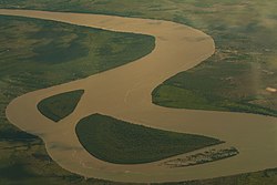
Flooding in Mozambique Púnguè River 2010-03-08
Autor/Urheber:
NASA
Shortlink:
Quelle:
Größe:
720 x 360 Pixel (128823 Bytes)
Beschreibung:
The Moderate Resolution Imaging Spectroradiometer (MODIS) on NASA’s Terra satellite captured this image of part of Sofala Province, around the city of Beira. The image uses a combination of infrared and visible light to increase the contrast between water and land. Vegetation appears bright green. Clouds appear sky blue. Water appears navy blue. Waters overflowing the banks of the Púnguè River create a big blue splotch northwest of Beira, and swell the river near the coast.
Lizenz:
Public domain
Relevante Bilder
Relevante Artikel
PungweDer Pungwe, portugiesisch Rio Pungué, ist ein Fluss in der Provinz Manicaland in Simbabwe und in den Provinzen Manica und Sofala in Mosambik. Er zählt mit seinen Wasserfällen – die mit 760 m freiem Fall die sechsthöchsten der Erde sind – zu den Attraktionen der Region. .. weiterlesen


