Chile-Chonos Archipelago
Autor/Urheber:
Petermann, A.
Shortlink:
Quelle:
Größe:
1032 x 1276 Pixel (585964 Bytes)
Beschreibung:
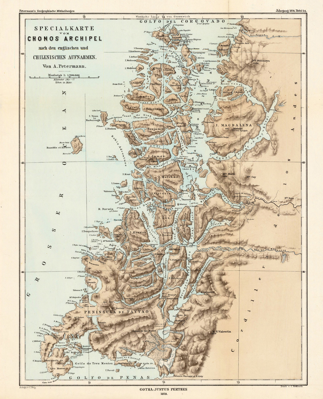
Lithograph, printed in colors when published. Detailled map, showing the Chonos Archipel from the gulf of Penas with the Peninsula de Taytao up to the gulf of Corcovado. Very detailled map with an enormous number of islands and peninsulas, most of them with place names. The map provides an overview of the results of the travel by Th. von Heugelin to Somalia. It is also ornated with a scene of birds and mammals, which were discovered by Th. Heugelin in Somalia.
Lizenz:
Public domain
Bild teilen:


Relevante Bilder

Relevante Artikel
Chonos-ArchipelDer Chonos-Archipel ist eine Inselgruppe im Süden von Chile in der Región de Aysén. Der Archipel ist nach dem ausgestorbenen Volk der Chono benannt. .. weiterlesen
James-Insel (Chile)Die James-Insel ist eine chilenische Insel im Pazifik. Sie gehört zu dem unmittelbar östlich dem südamerikanischen Festland vorgelagerten Chonos-Archipel. Die Insel hat eine Fläche von 388 km² und ist unbewohnt. Die gesamte Insel gehört zum nationalen Naturreservat Reserva Nacional Las Guaitecas. .. weiterlesen