Cerrado ecoregion
Autor/Urheber:
Pfly
Shortlink:
Quelle:
Größe:
400 x 300 Pixel (102788 Bytes)
Beschreibung:
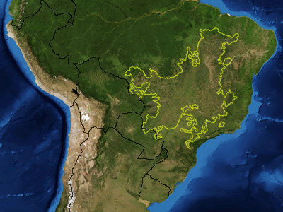
This is a map showing the location of the Cerrado ecoregion as delineated by the World Wide Fund for Nature. I, Pfly, made it using NASA Blue Marble imagery and ecoregion GIS data which I simplified and digitized in Photoshop.
Lizenz:
Public domain
Credit:
NASA, plus my additions by myself.
Bild teilen:


Relevante Bilder


Relevante Artikel
GoiásGoiás [ɡoˈjas] ist ein Bundesstaat im „Mittelwesten“ von Brasilien. .. weiterlesen