Cape Cod Landsat 7
Autor/Urheber:
Shortlink:
Quelle:
Größe:
2418 x 2145 Pixel (1120814 Bytes)
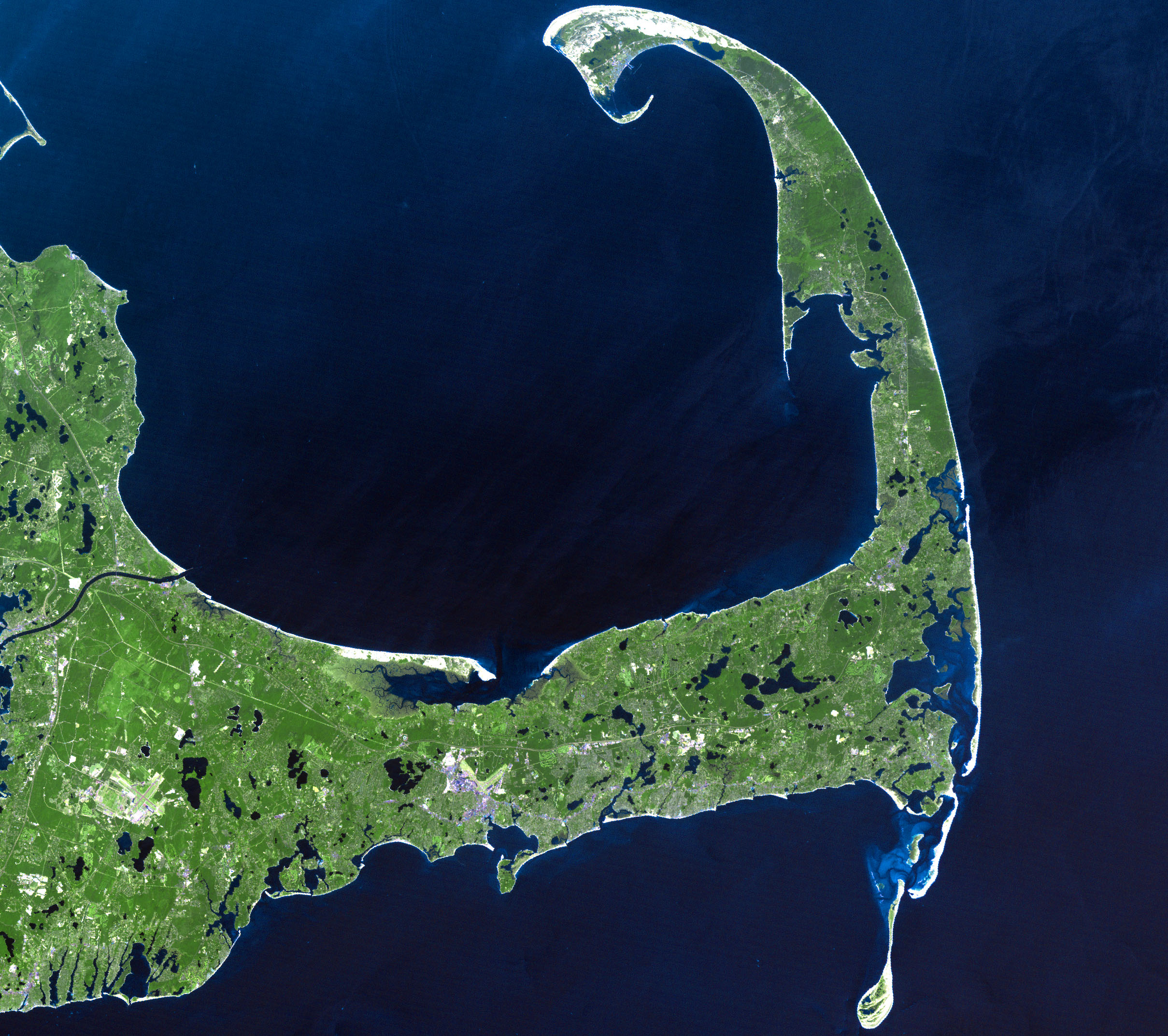
Beschreibung:
In easternmost Massachusetts, Cape Cod juts dramatically out into the Atlantic Ocean. The 65-mile peninsula has Cape Cod Bay to its north, the Nantucket Sound to its south and the Atlantic Ocean to its east. It is the world’s largest glacially formed peninsula; a remnant landscape left by the retreating Laurentide Ice Sheet.
The outer shore of the cape, from Long Point to south of Pleasant Bay, was designated as the Cape Cod National Seashore in August of 1961. The National Seashore encompasses over 44,000 acres of land, which includes marine, estuarine, and freshwater ecosystems.
This Landsat 7 image was acquired on June 22, 2002. The pseudo-natural colour image, is a composite of ETM+ bands 7, 5, and 3. Cape Cod is found on Landsat WRS-2 Path 11 Row 31.
Lizenz:
Public domain
Credit:
Bild teilen:


Relevante Bilder
.svg)
.svg)

Relevante Artikel
Angriff auf OrleansDer deutsche Angriff auf Orleans war eine Beschießung einer kleinen Stadt und ihres Hafens während des Ersten Weltkrieges. Ein U-Boot der Kaiserlichen Marine griff am 21. Juli 1918 die Stadt Orleans auf der Halbinsel Cape Cod im US-Bundesstaat Massachusetts an und beschoss dabei auch die kleinen Handelsschiffe im Hafen. .. weiterlesen