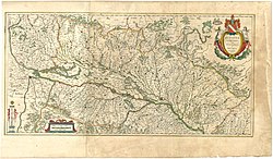
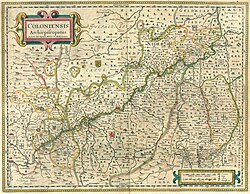
Blaeu 1645 - Circulus Westphalicus sive Germaniæ Inferioris
Autor/Urheber:
Willem and Joan Blaeu (edited by); uploaded by user Simplicius
Shortlink:
Quelle:
Größe:
3720 x 3120 Pixel (1438469 Bytes)
Beschreibung:
Attention - Unusual orientation: S N (... North points to the right)
- Historic map Circulvs Westphalicvs (Westphalian district) or Germaniæ Inferioris (lower Germany)
- Part of the book from 1645
- Theatrum Orbis Terrarum, sive Atlas Novus in quo Tabulæ et Descriptiones Omnium Regionum, Editæ a Guiljel et Ioanne Blaeu
- (Theater of the World, or a New Atlas of Maps and Representations of All Regions, Edited by Willem and Joan Blaeu)
Lizenz:
Public domain
Credit:
http://www.library.ucla.edu/yrl/reference/maps/blaeu//index.htm, Blaeu-Atlas 1635-1662, University of California
Relevante Bilder
Relevante Artikel
Atlas MaiorDer Atlas Blaeu, später Atlas Maior genannt, wurde von Willem Janszoon Blaeu herausgegeben, jedoch von seinem Sohn, dem Amsterdamer Verleger Joan Blaeu, 1662 bis 1665 zusammengestellt. Er ist einer der wichtigsten Atlanten des 17. Jahrhunderts. Der Atlas Maior war das teuerste und umfangreichste Buch, das im 17. Jahrhundert veröffentlicht wurde. Er blieb über 100 Jahre der verbindliche Weltatlas. .. weiterlesen


