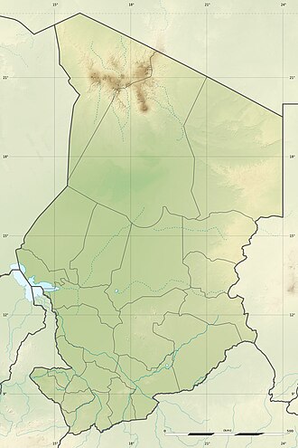
Fitri-See
| Fitri-See | ||
|---|---|---|
 | ||
| Geographische Lage | Provinz Batha, | |
| Zuflüsse | Batha | |
| Abfluss | keiner | |
| Inseln | > 60 (Dez. 2005) | |
| Orte am Ufer | Yao | |
| Ufernaher Ort | Ati | |
| Daten | ||
| Koordinaten | 12° 48′ 0″ N, 17° 30′ 0″ O | |
| Höhe über Meeresspiegel | 285 m | |
| Fläche | 500 km² | |
| Länge | 23 km (Dez. 2005) | |
| Breite | 11 km (Dez. 2005) | |
| Einzugsgebiet | 70.000 km² | |
Besonderheiten | ||
Der Fitri-See ist ein See im Zentrum des Tschad.
Geographie
Er liegt etwa 300 km östlich von N’Djamena und 100 km westlich der Stadt Ati in der Provinz Batha, im Zentrum des Siedlungsgebietes der Bulala.
Die Fläche des Sees beträgt normalerweise etwa 500 km², was in etwa der Größe des Bodensees entspricht. Sie kann sich in regenreichen Jahren aber verdreifachen. Der Süßwasser-See ist flach und wird durch saisonale Regenfälle und Zuflüsse aus seinem 70.000 km² großen Einzugsgebiet gespeist. Der größte Zulauf ist der saisonale Fluss Batha (Bahr el Batha), der von Osten her Wasser aus dem Wadai-Massiv heranführt und in einem Delta mündet.
Bedeutendste Siedlung im Ufer-Bereich des Sees ist Yao, Hauptstadt des früheren Sultanats Yao.
Hydrologie
Die Salinität des Sees ist wie bei anderen Sahel-Seen im Tschadbecken niedrig. Im Volksmund wird der Fitri-See als kleiner Bruder des Tschadsees bezeichnet, mit dem er im Zeitalter des Tschadien bis vor 5000 Jahren ein Teil des Mega-Tschadsees war.
Ähnlich wie andere Seen des Tschad ist der Fitri-See nicht ganz so groß wie früher. Zudem kann der normalerweise dauerhafte See in schweren Dürreperioden komplett trockenfallen, wie zu Beginn des 20. Jahrhunderts und 1984/85.
Wirtschaft
Der See ist eine wichtige Ernährungsquelle für die lokale Bevölkerung, da in ihm mehr als 3000 Tonnen Fisch pro Jahr gefangen werden.
Naturschutz
Der See wurde 1990 durch die Ramsar-Konvention zu einem Feuchtgebiet von internationaler Bedeutung erklärt, dieses Gebiet erstreckt sich auf 1950 km² rund um den See.
Quelle
- Ramsar-Information über den TschadLänderinformation Tschad auf Ramsar Wetland ( vom 24. September 2012 im Internet Archive) 172 kB PDF-Datei
- BirdLife International: Lake Fitri. Abgerufen am 17. Januar 2022.
- F. Hagenbucher: Notes sur les Bilala du Fitri (pdf)
Weblinks
- Herbert Franz: Beitrag zur Kenntnis der Stratigraphie und Klimatologie des Quartärs im Tschadbecken (Französisch-Aequatorialafrika). In: Austrian Journal of Earth Sciences. Band 51, 1958, S. 19–65 (zobodat.at [PDF]).
- Lac Fitri Ramsar Site in der World Database on Protected Areas (englisch)
Auf dieser Seite verwendete Medien
Lake Fitri, Chad is featured in this image photographed by an Expedition 30 crew member on the International Space Station.
- Lake Fitri is an endorheic, or terminal lake in a desert basin in the southern Sahara Desert. Muddy yellow-brown water marks the center of the depression (center), with a ring of dark brown muds and burnt vegetation on the exposed lake floor to the north. The lake shoreline supports a thin line of reed and floating grass vegetation which appears as dark green in the image. Deserts have so little rainfall that many rivers cannot reach the sea, but end at local low points where they form lakes. Here the usually dry Wadi Batha empties into Lake Fitri. Over time, water flow in Wadi Batha has created a large delta, which occupies the entire top left third of the image—a sense of scale is given by the 23--kilometer length of the lake. The lake has been designated under the Ramsar Convention as a wetland of international importance.
- Other features visible in the image reveal evidence of significant climate change. The dry part of the present lake shows that the lake has been larger in the last several decades. But, as NASA scientists point out, the lake was once many times larger than its present surface area, as shown by numerous sweeping curves of ancient beaches which are now situated many kilometers from the present shoreline, at higher altitudes (upper right). Inland lakes are highly sensitive to the exact equilibrium between the amount of inflow from contributing rivers like Wadi Batha and evaporation. Each beach ridge therefore shows a different lake level and thus a different balance in the lake-river-climate system.
- A smaller river enters from the south (top right) and cuts through the beach reaches on its way to the lake. The irregular, elongated, tan patches to the west of the lake are linear dunes aligned parallel to the dominant winds which blow from the northeast. The dunes have all formed on the downwind side (southwest) side of the lake since the lake bed and delta provide the sands which have built the dunes. The dunes indicate that during past climatic phases the lake has been almost or completely dry on repeated occasions—often enough for these great dunes, many kilometers long and several meters high, to form even in the lowest parts of the lake.
- The islands visible in the center of the lake are likewise remnants of dunes. These dunes are smaller than those on the lake margin, presumably because waves from the lake have eroded them. Villages occupy the points of some major dunes, and some islands, where fishermen can gain easy access to the lake.
Autor/Urheber: Eric Gaba (Sting - fr:Sting), Lizenz: CC BY-SA 3.0
Blank physical map of Chad as since the 2008-02 reform of the Regions, for geo-location purposes.


