Yoshiwara Map Edo by Utagawa Hiroshige II July 1860
Autor/Urheber:
Utagawa Hiroshige II (1826-1869)
Shortlink:
Quelle:
Größe:
4000 x 2036 Pixel (15284458 Bytes)
Beschreibung:
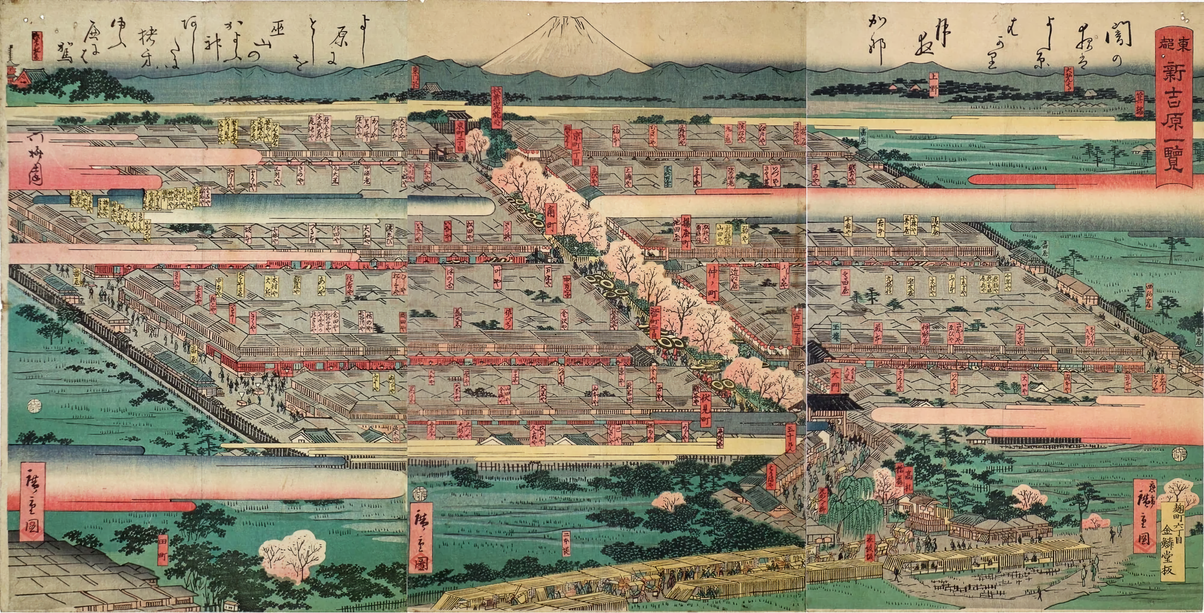
Yoshiwara red-light district before the advent of electricity in July 1860 (Edo period). This is Hiroshige Utagawa II's "Tōto Shin-Yoshiwara ichiran (View of Shin-Yoshiwara in the Eastern Capital). The Yoshiwara red-light district has a square shape and is surrounded by rice fields. If you look at the maps from that time, you'll understand. Yoshiwara Yukaku was a square, 330 meters wide and about 250 meters long. Literally "guo" = surrounded place. The Nakanochō main street, lined with cherry trees, had teahouses that mediated for the brothels. Although it is not clearly depicted in ukiyo-e, the Yoshiwara red-light district was surrounded by a wall, and outside of it was a moat with a width of more than 5 meters called “Oguro Dobu”. It was generally only accessible by a large central gate and by boat via the Sanya canal which was filled in long ago. The district's location corresponds to modern-day Senzoku 4-Chōme in Tokyo, Taitō-ku.
Lizenz:
Public domain
Credit:
Ota Memorial Museum of Art (太田記念美術館). See also: Tokyo Metropolitan Library - https://archive.library.metro.tokyo.lg.jp/da/detail?tilcod=0000000003-00226342
Bild teilen:


Relevante Bilder


Relevante Artikel
YoshiwaraYoshiwara war im 17.–19. Jahrhundert während der Edo-Zeit das einzige lizenzierte Bordellviertel in der, seinerzeit Edo genannten, japanischen Hauptstadt Tokio und eines von 25 in Japan insgesamt. In der zweiten Hälfte des 19. und der ersten Hälfte des 20. Jahrhunderts wurde der Name „Yoshiwara“ von westlichen Seefahrern und Touristen als Synonym für jedes japanische Bordell gebraucht. .. weiterlesen