Yakima Valley AVA

Shortlink:
Quelle:
Größe:
705 x 468 Pixel (128997 Bytes)
Beschreibung:
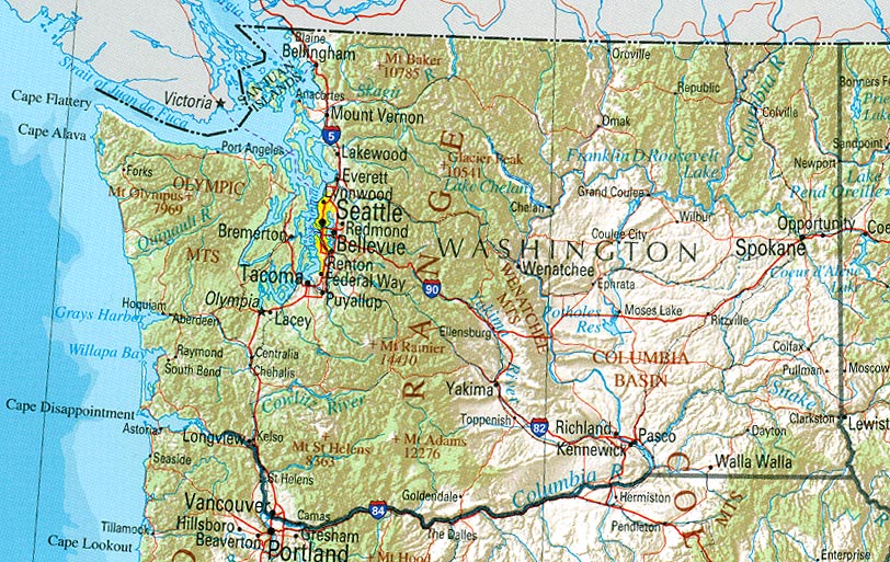
Modified map used to show the Yakima Valley AVA within Washington State. Modified copied similarly released to public domain. *note Map excludes depiction of southern en:Horse Heaven Hills AVA which is also part of Yakima Valley. Will hopefully try to get an updated map at some point.
Lizenz:
Public domain
Credit:
Original public domain image locate at Perry-Castañeda Library Map Collection provided by [http://www.lib.utexas.edu/maps/washington.html U.S. Geological Survey 2001, printed 2002
Bild teilen:


Relevante Artikel
Yakima Valley AVAYakima Valley American Viticultural Area ist ein Weinbaugebiet im Süden des US-Bundesstaats Washington. Yakima Valley war die erste anerkannte Herkunftsbezeichnung Washingtons und ist mit seinen 4.400 Hektar Rebfläche Bestandteil der überregionalen Columbia Valley AVA. Die hauptsächlich angebauten Rebsorten sind Cabernet Sauvignon, Merlot, Syrah, Chardonnay und Riesling. Nahezu 40 Prozent der Weinproduktion des Bundesstaates Washington stammen von hier. .. weiterlesen