Wildfire spreads in Fort McMurray

Autor/Urheber:
NASA Earth Observatory image by Joshua Stevens, using Landsat data from the U.S. Geological Survey. Caption by Kathryn Hansen
Shortlink:
Quelle:
Größe:
999 x 753 Pixel (637227 Bytes)
Beschreibung:
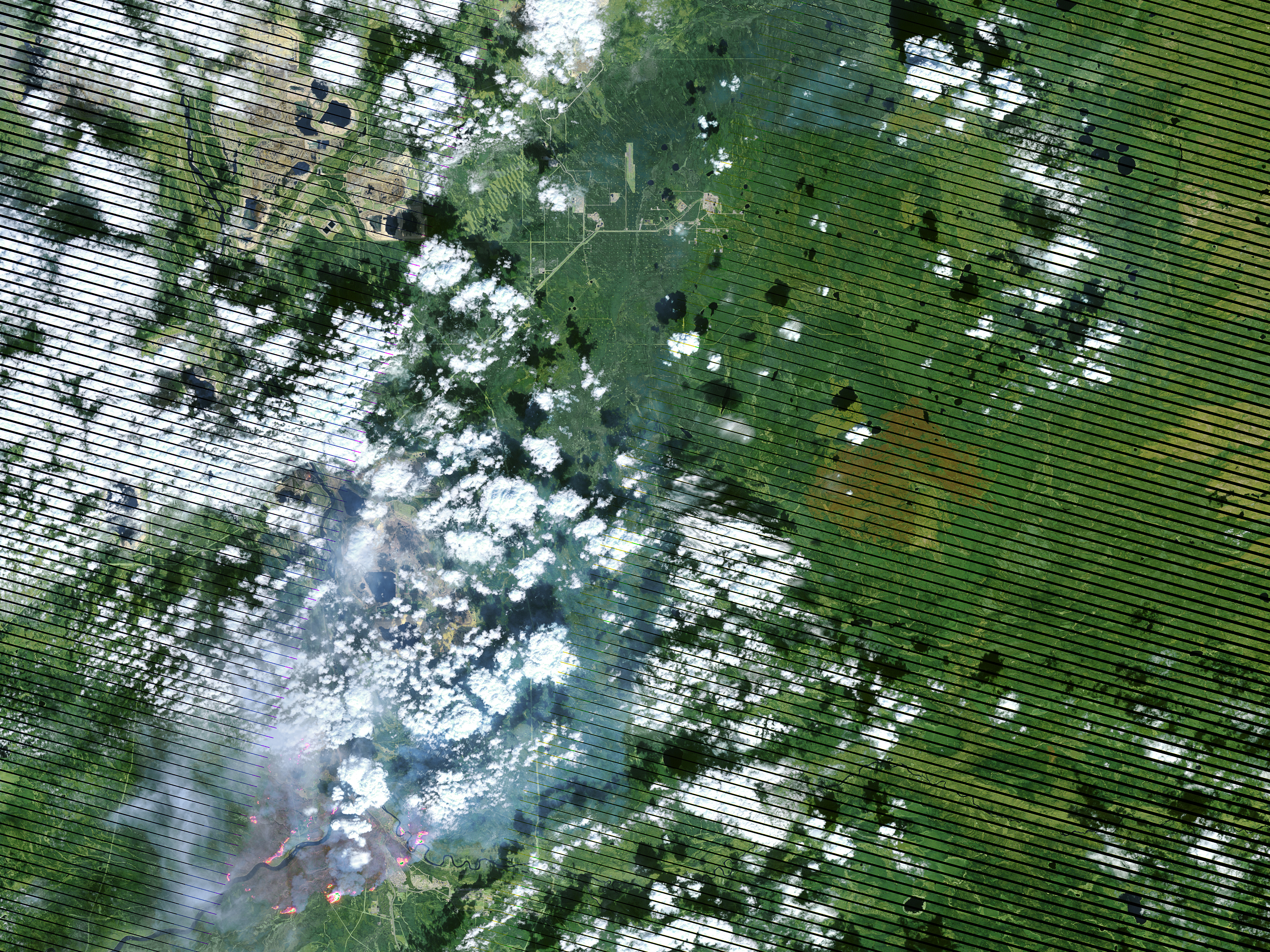
On May 4, 2016, the the Enhanced Thematic Mapper Plus (ETM+) on the Landsat 7 satellite acquired this false-color image of the wildfire that burned through Fort McMurray in Alberta, Canada. The image combines shortwave infrared, near infrared, and green light (bands 5-4-2). Near- and short-wave infrared help penetrate clouds and smoke to reveal the hot spots associated with active fires, which appear red. Smoke appears white and burned areas appear brown.
Lizenz:
Public domain
Credit:
Bild teilen:


Relevante Bilder


.svg)

Relevante Artikel
Fort McMurrayFort McMurray ist eine unselbständige Gemeinde im nordöstlichen Teil von Kanadas Provinz Alberta. Die Stadt liegt in der Region Nord-Alberta und gehört zum Gemeindebezirk Wood Buffalo. Die Stadt ist Zentrum der kanadischen Ölsandindustrie. 2016 wurden Teile der Stadt durch einen ins Stadtgebiet übergreifenden Waldbrand schwer verwüstet. .. weiterlesen