Wfm loch leven
Autor/Urheber:
NASA Landsat
Shortlink:
Quelle:
Größe:
1280 x 948 Pixel (2483478 Bytes)
Beschreibung:
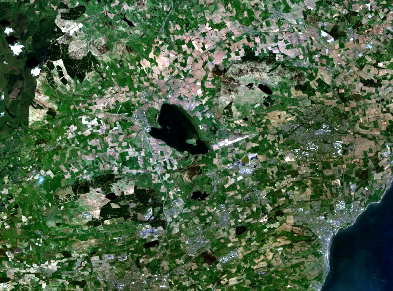
Loch Leven and central Fife in Scotland.
Kirkcaldy is visible on the coast to the southeast, Glenrothes to the east, and part of Dunfermline to the south. The M90 motorway runs to the west, through Kinross and past Milnathort.
Kirkcaldy is visible on the coast to the southeast, Glenrothes to the east, and part of Dunfermline to the south. The M90 motorway runs to the west, through Kinross and past Milnathort.
Kommentar zur Lizenz:
| Diese Datei ist gemeinfrei (Public Domain), da es sich um einen Screenshot der NASA-Software World Wind handelt, in der ein gemeinfreier Datensatz wie Blue Marble, MODIS, Landsat, SRTM, USGS oder GLOBE verwendet wird.
|
 |
Lizenz:
Public domain
Credit:
NASA World Wind
Bild teilen:


Relevante Bilder

(c) Oliver Dixon, CC BY-SA 2.0

Contains Ordnance Survey data © Crown copyright and database right, CC BY-SA 3.0

(c) John Douglas, CC BY-SA 2.0

(c) Dr Richard Murray, CC BY-SA 2.0


Relevante Artikel
Loch Leven (Perth and Kinross)Loch Leven ist ein Süßwassersee an der Ostgrenze der schottischen Council Area Perth and Kinross. Bei dem östlich von Kinross und Milnathort gelegenen Gewässer handelt es sich um den größten See der Central Lowlands. Etwa neun Kilometer östlich liegt Glenrothes. .. weiterlesen