TristanDaCunha2021OSM
Autor/Urheber:
Attribution:
Das Bild ist mit 'Attribution Required' markiert, aber es wurden keine Informationen über die Attribution bereitgestellt. Vermutlich wurde bei Verwendung des MediaWiki-Templates für die CC-BY Lizenzen der Parameter für die Attribution weggelassen. Autoren und Urheber finden für die korrekte Verwendung der Templates hier ein Beispiel.
Shortlink:
Quelle:
Größe:
6666 x 7000 Pixel (2888018 Bytes)
Beschreibung:
This map of Tristan da Cunha shows the island's cities, towns, villages and some other geographical details, and is likely the most comprehensive map of the island in this respect that you'll find anywhere online. It has been stitched together from panels of Open Street Map (which is freely licensed to all) with details plotted by the uploader.
Geographic limits of the map:
- N: -37.0122°
- S: -37.221°
- W: -12.3997°
- E: -12.1669°
Kommentar zur Lizenz:
The aforesaid website is freely usable to all.
Lizenz:
Credit:
Relevante Bilder
Relevante Artikel
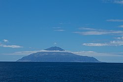
Queen Mary’s PeakDer Queen Mary’s Peak auf der Insel Tristan da Cunha ist mit einer Höhe von 2060 m die höchste Erhebung im Südatlantik. Benannt wurde der Berg nach Maria von Teck, der Gemahlin von Georg V. Er wurde erstmals um den 1. Januar 1817 bestiegen. .. weiterlesen


