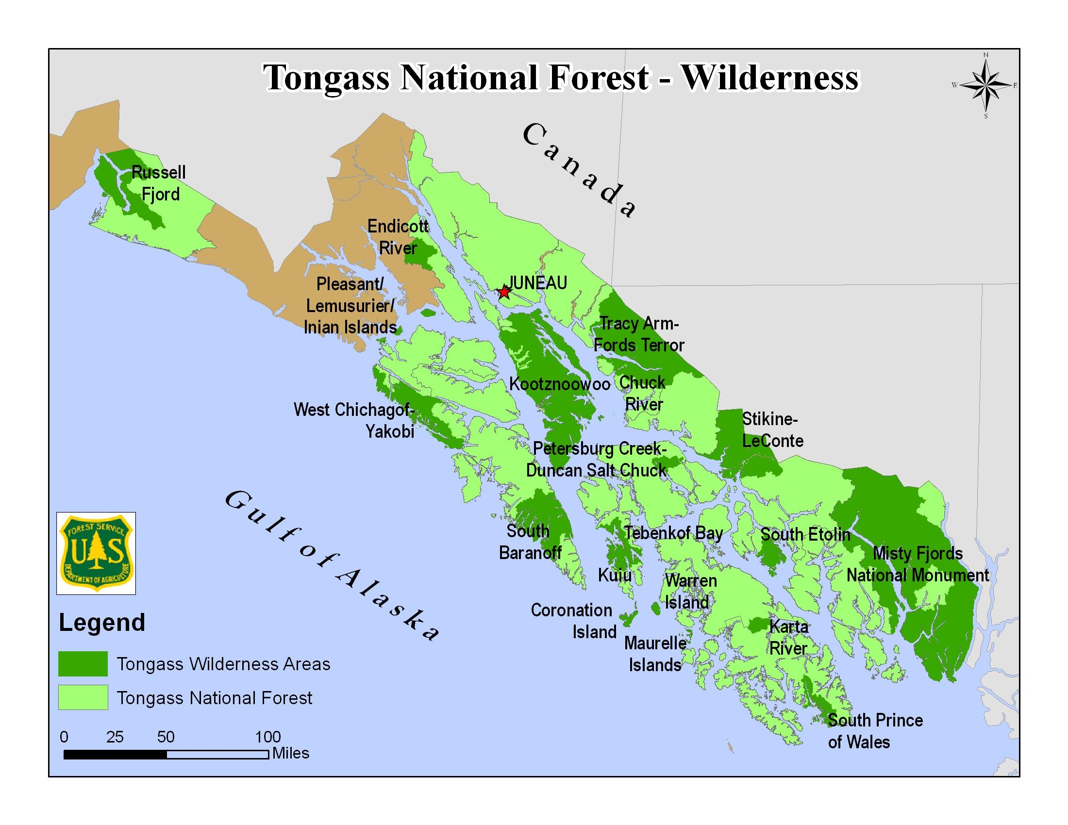
Tongass NF - map of wilderness areas
Autor/Urheber:
U.S. Forest Service
Shortlink:
Quelle:
Größe:
2200 x 1700 Pixel (976681 Bytes)
Beschreibung:
Map of the Tongass National Forest in southeast Alaska, USA, showing designated Wilderness Areas
Kommentar zur Lizenz:
|
This image is a work of the Forest Service of the United States Department of Agriculture. As a work of the U.S. federal government, the image is in the public domain.
|
|
Lizenz:
Public domain
Bild teilen:


Relevante Bilder


Relevante Artikel
Tongass National ForestDer am 10. September 1907 ausgewiesene Tongass-Nationalforst ist mit einer Fläche von 69.000 km² der größte Nationalforst der Vereinigten Staaten und befindet sich in Südost-Alaska, in der so genannten Alaska Panhandle. .. weiterlesen