Timor-Leste Geological map of zone G
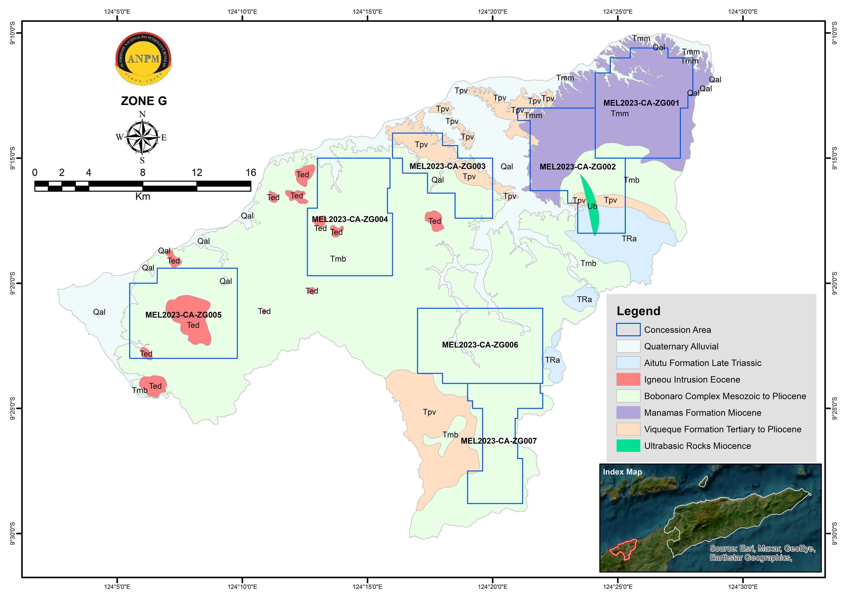
There are a number of metallic and non-metallic mineral indicated within this zone, such as gold, copper, manganese, gypsum, bentonite and limestone (UN-ESCAP 2003). The gold mineralisation within this zone is most likely associated with the volcanic rocks of Manamas Formation, however further detail exploration work need to be carried out to confirm this.
No detail mineralisation study has been carried out within the zone for their economic potential except for manganese exploration. The manganese exploration work carried out by PEM (2020) in Zone G particularly in Nipane and Passabe area shown that there is indeed manganese deposit within these areas, occurring as manganese fragment in chert boulder, manganese layers and manganese nodules (PEM 2020).


Relevante Bilder


.svg)


.jpg)


.jpg)


Relevante Artikel
Geographie OsttimorsDie Geographie Osttimors wird durch seine Lage im Übergang von Asien zu Australien geprägt. Osttimor ist das einzige Land Asiens, dessen Staatsgebiet komplett südlich des Äquators liegt. Das Territorium umfasst nicht nur die östliche Hälfte Timors, sondern auch die Exklave Oe-Cusse Ambeno, welche an der Nordküste des indonesischen Teils der Insel gelegen ist, sowie die beiden kleinen Inseln Atauro und Jaco. .. weiterlesen