Timor-Leste Geological map of zone E
Autor/Urheber:
Autoridade Nacional do Petróleo e Minerais
Shortlink:
Quelle:
Größe:
2923 x 2068 Pixel (1345188 Bytes)
Beschreibung:
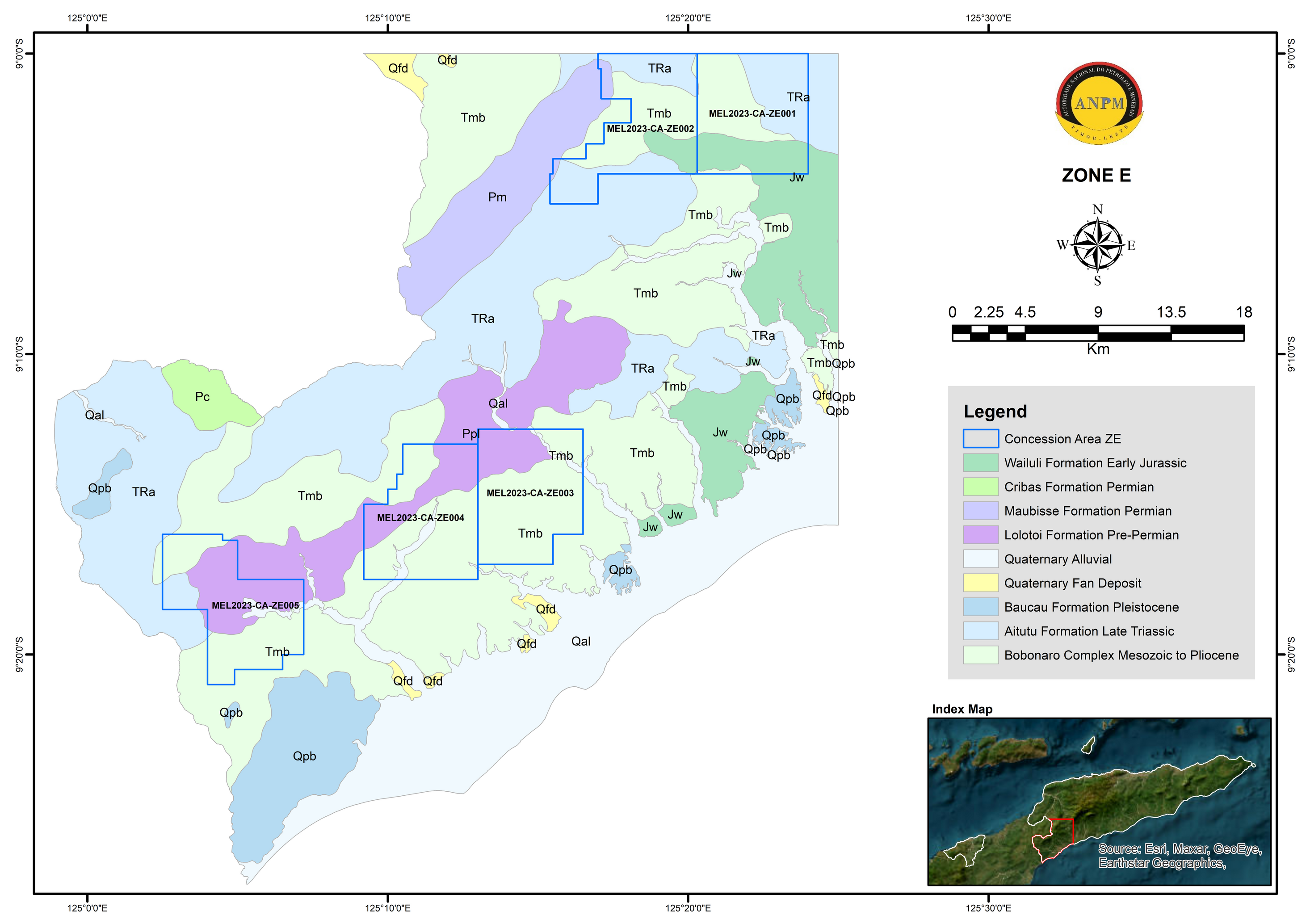
Zone E is located mainly within the Bobonaro and Covalima Municipalities and small part of Ermera Municipality particularly within the Atsabe area with a total estimated area of 1,431 km2. Zone E is mainly covered by three formations, i.e., the Lolotoi Complex, Aitutu Formation and Bobonaro Complex with minor Wailuli Formation, Maubisse Formation, Baucau Formation and Quaternary Alluvial as well as Quaternary fan deposit (Figure 7).
The indicated metallic minerals within this zone, are gold and copper, as well as non-metallic mineral such as limestone, potential marble, dolomite, and bentonite in the area (UN-ESCAP 2003). Similar to Zone D, very little studies focusing on the exploration for minerals was carried out in Zone E, resulting no detail data relating to the indicated mineralisation.
Lizenz:
Public domain
Credit:
Bild teilen:


Relevante Bilder


.svg)


.jpg)


.jpg)


Relevante Artikel
Geographie OsttimorsDie Geographie Osttimors wird durch seine Lage im Übergang von Asien zu Australien geprägt. Osttimor ist das einzige Land Asiens, dessen Staatsgebiet komplett südlich des Äquators liegt. Das Territorium umfasst nicht nur die östliche Hälfte Timors, sondern auch die Exklave Oe-Cusse Ambeno, welche an der Nordküste des indonesischen Teils der Insel gelegen ist, sowie die beiden kleinen Inseln Atauro und Jaco. .. weiterlesen