Timor-Leste Geological map of zone A
Autor/Urheber:
Autoridade Nacional do Petróleo e Minerais
Shortlink:
Quelle:
Größe:
2923 x 2068 Pixel (1417018 Bytes)
Beschreibung:
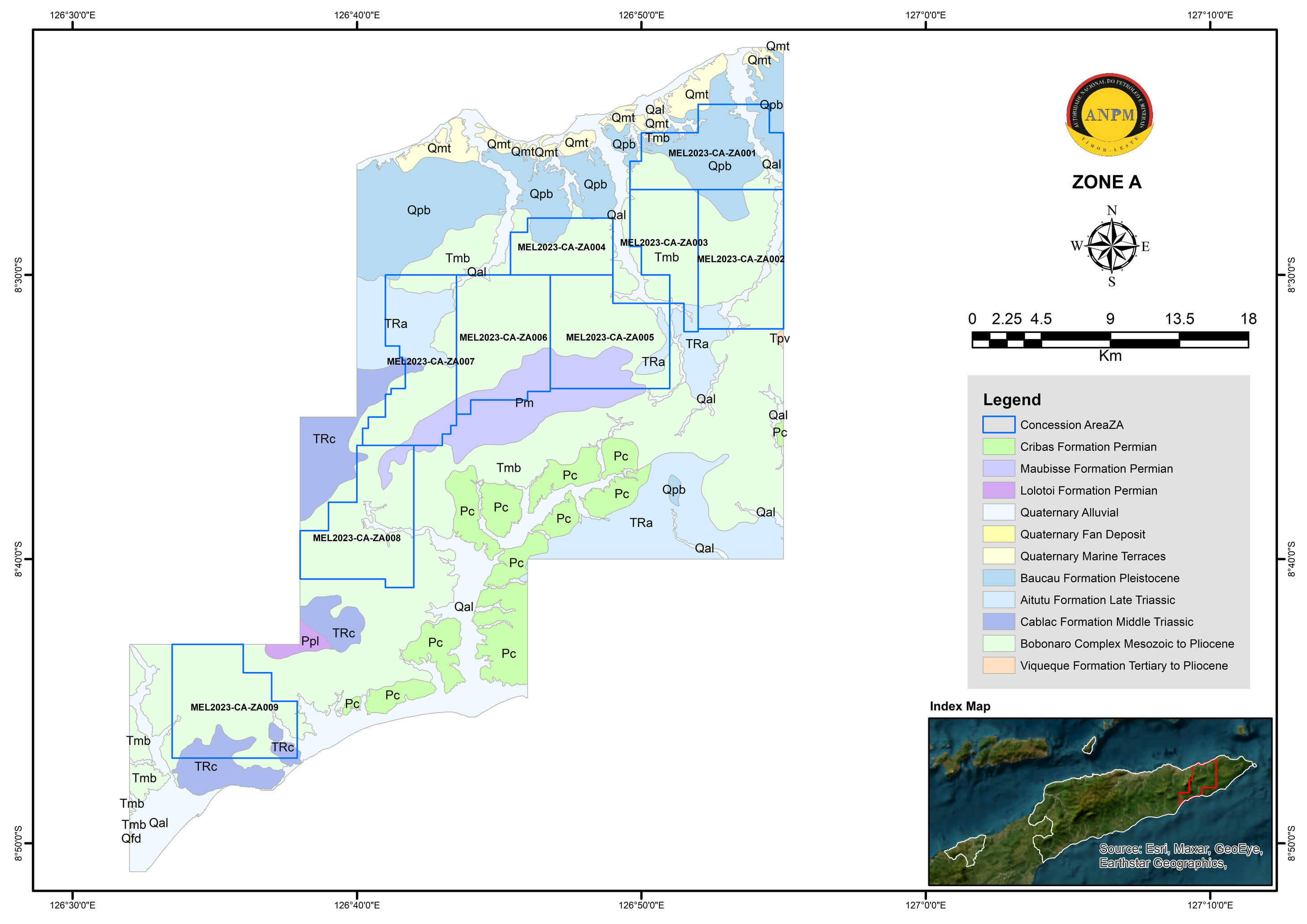
Zone A is located mainly within the area of Lautem Municipality and small part of the Viqueque and Baucau Municipalities with the estimated total area of 1114.65 km2. It has a total of nine (9) concession areas on offer for tender. The surface geology of this zone is primarily consist of Bobonaro Complex, Baucau Formation, Aitutu Formation, and Cablac Formation, with minor Lolotoi Formation, Maubisse Formation, Quaternary Alluvial and Quaternary Marine Terraces deposit (Figure 3). The lithologies that made up these formations are mainly sedimentary rocks such as limestone, sandstone, and marl, while the Bobonaro Complex contain various type of rocks of varying ages in scaly clay matrix.
Rock formations such as the Bobonaro Complex and Maubisse Formation are associated with high magnetic anomalies within the zones. The high magnetic anomalies correspond to the indication of potential metallic minerals and igneous rock present within the zone. Previous studies had noted that Zone A has indication for potential for minerals such as gold, chromium, manganese, and iron sand in part of the area including non-metallic minerals such as limestone and marble (UN-ESCAP 2003, IPG 2020; KARVAK 2022).
Lizenz:
Public domain
Credit:
Bild teilen:


Relevante Bilder


.svg)


.jpg)


.jpg)


Relevante Artikel
Geographie OsttimorsDie Geographie Osttimors wird durch seine Lage im Übergang von Asien zu Australien geprägt. Osttimor ist das einzige Land Asiens, dessen Staatsgebiet komplett südlich des Äquators liegt. Das Territorium umfasst nicht nur die östliche Hälfte Timors, sondern auch die Exklave Oe-Cusse Ambeno, welche an der Nordküste des indonesischen Teils der Insel gelegen ist, sowie die beiden kleinen Inseln Atauro und Jaco. .. weiterlesen