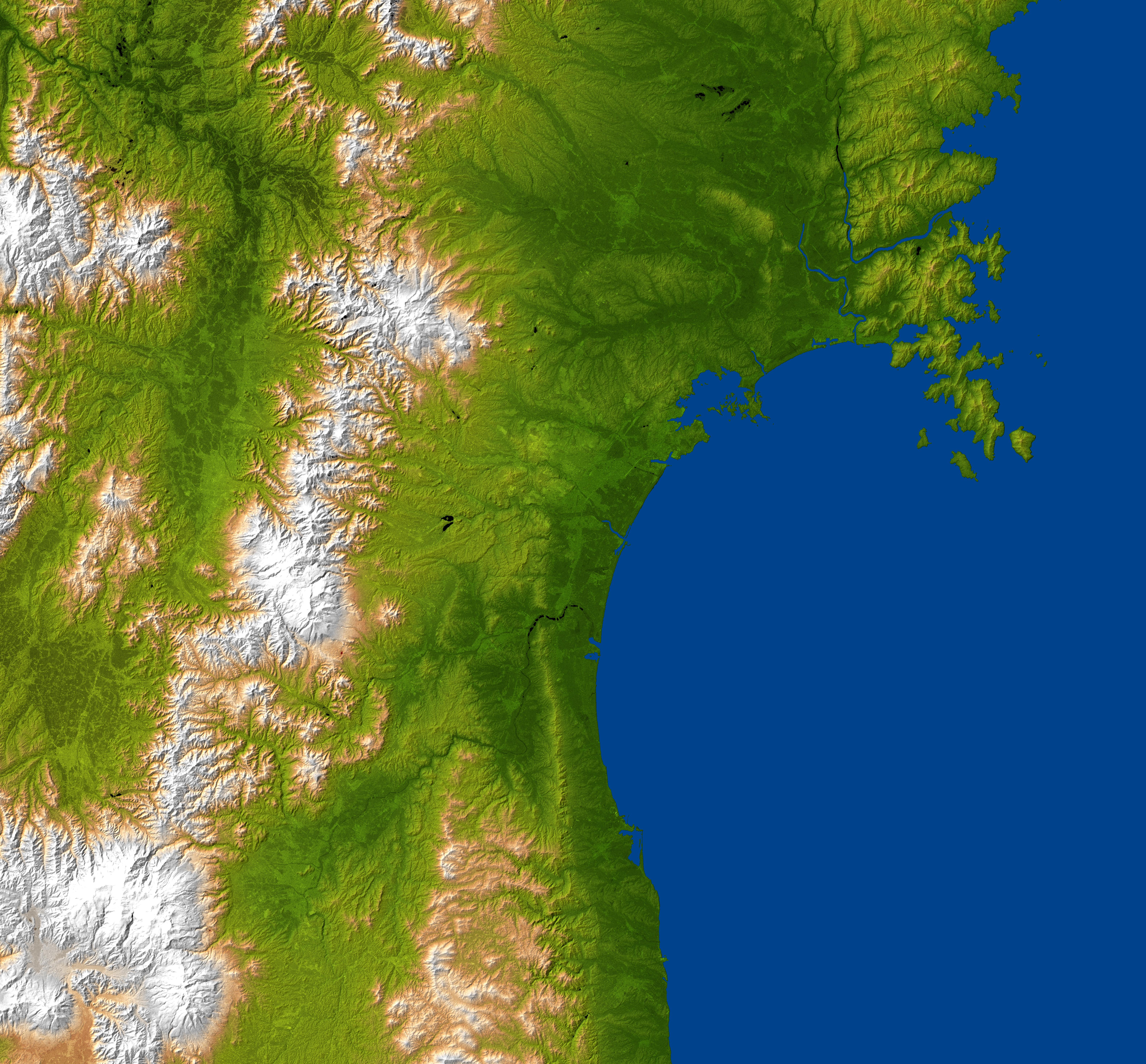
The topography surrounding Sendai
This is a “combined radar image and topographic view generated with data from NASA's Shuttle Radar Topography Mission (SRTM)[1] […] This image combines a radar image acquired in February 2000 during the SRTM mission, and color-coding by topographic height using data from the same mission. […] The mission is a cooperative project between NASA, the National Geospatial-Intelligence Agency (NGA)[2] of the U.S. Department of Defense and the German[3] and Italian[4] space agencies. It is managed by NASA's Jet Propulsion Laboratory[5], Pasadena, Calif., for NASA's Science Mission Directorate, Washington, D.C.”
Location: 38°15′N 140°51′E / 38.25°N 140.85°E
Size: approximately 174 by 160 kilometers (108 by 99 miles)
SRTM Data Acquired: February 2000
2011-03-11


Relevante Bilder


Relevante Artikel
Sendai-BuchtDie Sendai-Bucht ist eine Bucht des Pazifischen Ozeans vor der nordjapanischen (Tōhoku) Küste. .. weiterlesen
Ōu-GebirgeDas Ōu-Gebirge ist ein Gebirgszug in Japan in der Tōhoku-Region auf Honshū. .. weiterlesen