The earth and its inhabitants (1886) (21116337912)
Title: The earth and its inhabitants ..
Identifier: earthitsinhabita0186recl (find matches)
Year: 1886 (1880s)
Authors: Reclus, Elisée, 1830-1905; Ravenstein, Ernest George, 1834-1913; Keane, A. H. (Augustus Henry), 1833-1912
Subjects: Geography
Publisher: New York, D. Appleton and company
Contributing Library: MBLWHOI Library
Digitizing Sponsor: Boston Library Consortium Member Libraries
View Book Page: Book Viewer
About This Book: Catalog Entry
View All Images: All Images From Book
Click here to view book online to see this illustration in context in a browseable online version of this book.
Text Appearing Before Image:
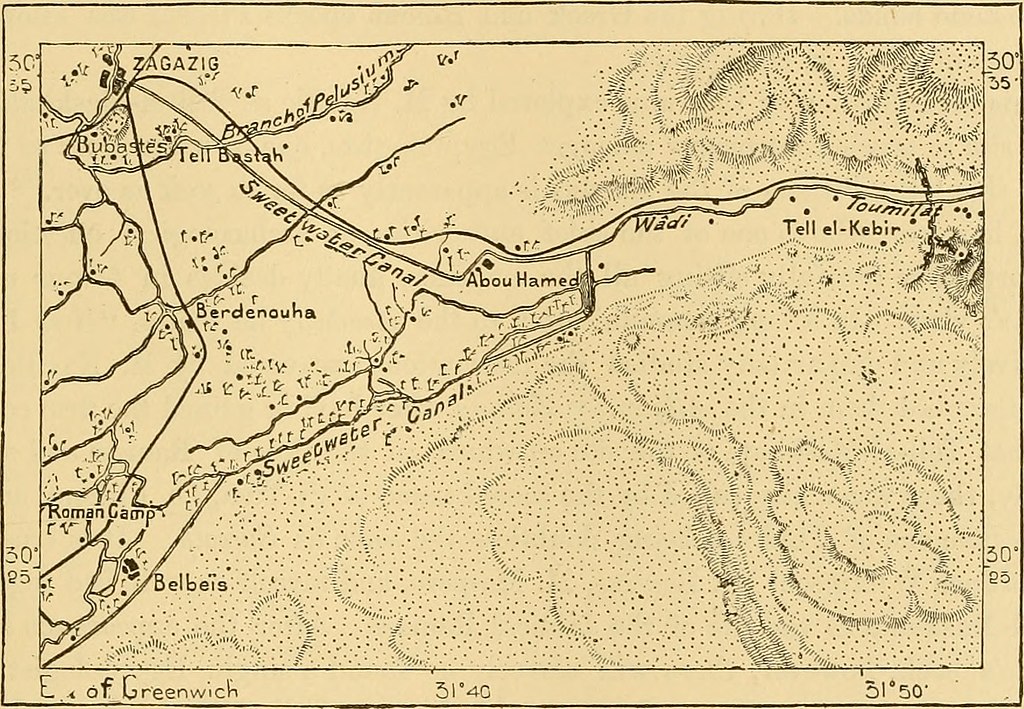
TELL-EL-KEBIE âPITHOM. 417 But the great entrepôt for the cotton and the cereals of this region of the delta is the populous city of Zagazig, which occupies a central position at the junction of several lines of railway, over against the western outlet of Wadj^-Tumilat. The population of this place has increased fivefold since the year 1860, thanks chiefly to the development of the cotton plantations. South of the Zagazig gardens a number of high mounds, collectively known by the name of Tell-el-Bast ah, still recall the ancient city of Pabast, the Buhastis of the Greeks, which was the capital of Egypt some twenty-seven or twenty-eight cen- turies ago ; that is to saj^, during the twenty-second dynasty, when the frequent Fig. 129.âEntrance of the Wady-Tumilat, Tell-el-Kebie,. Scale 1: 340,000.
Text Appearing After Image:
6 Miles. wars with Assyria reqidred the centre of gravity of the kingdom to be shifted more towards the east. Broken shafts and sculptured blocks still scattered about attest the former splendour enjoyed by this now mined city. North-east of it, on the very verge of the wilderness and on the last irrigating canals derived from the Nile, lies the village of Karaim, surrounded by palm-groves which have the reputation of jà elding the finest dates in Egypt. TeLL-EL-KeBIK PiTHOM. The entrance of the "Wady-Tumilat is guarded on the west by the station of Tell-el-Kebir, that is, the " Great Mound," where in the year 1882 the Egyptian forces under Arabi vainly attempted to make a stand against the British expedition advancing from Ismailia, its base on the Suez Canal. The fortifications erected by 27âAF.
Note About Images
Relevante Bilder
Relevante Artikel
Wadi TumilatWadi Tumilat ist die in der Ägyptologie übliche Bezeichnung für ein etwa 50 km langes, flaches Tal zwischen El-Abaseya im östlichen Nildelta und Ismailia am Timsahsee (Krokodilsee). .. weiterlesen

