Tanzania-Mount Meru NASA-PIA03356
Größe:
540 x 432 Pixel (88399 Bytes)
Beschreibung:
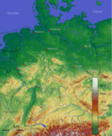
Tanzania - Mount Meru volcano Two visualization methods were combined to produce this image: shading and color coding of topographic height. The shade image was derived by computing topographic slope in the north-south direction. Northern slopes appear bright and southern slopes appear dark, as would be the case at noon at this latitude in June. Color coding is directly related to topographic height, with green at the lower elevations, rising through yellow, red, and magenta, to blue and white at the highest elevations.
Weitere Informationen zur Lizenz des Bildes finden Sie hier. Letzte Aktualisierung: Sat, 13 Jan 2024 07:16:24 GMT
Relevante Bilder
Relevante Artikel
Regionalfarbe
Regionalfarben nennt man die Farbflächen auf Wand- und Atlaskarten, die ein Gebiet in einzelne Höhenregionen gliedern. Beispielsweise steht grün für Tiefland, hellbraun für Hügel- oder Bergland, braun für Mittelgebirge und dunkelbraun und weiß für Hochgebirge. Darunter fasst man auch die Tiefenstufen des Meeres. In der Schulkartographie sind Regionalfarben Bestandteil der physischen Karte. Die Farben für die Höhenflächen (Farbhypsometrie) folgen heute in Deutschland meist der sogenannten konventionellen Farbskala, die sich eng an die Spektralfarbskala anlehnt.
.. weiterlesen


