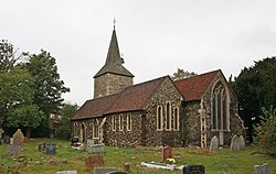
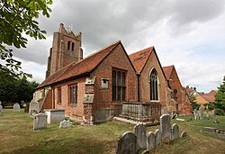
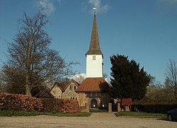
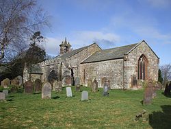
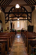
St Thomas the Apostle, Navestock (geograph 2962992)
(c) Robin Webster, CC BY-SA 2.0
Autor/Urheber:
Shortlink:
Quelle:
Größe:
480 x 640 Pixel (112174 Bytes)
Beschreibung:
St Thomas the Apostle, Navestock
Kommentar zur Lizenz:
Creative Commons Attribution Share-alike license 2.0
Lizenz:
Credit:
From geograph.org.uk
Relevante Bilder
![](https://upload.wikimedia.org/wikipedia/commons/thumb/3/3d/St_Thomas_the_Apostle%2C_Navestock_%28geograph_2444499%29.jpg/250px-St_Thomas_the_Apostle%2C_Navestock_%28geograph_2444499%29.jpg)
(c) John Salmon, CC BY-SA 2.0
![](https://upload.wikimedia.org/wikipedia/commons/thumb/0/0d/St_Thomas_the_Apostle%2C_Navestock_-_East_end_%28geograph_2444522%29.jpg/250px-St_Thomas_the_Apostle%2C_Navestock_-_East_end_%28geograph_2444522%29.jpg)
(c) John Salmon, CC BY-SA 2.0
![](https://upload.wikimedia.org/wikipedia/commons/thumb/5/52/St_Thomas_the_Apostle%2C_Navestock_-_East_end_%28geograph_2444516%29.jpg/250px-St_Thomas_the_Apostle%2C_Navestock_-_East_end_%28geograph_2444516%29.jpg)
(c) John Salmon, CC BY-SA 2.0
![](https://upload.wikimedia.org/wikipedia/commons/thumb/4/46/St_Mary_the_Virgin%2C_North_Stifford_%28geograph_2657462%29.jpg/250px-St_Mary_the_Virgin%2C_North_Stifford_%28geograph_2657462%29.jpg)
(c) John Salmon, CC BY-SA 2.0
![](https://upload.wikimedia.org/wikipedia/commons/thumb/e/ed/St_John_the_Baptist_Church%2C_Layer-de-la-Haye%2C_Essex_%28geograph_2013175%29.jpg/250px-St_John_the_Baptist_Church%2C_Layer-de-la-Haye%2C_Essex_%28geograph_2013175%29.jpg)
(c) Peter Stack, CC BY-SA 2.0
![](https://upload.wikimedia.org/wikipedia/commons/thumb/e/e5/St_Edmund_%26_St_Mary%2C_Ingatestone%2C_Essex_%28geograph_2018608%29.jpg/250px-St_Edmund_%26_St_Mary%2C_Ingatestone%2C_Essex_%28geograph_2018608%29.jpg)
(c) John Salmon, CC BY-SA 2.0
![](https://upload.wikimedia.org/wikipedia/commons/thumb/2/2d/St_Peters_Church%2C_Goldhanger%2C_Essex_%28geograph_2019794%29.jpg/250px-St_Peters_Church%2C_Goldhanger%2C_Essex_%28geograph_2019794%29.jpg)
(c) Peter Stack, CC BY-SA 2.0
![](https://upload.wikimedia.org/wikipedia/commons/thumb/e/eb/St_Laurence%2C_Eastwood_-_geograph.org.uk_-_339484.jpg/250px-St_Laurence%2C_Eastwood_-_geograph.org.uk_-_339484.jpg)
(c) Julieanne Savage, CC BY-SA 2.0
![](https://upload.wikimedia.org/wikipedia/commons/thumb/4/45/St_Michael_and_All_Angels_Church%2C_Berwick%2C_East_Sussex_%28Geograph_Image_1817187_e96ec5bc%29.jpg/250px-St_Michael_and_All_Angels_Church%2C_Berwick%2C_East_Sussex_%28Geograph_Image_1817187_e96ec5bc%29.jpg)
(c) Nigel Chadwick, CC BY-SA 2.0
![](https://upload.wikimedia.org/wikipedia/commons/thumb/d/dc/St_Margaret_de_Westwick%2C_Norwich_-_interior_%28geograph_1958352%29.jpg/125px-St_Margaret_de_Westwick%2C_Norwich_-_interior_%28geograph_1958352%29.jpg)
(c) Evelyn Simak, CC BY-SA 2.0
![](https://upload.wikimedia.org/wikipedia/commons/thumb/7/72/St_Mary%27s_Church%2C_Slaugham_-_Interior_%28Geograph_Image_862148_998e8123%29.jpg/250px-St_Mary%27s_Church%2C_Slaugham_-_Interior_%28Geograph_Image_862148_998e8123%29.jpg)
(c) Jonathan Billinger, CC BY-SA 2.0
![](https://upload.wikimedia.org/wikipedia/commons/thumb/d/d3/St_Mary_the_Virgin%2C_North_Stifford_-_East_end_%28geograph_2657471%29.jpg/250px-St_Mary_the_Virgin%2C_North_Stifford_-_East_end_%28geograph_2657471%29.jpg)
(c) John Salmon, CC BY-SA 2.0
![](https://upload.wikimedia.org/wikipedia/commons/thumb/4/48/The_Parish_Church_of_St_Mary_Magdalene%2C_Hayton%2C_Interior_%28geograph_3306989%29.jpg/250px-The_Parish_Church_of_St_Mary_Magdalene%2C_Hayton%2C_Interior_%28geograph_3306989%29.jpg)
(c) Alexander P Kapp, CC BY-SA 2.0
![](https://upload.wikimedia.org/wikipedia/commons/thumb/0/0d/St_Peter_%26_St_Paul%2C_Horndon_on_the_Hill_-_East_end_%28geograph_1890100%29.jpg/250px-St_Peter_%26_St_Paul%2C_Horndon_on_the_Hill_-_East_end_%28geograph_1890100%29.jpg)
(c) John Salmon, CC BY-SA 2.0
![](https://upload.wikimedia.org/wikipedia/commons/thumb/e/ef/Church_of_St_John_the_Baptist%2C_Markyate_%28geograph_2584457%29.jpg/250px-Church_of_St_John_the_Baptist%2C_Markyate_%28geograph_2584457%29.jpg)
(c) John Lord, CC BY-SA 2.0
![](https://upload.wikimedia.org/wikipedia/commons/thumb/0/0f/The_church_of_St._Mary_Magdalene%2C_Great_Burstead%2C_Essex_-_geograph.org.uk_-_1420669.jpg/125px-The_church_of_St._Mary_Magdalene%2C_Great_Burstead%2C_Essex_-_geograph.org.uk_-_1420669.jpg)
(c) Derek Voller, CC BY-SA 2.0
![](https://upload.wikimedia.org/wikipedia/commons/thumb/3/39/The_church_of_St_James_Pockthorpe%2C_Norwich_%28geograph_1999106%29.jpg/250px-The_church_of_St_James_Pockthorpe%2C_Norwich_%28geograph_1999106%29.jpg)
(c) Evelyn Simak, CC BY-SA 2.0
![](https://upload.wikimedia.org/wikipedia/commons/thumb/d/d5/All_Saints%2C_the_parish_church_of_Stock_-_geograph.org.uk_-_749288.jpg/250px-All_Saints%2C_the_parish_church_of_Stock_-_geograph.org.uk_-_749288.jpg)
(c) Robert Edwards, CC BY-SA 2.0
![](https://upload.wikimedia.org/wikipedia/commons/thumb/b/b2/Church_of_St_Michael_and_All_Angels%2C_Torpenhow%2C_Cumberland_-_geograph-1792786.jpg/250px-Church_of_St_Michael_and_All_Angels%2C_Torpenhow%2C_Cumberland_-_geograph-1792786.jpg)
(c) John Lord, CC BY-SA 2.0
![](https://upload.wikimedia.org/wikipedia/commons/thumb/7/7b/St_Giles_Church%2C_Gilesgate%2C_Durham_%28geograph_2261349%29.jpg/250px-St_Giles_Church%2C_Gilesgate%2C_Durham_%28geograph_2261349%29.jpg)
(c) Carol Bleasdale, CC BY-SA 2.0
![](https://upload.wikimedia.org/wikipedia/commons/thumb/e/ef/Bluebells_in_Holy_Trinity_churchyard%2C_Normanton-le-Heath_%28geograph_3484196%29.jpg/125px-Bluebells_in_Holy_Trinity_churchyard%2C_Normanton-le-Heath_%28geograph_3484196%29.jpg)
(c) Philip Jeffrey, CC BY-SA 2.0
![](https://upload.wikimedia.org/wikipedia/commons/thumb/9/94/St_Mary%2C_Sellindge%2C_Kent_-_East_end_%28geograph_2069668%29.jpg/250px-St_Mary%2C_Sellindge%2C_Kent_-_East_end_%28geograph_2069668%29.jpg)
(c) John Salmon, CC BY-SA 2.0
![](https://upload.wikimedia.org/wikipedia/commons/thumb/2/29/Church_of_St_Peter_and_St_Paul_-_West_Mersea_-_geograph.org.uk_-_661142.jpg/250px-Church_of_St_Peter_and_St_Paul_-_West_Mersea_-_geograph.org.uk_-_661142.jpg)
(c) Evelyn Simak, CC BY-SA 2.0
![](https://upload.wikimedia.org/wikipedia/commons/thumb/4/4a/St._Johns_Church%2C_Sutton-at-Hone_%28geograph_2207081%29.jpg/250px-St._Johns_Church%2C_Sutton-at-Hone_%28geograph_2207081%29.jpg)
(c) Roger Smith, CC BY-SA 2.0
![](https://upload.wikimedia.org/wikipedia/commons/thumb/3/3f/Holy_Trinity_Church_at_Milton_Damerel_%28geograph_3702341%29.jpg/250px-Holy_Trinity_Church_at_Milton_Damerel_%28geograph_3702341%29.jpg)
(c) Peter Wood, CC BY-SA 2.0
![](https://upload.wikimedia.org/wikipedia/commons/thumb/8/89/St_Peter_%26_St_Paul%2C_Horndon_on_the_Hill_%28geograph_1890104%29.jpg/250px-St_Peter_%26_St_Paul%2C_Horndon_on_the_Hill_%28geograph_1890104%29.jpg)
(c) John Salmon, CC BY-SA 2.0
![](https://upload.wikimedia.org/wikipedia/commons/thumb/7/7f/Interior_of_St._Peters_church%2C_Goldhanger_%28geograph_3894926%29.jpg/250px-Interior_of_St._Peters_church%2C_Goldhanger_%28geograph_3894926%29.jpg)
(c) Derek Voller, CC BY-SA 2.0
![](https://upload.wikimedia.org/wikipedia/commons/thumb/a/a7/Frostenden_All_Saints_church%2C_Suffolk_%28geograph_2012307%29.jpg/250px-Frostenden_All_Saints_church%2C_Suffolk_%28geograph_2012307%29.jpg)
(c) Adrian S Pye, CC BY-SA 2.0
![](https://upload.wikimedia.org/wikipedia/commons/thumb/2/2f/Petrockstowe_church_-_north_facade_%28geograph_4112150%29.jpg/250px-Petrockstowe_church_-_north_facade_%28geograph_4112150%29.jpg)
(c) Scriniary, CC BY-SA 2.0
![](https://upload.wikimedia.org/wikipedia/commons/thumb/0/0c/St_Mary%2C_Little_Easton%2C_Essex_-_geograph.org.uk_-_339750.jpg/250px-St_Mary%2C_Little_Easton%2C_Essex_-_geograph.org.uk_-_339750.jpg)
(c) John Salmon, CC BY-SA 2.0
![](https://upload.wikimedia.org/wikipedia/commons/thumb/0/0d/St_Botolph%27s_Church%2C_Chevening_%28Geograph_Image_1888106_b4cefa87%29.jpg/250px-St_Botolph%27s_Church%2C_Chevening_%28Geograph_Image_1888106_b4cefa87%29.jpg)
(c) Ian Capper, CC BY-SA 2.0
![](https://upload.wikimedia.org/wikipedia/commons/thumb/7/7a/Mickleover-_All_Saints_Church_and_churchyard_%28geograph_4536716%29.jpg/250px-Mickleover-_All_Saints_Church_and_churchyard_%28geograph_4536716%29.jpg)
(c) John Sutton, CC BY-SA 2.0
![](https://upload.wikimedia.org/wikipedia/commons/thumb/2/21/St_James%2C_Newbold_de_Verdun_%28geograph_3101033%29.jpg/250px-St_James%2C_Newbold_de_Verdun_%28geograph_3101033%29.jpg)
(c) John Salmon, CC BY-SA 2.0
![](https://upload.wikimedia.org/wikipedia/commons/thumb/9/9c/Interior%2C_St_Marys_Church%2C_Hinxhill_%28geograph_3100654%29.jpg/125px-Interior%2C_St_Marys_Church%2C_Hinxhill_%28geograph_3100654%29.jpg)
(c) Julian P Guffogg, CC BY-SA 2.0
![](https://upload.wikimedia.org/wikipedia/commons/thumb/f/f4/St_Mary%2C_Sellindge%2C_Kent_%28geograph_2069664%29.jpg/250px-St_Mary%2C_Sellindge%2C_Kent_%28geograph_2069664%29.jpg)
(c) John Salmon, CC BY-SA 2.0
![](https://upload.wikimedia.org/wikipedia/commons/thumb/8/8b/St_Peter%2C_East_Lavington_%28geograph_4077576%29.jpg/250px-St_Peter%2C_East_Lavington_%28geograph_4077576%29.jpg)
(c) John Salmon, CC BY-SA 2.0
![](https://upload.wikimedia.org/wikipedia/commons/thumb/1/1b/Holy_Trinity_church%2C_Blatherwycke-geograph.org.uk-4447367.jpg/250px-Holy_Trinity_church%2C_Blatherwycke-geograph.org.uk-4447367.jpg)
(c) Dave Thompson, CC BY-SA 2.0
![](https://upload.wikimedia.org/wikipedia/commons/thumb/c/cb/St_Peter%27s_Church%2C_Chailey_Green-geograph.org.uk-2874544.jpg/250px-St_Peter%27s_Church%2C_Chailey_Green-geograph.org.uk-2874544.jpg)
(c) Basher Eyre, CC BY-SA 2.0
![](https://upload.wikimedia.org/wikipedia/commons/thumb/4/46/The_chapel_of_St_Bartholomew_-_geograph.org.uk_-_219428.jpg/250px-The_chapel_of_St_Bartholomew_-_geograph.org.uk_-_219428.jpg)
(c) Malcolm Spicer, CC BY-SA 2.0
![](https://upload.wikimedia.org/wikipedia/commons/thumb/9/99/St_Michael_Steeple_Claydon_Geograph-2432471-by-Cameraman.jpg/250px-St_Michael_Steeple_Claydon_Geograph-2432471-by-Cameraman.jpg)
(c) Cameraman, CC BY-SA 2.0
![](https://upload.wikimedia.org/wikipedia/commons/thumb/4/47/St_Marys_church%2C_Hinxhill_%28geograph_3100650%29.jpg/250px-St_Marys_church%2C_Hinxhill_%28geograph_3100650%29.jpg)
(c) Julian P Guffogg, CC BY-SA 2.0
![](https://upload.wikimedia.org/wikipedia/commons/thumb/e/ed/St_Thomas_the_Apostle_Church%2C_Stanhope_-_geograph.org.uk_-_2259652.jpg/250px-St_Thomas_the_Apostle_Church%2C_Stanhope_-_geograph.org.uk_-_2259652.jpg)
(c) St Thomas the Apostle Church, Stanhope by Carol Bleasdale, CC BY-SA 2.0
Relevante Artikel
Liste der Hallenkirchen im Vereinigten Königreich▶ Liste(n) der Hallenkirchen – Übersicht .. weiterlesen