Somme department relief location map
Shortlink:
Quelle:
Größe:
1498 x 1075 Pixel (390593 Bytes)
Beschreibung:
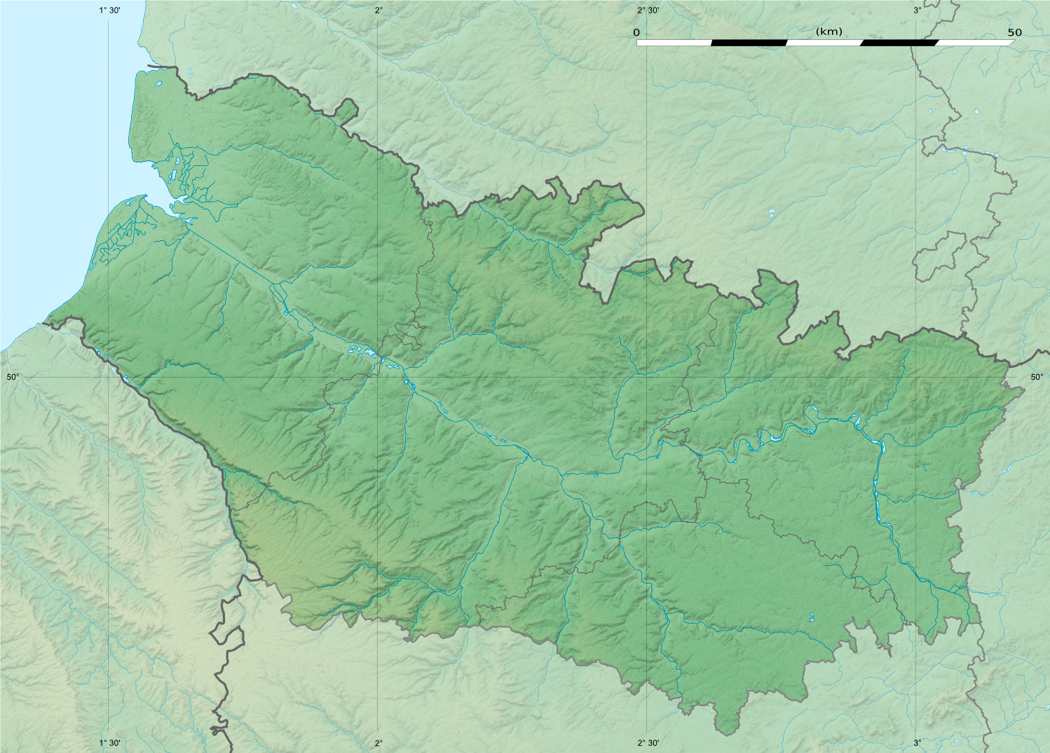
Blank physical map of the department of Somme, France, as in December 2014, for geo-location purpose, with distinct boundaries for regions, departments and arrondissements.
Kommentar zur Lizenz:
| Attribution and Share-Alike required |
|---|
| Any use of this map can be made as long as you credit me (Eric Gaba – Wikimedia Commons user: Sting) as the author and distribute the copies and derivative works under the same license(s) that the one(s) stated below. A message with a reply address would also be greatly appreciated. |
Lizenz:
Credit:
Eigenes Werk
- Sources of data:
- NASA Shuttle Radar Topography Mission (SRTM1 v2 and SWBD) (public domain);
- SRTM30 Plus;
- BD Carthage 2013 (open license) created by the IGN and available on Sandre's site;
- NASA Shuttle Radar Topography Mission (SRTM1 v2 and SWBD) (public domain);
- References for the boundaries:
Bild teilen:


Relevante Bilder


Relevante Artikel
Somme-BuchtAls Somme-Bucht wird das Ästuar der Somme bezeichnet, das mit etwa 7200 ha Fläche das größte seiner Art in Nordfrankreich bildet. Administrativ gehört die Somme-Bucht zum Département Somme in der Region Hauts-de-France. .. weiterlesen