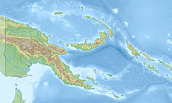
Sable Island PNG (Landsat)
Autor/Urheber:
NASA
Shortlink:
Quelle:
Größe:
512 x 256 Pixel (253211 Bytes)
Beschreibung:
Landsat image of Sable Island, Nuguria Islands, Bismarck Archipelago, Papua New Guinea
Lizenz:
Public domain
Credit:
Relevante Bilder
Relevante Artikel
Sable Island (Papua-Neuguinea)Sable Island ist eine kleine, unbewohnte Insel der Nuguria-Inseln im Pazifischen Ozean, etwa 16 km südwestlich des Nuguria-Atolls gelegen. Das rund 2 m hohe Eiland ist von einem Korallenriff umsäumt. Sable Island gehört politisch zu Papua-Neuguinea und dort zum Atolls Local Level Government des North Bougainville Districts in der autonomen Region Bougainville. .. weiterlesen


