Reichsstadt Biberach Territorium - Pfeffel 1746
Autor/Urheber:
Johann Andreas Pfeffel
Shortlink:
Quelle:
Größe:
1920 x 1728 Pixel (6759568 Bytes)
Beschreibung:
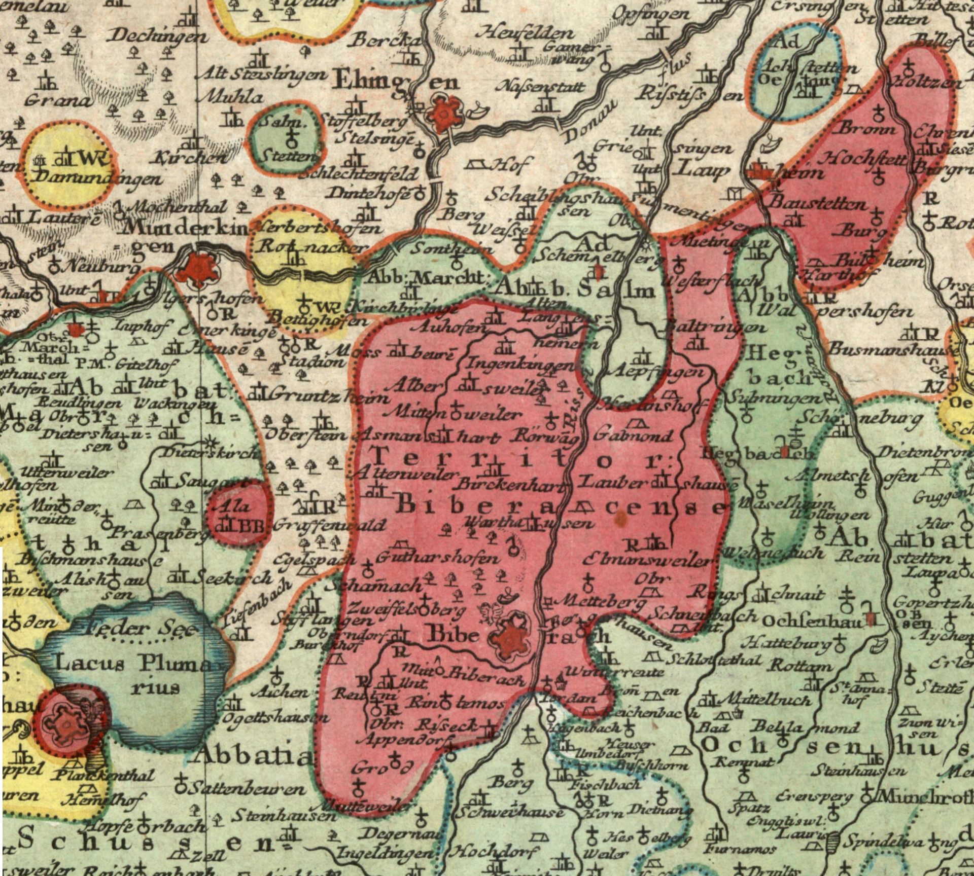
Detail cropped from a mid 18th century map showing the territory of the Free Imperial City of Biberach, now Biberach an der Riss. The small red-coloured exclave inscribed "BB" belonged to Biberach.
Cropped out of map two of a multi-map series centered on the Circle of Swabia titled Per Inclyti Circuli Suevici Supremorum Ordinum, etc. published by Augsburg publisher Johann Andreas Pfeffel in 1746.
Cropped out of map two of a multi-map series centered on the Circle of Swabia titled Per Inclyti Circuli Suevici Supremorum Ordinum, etc. published by Augsburg publisher Johann Andreas Pfeffel in 1746.
Lizenz:
Public domain
Credit:
Moll's map collection
Bild teilen:


Relevante Bilder


.svg)


Relevante Artikel
Reichsabtei OchsenhausenDie Reichsabtei Ochsenhausen war von 1090 bis 1803 ein Kloster der Benediktiner in Ochsenhausen in Oberschwaben, das zum Schwäbischen Reichskreis gehörte. .. weiterlesen