Prince Edward Island map 1775
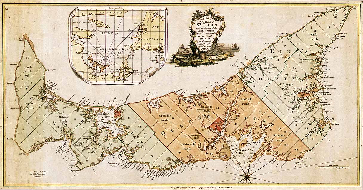
The island was the first of the new English colonies for which a general survey was conducted. Samuel Holland was in charge of the survey. Known as Île Saint-Jean at the time of the French, and later Saint John Island, it did not take its present name until 1799.
This very detailed plan shows the projected counties, parishes, townships and lots on the island following the expulsion of the Acadians in 1758. Samuel Holland, surveyor general of the province of Quebec, surveyed the island in the fall of 1764. He identified the location of the capital and named it Charlottetown. The counties and townships are listed with their sizes in acres. Inset map of the Gulf of St. Lawrence. Decorative cartouche showing farming and fishing sceneries.


Relevante Bilder
.svg)


.svg)

Relevante Artikel
Prince Edward IslandPrince Edward Island [ˌpɹɪns‿ˌɛdwɚd‿ˈaɪ̯lɨnd] ist eine Insel im Atlantik und eine Provinz im Osten Kanadas. Die Nachbarprovinzen der Insel sind New Brunswick im Westen und Nova Scotia im Süden und Osten. Prince Edward Island ist flächenmäßig die kleinste Provinz des Landes. Benannt ist sie nach Edward Augustus, Duke of Kent and Strathearn, dem Vater von Königin Victoria. .. weiterlesen