Portuguese Simbor 1911
Autor/Urheber:
Comissão de cartographia
Shortlink:
Quelle:
Größe:
1222 x 1420 Pixel (2489119 Bytes)
Beschreibung:
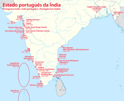
Basic map of the territory of Simbor, an exclave of the District of Diu located 25 km east of the city of Diu. This 1 sq. km territory comprised an island on which was built Fort St. Anthony of Simbor and, on the mainland bordering the Princely State of Junagadh (British India), two small strips of land on each side of the mouth of a small river. One end of the channel separating the island from the mainland appears to be blocked.
That map is an insert of a Portuguese map of the District of Diu (Portuguese India) titled Carta topographico-agricola do districto de Diu. Published in 1911 by the Cartography Commission (Commissăo de cartographia).
That map is an insert of a Portuguese map of the District of Diu (Portuguese India) titled Carta topographico-agricola do districto de Diu. Published in 1911 by the Cartography Commission (Commissăo de cartographia).
Lizenz:
Public domain
Credit:
Portuguese old colonial maps site
Relevante Bilder
Relevante Artikel
St.-Antonius-von-Simbor-FortDas St.-Antonius-von-Simbor-Fort ist die Ruine einer Festung (fort) der Portugiesen an der Südküste der Halbinsel Kathiawar/Saurashtra des indischen Bundesstaates Gujarat. Es gehörte bis zum Jahr 1961 zu den portugiesischen Besitzungen von Dadra und Nagar Haveli und Daman und Diu. .. weiterlesen


