PortlandBillAndChesilBeach(Landsat)
Autor/Urheber:
Fotografie: NASA
Shortlink:
Quelle:
.jpg?uselang=de)
Größe:
940 x 912 Pixel (381170 Bytes)
Beschreibung:
Screenshot from World Wind software displaying NASA Landsat imagery. The website says "The Landsat Global Mosaic, Blue Marble, and the USGS raster maps and images are all Public Domain." (http://www.worldwindcentral.com/wiki/World_Wind_FAQ)
Lizenz:
Public domain
Credit:
Satellite imagery taken from NASA World Wind software (by screenshot)
Bild teilen:


Relevante Bilder


Relevante Artikel
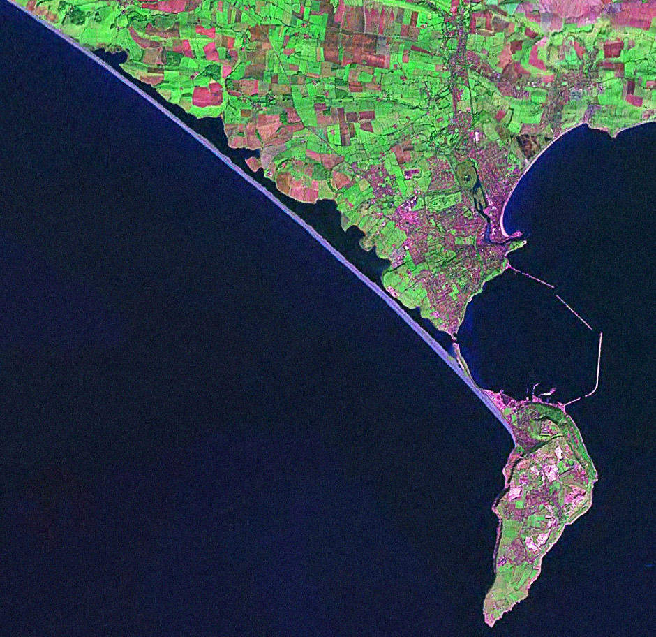
Chesil BeachChesil Beach ist eine Küstenformation in Dorset, England. Die Formation erstreckt sich über 29 km von West Bay bis nach Chiswell auf der Isle of Portland. Sie verbindet dabei die Isle of Portland mit dem Festland bei Weymouth. Die Formation ist 200 m breit und 15 m hoch und schützt die Orte Weymouth und Chiswell gegen die Hauptwind und -wellenrichtung. Von West Bay bis in die Nähe von Abbotsbury verläuft die Chesil Beach an den Klippen, dann trennt Chesil Beach eine mit Brackwasser gefüllte Lagune ab, genannt „The Fleet“. Chesil Beach und The Fleet sind Teil der Jurassic Coast und damit ebenfalls UNESCO-Weltnaturerbe. .. weiterlesen