Plan of Fort Pitt, 1761
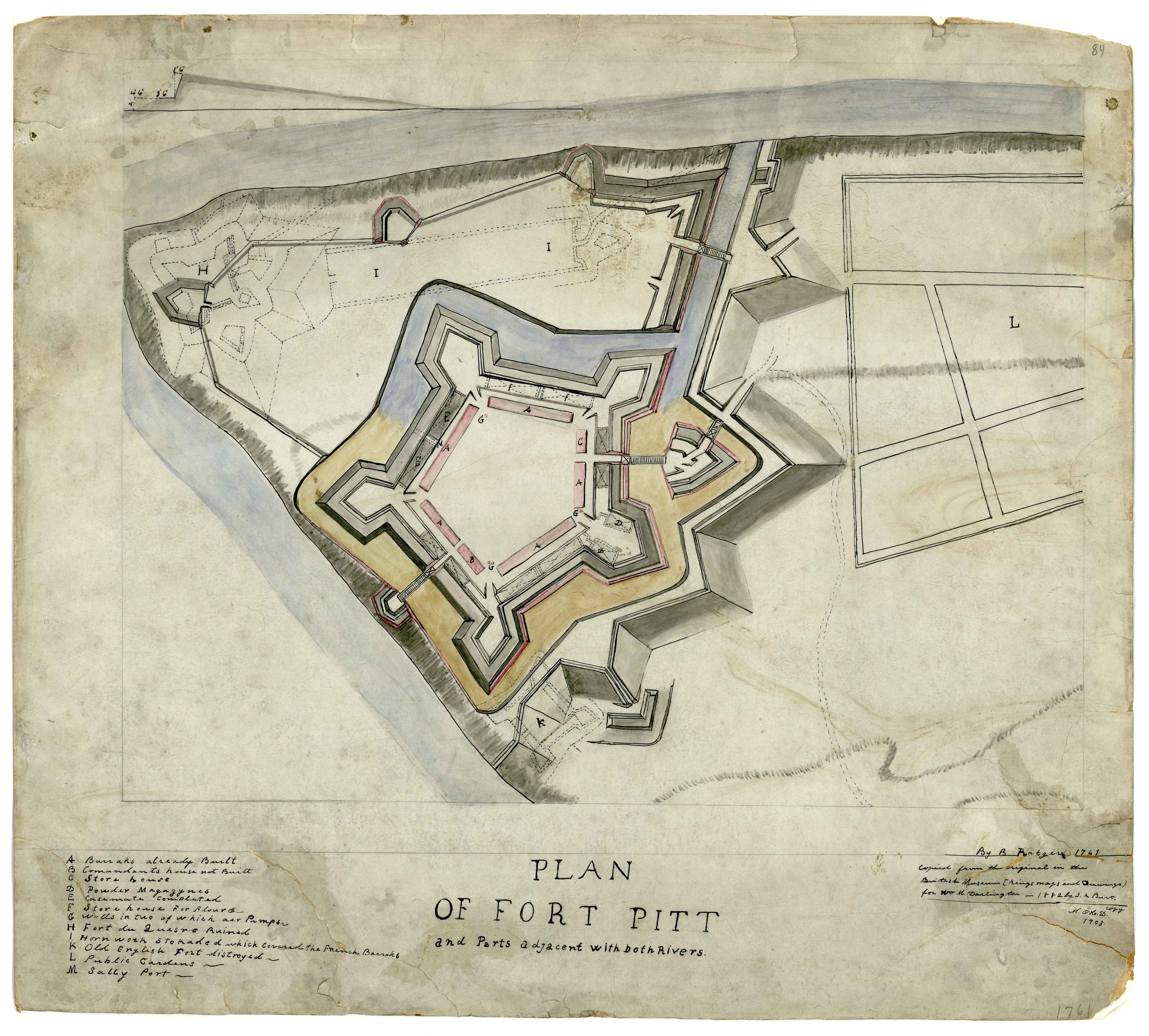
Title: Plan of Fort Pitt and parts adjacent …
Date: 1761
Creator: Ratzer, Bernard.
Description: Plan of Fort Pitt and parts adjacent with both rivers. Manuscript Map. Copied from the orginial in the British Library (Kings' maps and drawings) for Wm. Darlington by J. A. Burt, 1882. M. O'H. D. copy 1903. Also showing, in dotted line, the earlier French Fort Duquesne.
Subjects: Fort Pitt (Pa.)--Maps, Manuscript.; Fort Duquesne (Pa.)--Maps, Manuscript.; Pennsylvania--Maps, Manuscript.; United States--History--French and Indian War, 1755-1763--Maps, Manuscript.; Allegheny County (Pa.)--Maps, maunscript.; Maps, Manuscript.; Burt, J
Dimension: 50 x 56 cm
Scale: 1:3,050
Identifier: DARMAP0213


Relevante Bilder

.jpg)

_by_Bill_Woodrow%2c_British_Library%2c_London%2c_UK_-_20061031.jpg)


Relevante Artikel
British LibraryDie British Library (BL), übersetzt „Britische Bibliothek“, ist die Nationalbibliothek des Vereinigten Königreichs. Sie befindet sich in London und ist eine der bedeutendsten Forschungs- und Universalbibliotheken der Welt. Sie beherbergt mit über 170 Millionen Werken den weltweit größten Medienbestand aller Bibliotheken. Im Unterschied zur Deutschen Nationalbibliothek sammelt sie Bücher aus allen Zeiten, allen Ländern und in allen Sprachen und verwahrt Zeitschriften, Zeitungen, Broschüren, Tonaufnahmen, Patente, Datenbanken, Karten, Briefmarken, Kunstdrucke, Gemälde und vieles mehr. .. weiterlesen