Paamamap
Autor/Urheber:
Shortlink:
Quelle:
Größe:
547 x 505 Pixel (6858 Bytes)
Beschreibung:
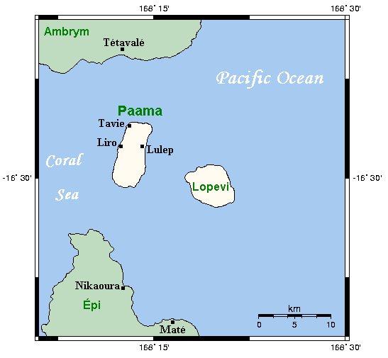
Map of Paama and neighbouring islands, Vanuatu
Lizenz:
Credit:
This map's source is here, with the uploader's modifications, and the GMT homepage says that the tools are released under the GNU General Public License
Bild teilen:


Relevante Bilder


Relevante Artikel
PaamaPaama ist eine Insel der südwestpazifischen Neuen Hebriden und Teil der Inselrepublik Vanuatu. Sie ist eine der drei Hauptinseln der Provinz Malampa. Heute leben rund 2000 Einwohner auf einer Fläche von 32 km². .. weiterlesen
LopéviLopévi ist eine unbewohnte Insel in der Provinz Malampa im westpazifischen Inselstaat Vanuatu. Das Eiland liegt etwa 16 km südöstlich von Ambrym und 7 km östlich von Paama. .. weiterlesen