PIA02696-Mars Rover Opportunity-Payson Panorama
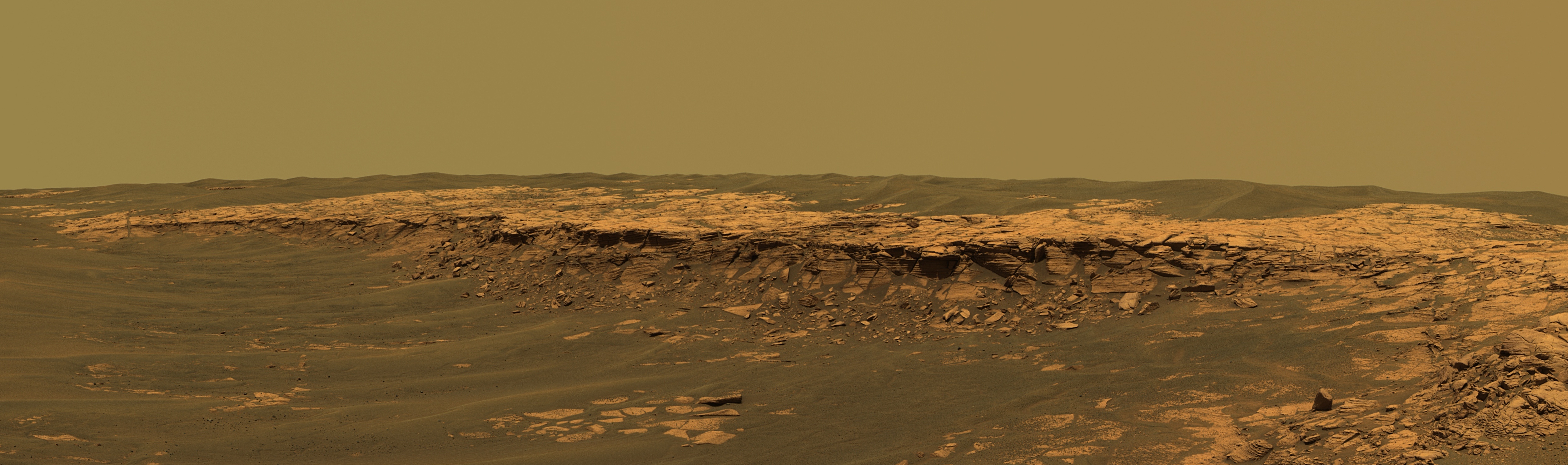
To the left of the outcrop, a flat, thin layer of spherule-rich soils overlies more outcrop materials. The rover is currently traveling down this "road" and observing the approximately 25-meter (82-foot) length of the outcrop prior to departing Erebus crater.
The panorama camera took 28 separate exposures of this scene, using four different filters. The resulting panorama covers about 90 degrees of terrain around the rover. This approximately true-color rendering was made using the camera's 753-nanometer, 535-nanometer and 423-nanometer filters. Image-to-image seams have been eliminated from the sky portion of the mosaic to better simulate the vista a person standing on Mars would see.


Relevante Bilder


Relevante Artikel
Aufschluss (Geologie)Ein Aufschluss ist eine Stelle an der Erdoberfläche, an der Gestein, das mit dem regionalen Gesteinsuntergrund verbunden ist, unverhüllt zu Tage tritt. Dieses ist unter humiden (feuchten) Klimabedingungen insbesondere im Flachland oftmals weitgehend durch Boden und Pflanzenbewuchs verdeckt und daher nicht aufgeschlossen. Lassen sich in einem Aufschluss neben der Gesteinsart auch grobe Strukturen wie Klüftung, Schichtung oder Schieferung erkennen und einmessen, spricht man von relativ guten, sind auch Details wie Sedimentstrukturen erkennbar, von idealen Aufschlussverhältnissen. Aufschlüsse sind auch Orte zur Aufnahme von Gesteinsproben für wissenschaftliche oder technische Zwecke. .. weiterlesen