NewOrleansNegroStreetWalkerEvans1935

Autor/Urheber:
Shortlink:
Quelle:
Größe:
5545 x 3678 Pixel (10764128 Bytes)
Beschreibung:
New Orleans, 1935. "New Orleans Negro street. Louisiana"
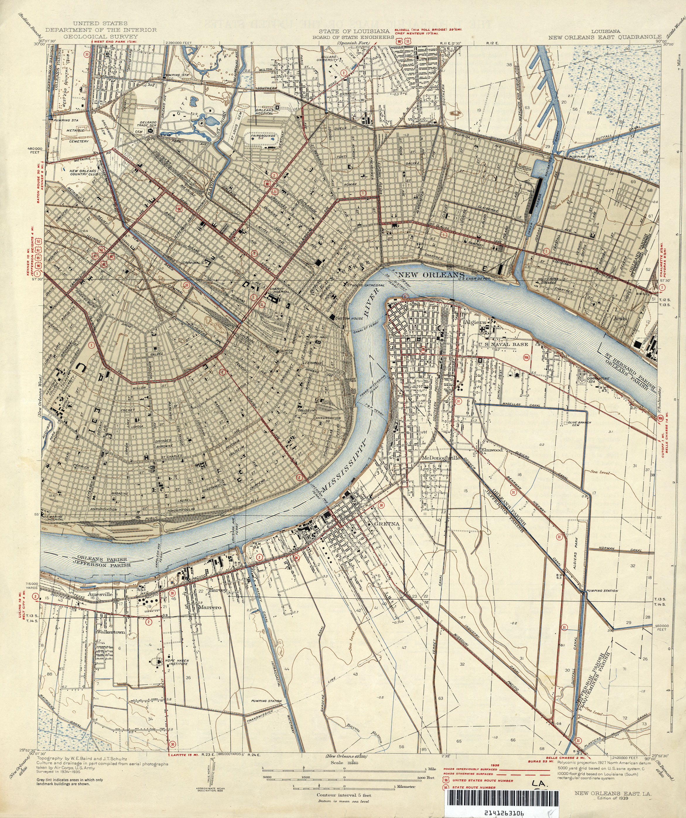
- Note: Appears to be the back of town section in or near the Treme neighborhood, likely at or near area soon after demolished for the construction of the Iberville Housing Projects. Photo seems to have been taken with telephoto lens which forshortens distance. 2 church steeples are seen at left. Closer one-- possibly Our Lady of Guadelupe? Further one probably St. Louis Cathedral. At end of the street in far distance the cupola of the Cabildo is visible; just to the right of the rightmost telephone pole the tower of the Jax Brewery is seen. Conti Street? Or a bit further down river, with the old Carondelet Canal behind the fence at right? Wall at right-- St. Louis Cemetery?
- To thread the needle between the Cabildo cupola and the Jax Brewery would require that it was taken on Lafitte Ave., probably at the intersection of Claiborne Ave. If that's correct, then the fence to the right would have been limiting access to the railroad tracks shown in this 1935 map. Another location with the same angle, would be that this photo was taken on present day Saint Peter Street near or at the intersection of Treme Street. This location could easily confirm the straight ahead shot of the Cabildo cupola.
Kommentar zur Lizenz:
| This image is a work of an employee of the United States Farm Security Administration or Office of War Information domestic photographic units, taken as part of that person's official duties. As a work of the U.S. federal government, the image is in the public domain in the United States. See Copyright. |
Lizenz:
Public domain
Credit:
Dieses Bild ist unter der digitalen ID fsa.8c52095 in der Abteilung für Drucke und Fotografien der US-amerikanischen Library of Congress abrufbar.
Diese Markierung zeigt nicht den Urheberrechtsstatus des zugehörigen Werks an. Es ist in jedem Falle zusätzlich eine normale Lizenzvorlage erforderlich. Siehe Commons:Lizenzen für weitere Informationen.
Diese Markierung zeigt nicht den Urheberrechtsstatus des zugehörigen Werks an. Es ist in jedem Falle zusätzlich eine normale Lizenzvorlage erforderlich. Siehe Commons:Lizenzen für weitere Informationen.
Bild teilen:


Relevante Bilder


Relevante Artikel
TreméTremé [trəˈmeɪ] ist ein Stadtteil in New Orleans und ein Unterbezirk der Mid-City District Area. Seine Grenzen wurden von der City Planning Commission festgelegt: im Norden die Esplanade Avenue, die North Rampart Street im Osten, die St. Louis Street im Süden und die North Broad Street im Westen. Es ist eines der ältesten Viertel der Stadt und war schon früh das Hauptviertel der freien Schwarzen. Es ist ein wichtiges Zentrum für die städtische afroamerikanische und kreolische Kultur, besonders die moderne Brassbandtradition. .. weiterlesen