Nevis historical map - 01
Autor/Urheber:
Library of Congress, Geography and Map Division.
Shortlink:
Quelle:
Größe:
2439 x 3300 Pixel (5320017 Bytes)
Beschreibung:
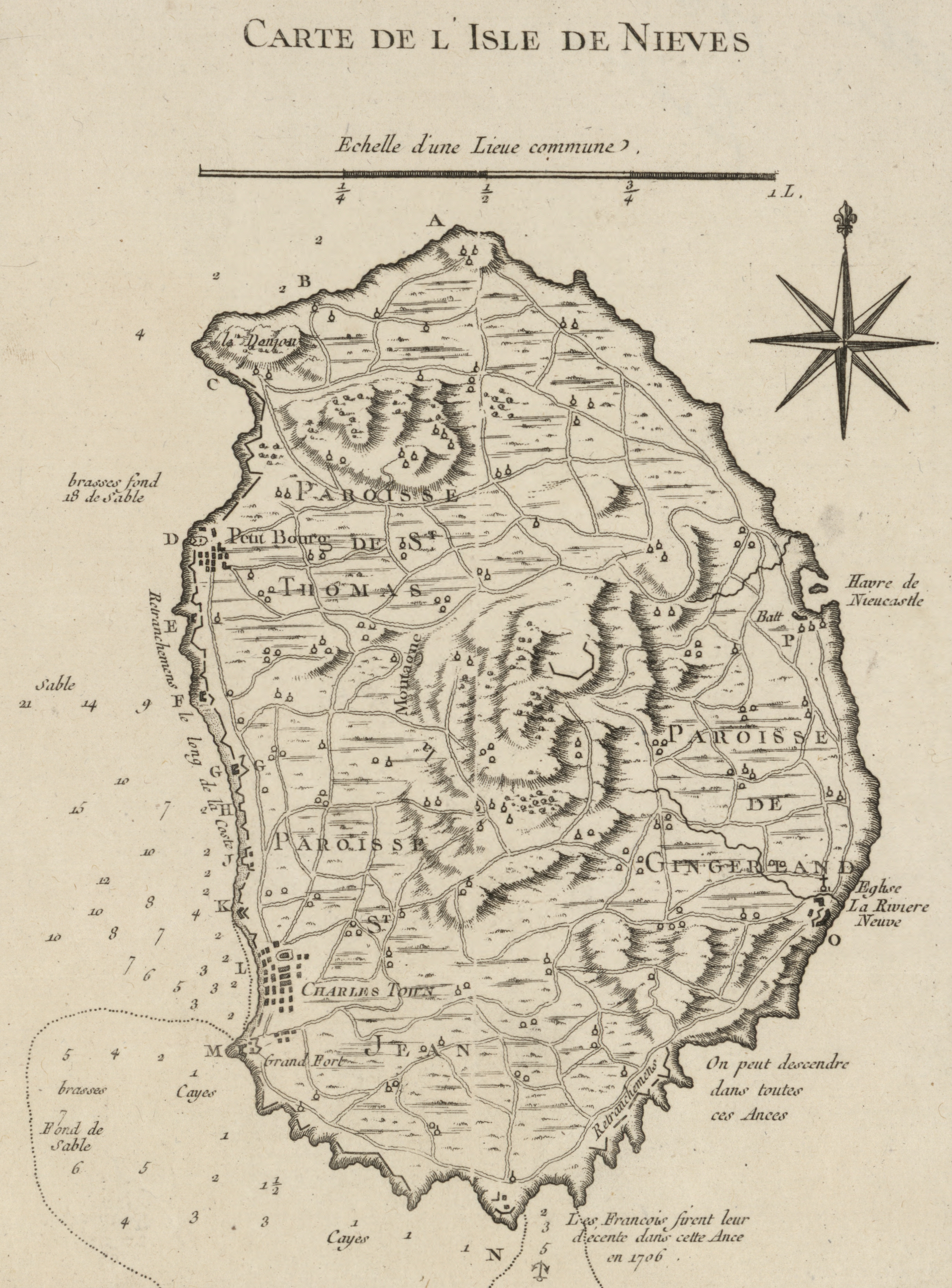
Nevis historical map
- Title: Carte de l'isle de Nieves.
- Contributor Names: Bellin, Jacques Nicolas, 1703-1772.
- Created / Published: Paris, 1764
- Notes:
- Scale ca. 1:50,000.
- Relief shown by hachures. Depths shown by soundings.
- "Tome I, no. 84."
- From the author's Le petit atlas maritime. 1764.
- LC Maps of North America, 1750-1789, 1995
- Available also through the Library of Congress Web site as a raster image.
- Vault
- AACR2
- Medium: map 22 x 16 cm.
- Call Number: G5042.N4 1764 .B4
- Repository: Library of Congress Geography and Map Division Washington, D.C. 20540-4650 USA dcu
- Digital Id: http://hdl.loc.gov/loc.gmd/g5042n.ar199500
- Library of Congress Catalog Number: 74691008
Lizenz:
Public domain
Bild teilen:


Relevante Bilder


Relevante Artikel
Geschichte von St. Kitts und NevisDie Geschichte von St. Kitts und Nevis behandelt die Geschichte des Karibikstaats St. Kitts und Nevis, der seit 1983 unabhängig von Großbritannien ist. .. weiterlesen