NPS wrangell-st-elias-nabesna-road-map
Autor/Urheber:
U.S. National Park Service, restoration/cleanup by Matt Holly
Shortlink:
Quelle:
Größe:
1344 x 1023 Pixel (452076 Bytes)
Beschreibung:
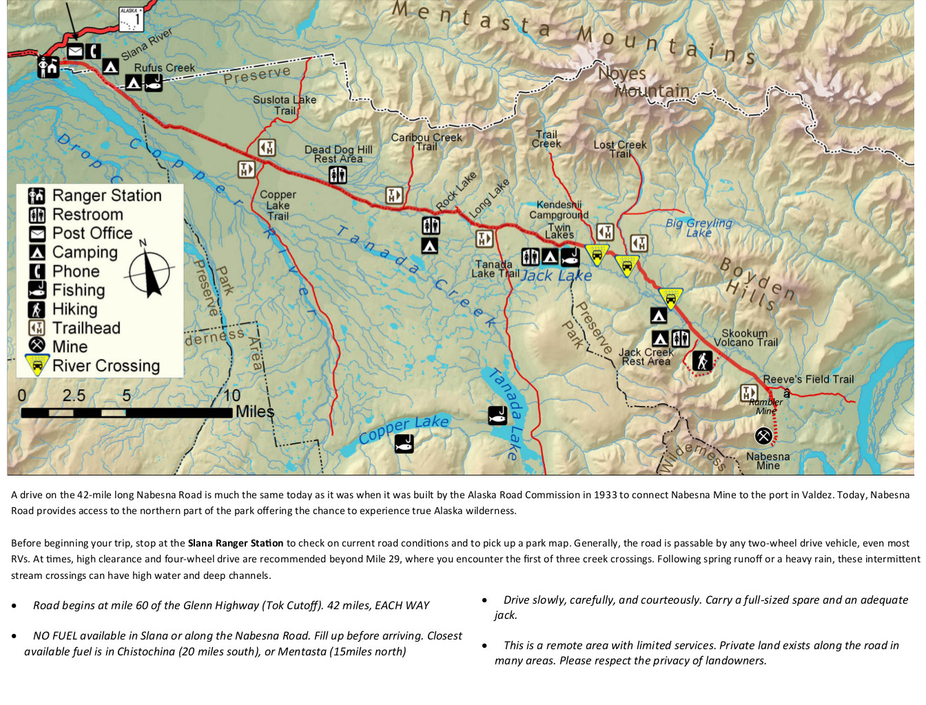
The Nabesna Road map from newspaper shows the other maintained road inside the park, allowing you to access the northern part of the park. Labeled are ranger stations, restrooms, camping, and more.
Lizenz:
Public domain
Credit:
U.S. National Park Service (http://npmaps.com/wp-content/uploads/wrangell-st-elias-nabesna-road-map.jpg)
Bild teilen:


Relevante Artikel
Nabesna RoadDie Nabesna Road ist eine 68 km lange Schotterstraße am Oberlauf des Copper River im Valdez-Cordova Census Area in Alaska. Sie verbindet Slana am Tok Cut-Off mit Nabesna im Wrangell-St.-Elias-Nationalpark. Neben der McCarthy Road ist sie eine von zwei Straßen, die in den Park führt. .. weiterlesen